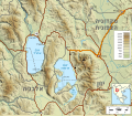
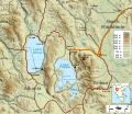
Category:Relief maps of Ohrid and Prespa lakes
Jump to navigation
Jump to search
Media in category "Relief maps of Ohrid and Prespa lakes"
The following 6 files are in this category, out of 6 total.
-
Location of Hill 1248 and Pelister mountain range.png 691 × 602; 702 KB
-
Ohrid and Prespa lakes topographic map de.svg 692 × 602; 4.8 MB
-
Ohrid and Prespa lakes topographic map-es.svg 692 × 602; 5.38 MB
-
Ohrid and Prespa lakes topographic map-HE.svg 692 × 602; 4.82 MB
-
Ohrid and Prespa lakes topographic map.svg 692 × 602; 4.83 MB
-
Situation de la cote 1248 et du massif du Pelister.png 688 × 599; 702 KB


