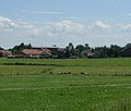
Category:Reinhardsried
Jump to navigation
Jump to search
village in the municipality of Unterthingau, Germany | |||||
| Upload media | |||||
| Instance of |
| ||||
|---|---|---|---|---|---|
| Location | Unterthingau, Ostallgäu, Swabia, Bavaria, Germany | ||||
| Elevation above sea level |
| ||||
 | |||||
Media in category "Reinhardsried"
The following 8 files are in this category, out of 8 total.
-
Feuerwehrhaus - panoramio - Richard Mayer (1).jpg 2,738 × 2,054; 760 KB
-
Patina auf dem Blech - panoramio.jpg 2,816 × 2,120; 1.15 MB
-
Reinhardsried - panoramio.jpg 2,432 × 2,064; 686 KB
-
Reinhardsried 4.jpg 2,730 × 2,041; 742 KB
-
Unterthingau - Kipfenberg - Reinhardsried v W, Abendsonne 02.JPG 2,256 × 1,496; 619 KB
-
Unterthingau - Reinhardsried - Dorfstr Nr 3 v SW.JPG 3,264 × 2,448; 1.34 MB
-
Unterthingau - Reinhardsried - Kapellenweg Nr 3 v NO.JPG 4,000 × 2,248; 4.6 MB
-
Wappen Reinhardsried.png 142 × 168; 11 KB


