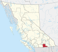
Category:Regional District of Kootenay Boundary
Jump to navigation
Jump to search
regional district in British Columbia, Canada | |||||
| Upload media | |||||
| Instance of |
| ||||
|---|---|---|---|---|---|
| Location | British Columbia, Canada | ||||
| Population |
| ||||
| official website | |||||
 | |||||
Subcategories
This category has the following 10 subcategories, out of 10 total.
Media in category "Regional District of Kootenay Boundary"
The following 13 files are in this category, out of 13 total.
-
16 Regional District of Kootenay Boundary British Columbia.svg 1,126 × 770; 14.73 MB
-
CAN BC Regional District of Kootenay Boundary locator.svg 1,944 × 1,737; 1.44 MB
-
Bridge Over The KVR - panoramio.jpg 2,560 × 1,920; 1.7 MB
-
Genelle BC.svg 608 × 528; 4.5 MB
-
Kettle Valley Golf Course (6184435932).jpg 1,280 × 960; 548 KB
-
Kootenay Boundary D, BC, Canada - panoramio (1).jpg 4,288 × 2,848; 6.15 MB
-
Kootenay Boundary D, BC, Canada - panoramio.jpg 4,288 × 2,848; 6.42 MB
-
KVR Bridge Over The Kettle River - panoramio.jpg 3,072 × 2,304; 4.43 MB
-
Midway, British Columbia Location.png 640 × 480; 470 KB
-
Old KVR Train Bridge - panoramio.jpg 2,560 × 1,920; 1.27 MB
-
Paterson BC border station.jpg 3,249 × 2,069; 330 KB
-
Santa Rosa Rec Site - panoramio.jpg 2,816 × 2,112; 3.01 MB
-
Trail, British Columbia, 1908.jpg 640 × 453; 61 KB


