Category:Red doors in England
Jump to navigation
Jump to search
Subcategories
This category has the following 5 subcategories, out of 5 total.
C
- Red doors in Cornwall (14 F)
L
M
- Red doors in Merseyside (3 F)
N
T
- Tonbridge Old Fire Station (16 F)
Media in category "Red doors in England"
The following 200 files are in this category, out of 200 total.
-
06 Aslackby St James, exterior- Porch from south.jpg 3,456 × 4,608; 8.82 MB
-
124 and 125 Northgate Street, Bury St Edmunds, October 2022.jpg 4,032 × 3,024; 3.92 MB
-
13 Ship Street, Oxford-3618825649.jpg 1,024 × 683; 103 KB
-
178 Townsend Lane, Clubmoor.jpg 3,828 × 3,540; 5.57 MB
-
18th-century dovecot at northeast of Parham House, West Sussex, England.jpg 3,000 × 2,250; 5.2 MB
-
32 Love Street - geograph.org.uk - 484401.jpg 480 × 640; 76 KB
-
43 St Giles', Oxford, October 2021.jpg 3,024 × 4,032; 4.09 MB
-
51 Flickr April 2024.jpg 2,265 × 3,397; 8.79 MB
-
87 And 89, King Street.jpg 1,745 × 2,046; 1.04 MB
-
A Red Door - High Street - geograph.org.uk - 1962185.jpg 480 × 640; 82 KB
-
Abingdon BathSt 31–33.jpg 1,280 × 719; 570 KB
-
Abingdon BathStreet33.jpg 1,024 × 683; 115 KB
-
Abingdon OckStreet 83.jpg 1,280 × 1,280; 808 KB
-
Adams Building Rear Door.JPG 2,464 × 3,646; 967 KB
-
Albion Garage - Tithe Barn Street - geograph.org.uk - 1891644.jpg 640 × 480; 87 KB
-
An effervescent little shop - geograph.org.uk - 1639916.jpg 640 × 480; 85 KB
-
Anglia, Windsor. - panoramio (2).jpg 4,608 × 2,592; 3.92 MB
-
Another sad, sad sight - geograph.org.uk - 788125.jpg 480 × 640; 79 KB
-
Auto-electrical workshop, South Cliffe, Thornton - geograph.org.uk - 2026908.jpg 2,000 × 1,469; 753 KB
-
Barn at Crackenthorpe - geograph.org.uk - 136480.jpg 640 × 480; 101 KB
-
Barn door - geograph.org.uk - 412063.jpg 480 × 640; 113 KB
-
Barnstaple (Devon, UK), Pannier Market -- 2013 -- 5.jpg 2,478 × 3,200; 4.5 MB
-
Georgian Doorway, 51 Whitecross Street - geograph.org.uk - 1164430.jpg 536 × 640; 105 KB
-
Blue door versus red door - geograph.org.uk - 1262882.jpg 640 × 481; 79 KB
-
Bramley Zion 09-04-2014 00-22-58 (42041096901).jpg 2,048 × 1,229; 447 KB
-
Brierfield Baptist Church, Doorway - geograph.org.uk - 1121420.jpg 480 × 640; 85 KB
-
Brigg Fire Station - geograph.org.uk - 231171.jpg 640 × 529; 145 KB
-
Bright red doors - Camberry Close - geograph.org.uk - 781641.jpg 640 × 465; 73 KB
-
Bromborough Community Fire Station 2020.jpg 4,909 × 3,005; 16.59 MB
-
Buiding under severe stress.JPG 2,048 × 1,536; 1.29 MB
-
St Michael's Church, Burrowbridge, Somerset.jpg 1,144 × 856; 109 KB
-
Burslem old fire station - geograph.org.uk - 607266.jpg 640 × 426; 213 KB
-
Caistor Fire Station Geograph-2024676-by-Kevin-Hale.jpg 640 × 427; 183 KB
-
Caistor Grammar School - geograph.org.uk - 133408.jpg 640 × 427; 98 KB
-
Canterbury (2007) 32.jpg 675 × 1,022; 869 KB
-
Carlisle StJohnEvangelist DoorNorth.jpg 913 × 1,280; 759 KB
-
Carlisle StJohnEvangelist DoorVestry.jpg 916 × 1,280; 748 KB
-
Cat in Station Street (2) - geograph.org.uk - 1454217.jpg 640 × 458; 69 KB
-
Chalgrove Red Lion pub.jpg 640 × 480; 104 KB
-
West end of the former St Olave's Church - geograph.org.uk - 588188.jpg 480 × 640; 194 KB
-
St George's Church, Cleveland Road, Chichester.JPG 2,592 × 1,944; 1.59 MB
-
St Pancras' Church, St Pancras, Chichester (NHLE Code 1354343).JPG 2,200 × 1,600; 1.21 MB
-
Chipping Campden fire station - geograph.org.uk - 623347.jpg 640 × 427; 192 KB
-
Christ Church, Cockermouth, Doorway - geograph.org.uk - 553013.jpg 640 × 480; 201 KB
-
Church Lane Fire Station - Sleaford - geograph.org.uk - 1640131.jpg 640 × 425; 61 KB
-
Church of the Holy Cross Great Ponton Lincolnshire England - south porch door.jpg 2,962 × 4,196; 12.95 MB
-
Church of the Holy Cross Great Ponton Lincolnshire England - south porch.jpg 4,608 × 3,456; 12.92 MB
-
Interior of All Hallows, Clixby - geograph.org.uk - 429199.jpg 640 × 480; 56 KB
-
Cow Row, Buckminster - geograph.org.uk - 38234.jpg 640 × 480; 110 KB
-
Daventry, disused garages - geograph.org.uk - 1741076.jpg 640 × 426; 154 KB
-
Dean House Farm, Luddenden Dean - geograph.org.uk - 363903.jpg 640 × 478; 102 KB
-
Deddington Fire Station - geograph.org.uk - 447827.jpg 640 × 559; 78 KB
-
Deddington FireStation.jpg 1,280 × 625; 440 KB
-
Deddington HighSt Library.jpg 1,280 × 682; 533 KB
-
Did the builder have problems - geograph.org.uk - 1239166.jpg 480 × 640; 74 KB
-
Door in Cononley 01.JPG 1,536 × 2,048; 1.54 MB
-
Doorway - The Old Police Station - geograph.org.uk - 1164442.jpg 554 × 640; 95 KB
-
Doorway to the Royal Lofts, West Street, Sowerby Bridge - geograph.org.uk - 2884697.jpg 1,500 × 2,000; 620 KB
-
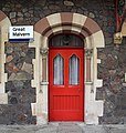
Doorway, Malvern station - geograph.org.uk - 1427486.jpg 608 × 640; 367 KB
-
Dorchester, old fire station - geograph.org.uk - 1490772.jpg 640 × 480; 79 KB
-
Drayton RedLion.jpg 1,024 × 512; 291 KB
-
East Allen Dale at Sinderhope (3) - geograph.org.uk - 1216592.jpg 640 × 480; 73 KB
-
Elswick Memorial Church - geograph.org.uk - 1528395.jpg 520 × 640; 101 KB
-
Endcliffe Hall Sheffield 2017-11-09 (146).JPG 5,184 × 3,456; 8.45 MB
-
Endcliffe Hall Sheffield 2017-11-09 (147).JPG 3,456 × 5,184; 8.2 MB
-
Entrance to 36 and 37 Hawley Square, Margate, November 2021.jpg 4,032 × 3,024; 5.11 MB
-
Entrance to 417 and 419 London Road, Boxmoor, Hemel Hempstead, August 2024.jpg 3,024 × 4,032; 3.45 MB
-
Former Bugby Chapel, Prospect Place, Epsom (NHLE Code 1232197) (August 2013) (1).JPG 2,400 × 1,800; 766 KB
-
Former Bugby Chapel, Prospect Place, Epsom (NHLE Code 1232197) (August 2013) (2).JPG 2,500 × 1,800; 788 KB
-
Former Bugby Chapel, Prospect Place, Epsom (NHLE Code 1232197) (August 2013) (3).JPG 2,400 × 1,800; 711 KB
-
Former Bugby Chapel, Prospect Place, Epsom (NHLE Code 1232197) (from SW).JPG 2,400 × 1,600; 602 KB
-
Former Bugby Chapel, Prospect Place, Epsom (NHLE Code 1232197).JPG 2,500 × 1,800; 720 KB
-
Fire Engine House - Old Harlow - geograph.org.uk - 275610.jpg 474 × 640; 121 KB
-
Fire station, Old Harlow - geograph.org.uk - 1579073.jpg 640 × 480; 101 KB
-
Former fire station, Spalding.jpg 2,848 × 2,136; 2.92 MB
-
Former Methodist Chapel, Linthwaite - geograph.org.uk - 495992.jpg 640 × 472; 86 KB
-
Former Oddfellows Arms - geograph.org.uk - 335350.jpg 640 × 427; 68 KB
-
Free School Lane, Lincoln.jpg 1,944 × 2,592; 1.74 MB
-
Georgian door - geograph.org.uk - 335327.jpg 427 × 640; 95 KB
-
Georgian houses - geograph.org.uk - 114652.jpg 640 × 427; 150 KB
-
Gloucester Old Fire Station - geograph.org.uk - 418394.jpg 640 × 427; 209 KB
-
Chapel, Northgate Street, Gloucester.JPG 4,000 × 3,000; 4.17 MB
-
Grammar School Library - geograph.org.uk - 133406.jpg 640 × 427; 108 KB
-
Grand Parade Front Doors, West Hoe, Plymouth.jpg 1,921 × 2,881; 3.38 MB
-
HamptonPoyle ChurchFarm house south.jpg 1,221 × 1,280; 869 KB
-
Henley Post office entrance - geograph.org.uk - 3157481.jpg 533 × 800; 104 KB
-
Henry Bell's House - geograph.org.uk - 544339.jpg 640 × 480; 107 KB
-
High Street, Alfriston - geograph.org.uk - 715733.jpg 640 × 464; 92 KB
-
Hill View, Blockley, Gloucestershire-geograph-5431795-by-Ian-Capper.jpg 662 × 1,000; 905 KB
-
Hinckley Fire Station - geograph.org.uk - 418403.jpg 640 × 427; 204 KB
-
Honestly, who thinks up these street names? (2640218336).jpg 1,855 × 1,860; 3.17 MB
-
Hook Norton fire station - geograph.org.uk - 623362.jpg 640 × 427; 171 KB
-
HookNorton FireStation west.jpg 1,280 × 719; 355 KB
-
HookNorton FireStation WSW.jpg 1,280 × 853; 389 KB
-
House in Cross Green, Otley - geograph.org.uk - 694017.jpg 640 × 480; 101 KB
-
Houses on Coltman Street - geograph.org.uk - 583150.jpg 640 × 515; 120 KB
-
C of E Church Kings Langley - geograph.org.uk - 27963.jpg 640 × 480; 19 KB
-
Leeds University (36680919813).jpg 3,840 × 2,160; 2.91 MB
-
Olivet Chapel, Bradford Road, Leeds - geograph.org.uk - 366711.jpg 636 × 497; 58 KB
-
Leicester Eastern Fire Station - geograph.org.uk - 467480.jpg 640 × 427; 159 KB
-
Lifeboat station - geograph.org.uk - 1143751.jpg 640 × 429; 60 KB
-
London Road Fire Station – Interior – Stained Glass Lancaster Rose.jpg 4,288 × 3,216; 2.97 MB
-
Longton fire station - geograph.org.uk - 607284.jpg 640 × 427; 187 KB
-
Malton Fire Station - geograph.org.uk - 175963.jpg 640 × 427; 50 KB
-
Living Waters Church, Manston, Kent.jpg 3,320 × 2,564; 4.57 MB
-
Market Harborough fire station - geograph.org.uk - 549420.jpg 640 × 427; 244 KB
-
Primitive Motorist Chapel - geograph.org.uk - 562629.jpg 640 × 480; 104 KB
-
New England Road - geograph.org.uk - 1595130.jpg 640 × 480; 66 KB
-
New waiting room doors, Halifax station - geograph.org.uk - 2217316.jpg 600 × 800; 106 KB
-
St Thomas' Church, Newhey, Doorway - geograph.org.uk - 1147052.jpg 480 × 640; 96 KB
-
Unitarian Church, Newington Green - geograph.org.uk - 396973.jpg 640 × 480; 106 KB
-
Norwich Fish Market, Mountergate - geograph.org.uk - 114672.jpg 640 × 480; 196 KB
-
Bethel Methodist Church, Nottingham Road, Mansfield (3).jpg 4,048 × 3,036; 4.05 MB
-
Oddfellows door detail.jpg 3,785 × 4,491; 3.02 MB
-
Old houses in Middle Street - geograph.org.uk - 1631868.jpg 640 × 480; 174 KB
-
Old School - School Lane, Kirkheaton - geograph.org.uk - 889739.jpg 640 × 439; 212 KB
-
Orsett Fire Station, Essex - geograph.org.uk - 56678.jpg 640 × 429; 62 KB
-
Outbuilding to 3 Crown Street, Bury St Edmunds, October 2022.jpg 4,032 × 3,024; 4.19 MB
-
Paley and Austin office.jpg 486 × 640; 176 KB
-
Panelled red door in Bath, Somerset, England.jpg 3,115 × 4,295; 1.43 MB
-
Papworth Everard fire station - geograph.org.uk - 629865.jpg 640 × 427; 191 KB
-
Peeking through the trees - geograph.org.uk - 1070152.jpg 480 × 640; 132 KB
-
Phoebe Lane Mill - geograph.org.uk - 926577.jpg 640 × 418; 78 KB
-
Entrance to Christ Church, Widley - geograph.org.uk - 732026.jpg 640 × 480; 101 KB
-
Church of St George the Martyr, Preston.jpg 3,217 × 2,089; 1.64 MB
-
St George the Martyr Preston.jpg 4,420 × 3,084; 7.21 MB
-
Ragged School Doorway.jpg 2,480 × 3,726; 2.79 MB
-
Red door - geograph.org.uk - 104311.jpg 640 × 426; 106 KB
-
Red door - geograph.org.uk - 864312.jpg 640 × 480; 152 KB
-
Red Door In Chobham Village 2 Surrey UK.jpg 1,134 × 756; 98 KB
-
Red Door In Chobham Village Surrey UK.jpg 758 × 1,134; 75 KB
-
Red door, blue door (5596380034).jpg 2,305 × 3,274; 6.8 MB
-
Red Doors - geograph.org.uk - 1803056.jpg 1,962 × 1,492; 388 KB
-
Red doors - geograph.org.uk - 3768508.jpg 4,008 × 3,116; 1.86 MB
-
Red, yellow, green - geograph.org.uk - 1218486.jpg 437 × 640; 108 KB
-
Redlodgeentrance.JPG 1,869 × 1,628; 842 KB
-
Relief, King Offa School, Down Road, Bexhill.jpg 4,608 × 3,456; 2.22 MB
-
Road junction - geograph.org.uk - 577420.jpg 640 × 480; 230 KB
-
Sawtry fire station - geograph.org.uk - 629803.jpg 640 × 427; 180 KB
-
School Door - for Boys - geograph.org.uk - 1410683.jpg 480 × 640; 95 KB
-
Scorton Methodist Church, Doorway - geograph.org.uk - 951483.jpg 480 × 640; 193 KB
-
Shared Outhouse in Oughtibridge - geograph.org.uk - 760146.jpg 640 × 427; 123 KB
-
Shepshed fire station - geograph.org.uk - 288290.jpg 640 × 427; 173 KB
-
Sign of the Times - geograph.org.uk - 499395.jpg 640 × 427; 74 KB
-
Skegness fire station - geograph.org.uk - 836063.jpg 640 × 427; 188 KB
-
Spilsby fire station - geograph.org.uk - 836058.jpg 640 × 427; 194 KB
-
St Hilda’s Church Sunday School, Jesmond.jpg 4,032 × 3,024; 4.53 MB
-
St James' Church, Wetherby (31st December 2023) 004.jpg 5,152 × 3,864; 6.21 MB
-
St. Paul's Street, Stamford - geograph.org.uk - 487447.jpg 640 × 477; 81 KB
-
Stanwell HighSt 29 south.jpg 1,280 × 852; 722 KB
-
Stanwell HighSt 29 SW.jpg 1,280 × 716; 493 KB
-
Stanwell HighSt 29 west.jpg 1,280 × 853; 733 KB
-
Stevenage Bath House (4995976784).jpg 2,640 × 1,980; 943 KB
-
Street Scene, Yetminster - geograph.org.uk - 1568145.jpg 640 × 480; 118 KB
-
Taking-in door, Shipley.jpg 1,319 × 1,319; 1.72 MB
-
The "poultiggery" at Cherryburn - geograph.org.uk - 779863.jpg 640 × 480; 96 KB
-
The Buffalo Arms - geograph.org.uk - 762365.jpg 640 × 427; 60 KB
-
The Old Fire Station, New Alresford - geograph.org.uk - 1327612.jpg 640 × 428; 104 KB
-
The Old Police Station, High Street - geograph.org.uk - 202297.jpg 640 × 480; 120 KB
-
The Red House - geograph.org.uk - 335316.jpg 427 × 640; 66 KB
-
The Swan (13241039495).jpg 2,326 × 2,326; 4.32 MB
-
The West Promenade - geograph.org.uk - 1093816.jpg 640 × 480; 122 KB
-
Theakstons Brewery.jpg 2,560 × 1,920; 2.32 MB
-
Towcester fire station - geograph.org.uk - 629683.jpg 640 × 427; 195 KB
-
UpperHeyford SchoolHouse east.jpg 3,008 × 2,000; 3.09 MB
-
UpperHeyford SchoolHouse.JPG 2,974 × 1,948; 2.8 MB
-
Volvo B7TL Wright EclipseGemini LX06 EAG Wallingford.jpg 1,280 × 1,241; 625 KB
-
Wallingford fire station - geograph.org.uk - 473178.jpg 640 × 427; 214 KB
-
Wallingford fire station - geograph.org.uk - 473181.jpg 640 × 427; 208 KB
-
Wallingford FireStation.jpg 903 × 903; 563 KB
-
Wantage fire station.jpg 1,173 × 625; 575 KB
-
Water's Almshouses - geograph.org.uk - 744257.jpg 640 × 480; 77 KB
-
Wednesbury Old Post Office - 2016-11-30 - Andy Mabbett - 03.jpg 3,872 × 2,592; 4.57 MB
-
Wheatley Fire Station - geograph.org.uk - 1724834.jpg 1,500 × 972; 241 KB
-
Wheatley fire station - geograph.org.uk - 473103.jpg 640 × 427; 193 KB
-
Windmill View Court - geograph.org.uk - 335474.jpg 640 × 427; 68 KB
-
Folding doors - geograph.org.uk - 1132225.jpg 640 × 451; 58 KB


