Category:Real estate advertisements in Queensland
Jump to navigation
Jump to search
Media in category "Real estate advertisements in Queensland"
The following 46 files are in this category, out of 46 total.
-
 Advertising land sale in Glass House Mountains under the title "Pineapple Farms Beerwah", 1903.jpg 13,596 × 21,287; 41.75 MB
-
 Bellevue Park Estate advertisement, 1914.jpg 3,024 × 4,032; 3.69 MB
-
 Brookfield Fruit Farms Estate, 1914.jpg 3,890 × 6,000; 9.49 MB
-
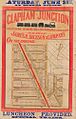 Clapham Junction portions 185 186 199 200.jpg 636 × 1,000; 315 KB
-
 Dallarnil township; Charles White, Auctioneer ; J. Hamilton Adair, Surveyor, 1913.jpg 4,781 × 6,000; 6.55 MB
-
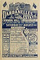 Dardanelles Estate, Cannon Hill, 1915.jpg 1,336 × 2,001; 605 KB
-

-
 Government land sales, Kirra Beach, Town of Coolangatta, 1938.jpg 9,796 × 7,326; 10.16 MB
-
 Graceville Memorial Park Estate 1926.jpg 7,990 × 5,185; 7.81 MB
-
 Harrow Estate Sale Poster, near Cambooya, circa 1910.jpg 2,048 × 2,712; 5.98 MB
-
 Moorooka Park, estate map, 1889.jpg 3,721 × 6,000; 4.16 MB
-
 Portwood estate map, Redcliffe, 1878.jpg 4,794 × 6,000; 3.77 MB
-
 Propify Video Render.jpg 1,920 × 1,080; 98 KB
-
 Real estate map of Coolum Beach Estate, 1923 (25793072504).jpg 1,000 × 633; 499 KB
-
 Real estate map of Dora Vale Estate, Moorooka, 1927 (25795153973).jpg 1,000 × 800; 575 KB
-
 Real estate map of Garfield estate, 1924 (26372006366).jpg 4,000 × 3,170; 2.4 MB
-
-
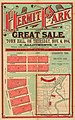 Real estate map of Hermit Park estate, Townsville, 1884 (26305570822).jpg 2,498 × 4,000; 1.56 MB
-
 Real estate map of Kedron Park estate, 1888 (25793072414).jpg 2,639 × 4,000; 1.34 MB
-
 Real estate map of Kedron View Estate, Brisbane, ca. 1914 (25795153793).jpg 1,000 × 663; 503 KB
-
 Real estate map of Langlands Estate East, Brisbane, 1886 (25795153513).jpg 625 × 1,000; 448 KB
-
 Real estate map of Manly Beach Estate, 1887 (26372005876).jpg 682 × 1,000; 502 KB
-
 Real estate map of Northcliffe Estate, ca. 1920s (26372005926).jpg 748 × 1,000; 573 KB
-
 Real estate map of Ocean View Estate, Southport, ca. 1920 (26397908645).jpg 636 × 1,000; 504 KB
-
 Real estate map of Princess Bridge Estate, St Lucia, 1885 (26125061470).jpg 4,000 × 2,547; 1.75 MB
-
 Real estate map of Queensport Aquarium Estate, Hemmant, 1889 (26331712261).jpg 1,000 × 643; 465 KB
-
 Real estate map of Redland Bay township, 1888 (25793072344).jpg 2,545 × 4,000; 1.26 MB
-
 Real estate map of Richter Estate, Annerley, 1889 (26125061420).jpg 630 × 1,000; 471 KB
-

-

-
 Real estate map of Seville Estate, Coorparoo, 1888 (25793072864).jpg 2,553 × 4,000; 1.14 MB
-
 Real estate map of Southport allotments, Gold Coast, ca. 1885 (26305570092).jpg 2,525 × 4,000; 1.62 MB
-

-
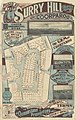 Real estate map of Surry Hill Estate, Coorparoo, ca. 1910s (26372005336).jpg 641 × 1,000; 434 KB
-
 Real estate map of Telemon Estate, Beaudesert, 1928 (25795152923).jpg 1,000 × 629; 522 KB
-
 Real estate map of The Graceville Estate, ca. 1888 (26305569992).jpg 1,000 × 627; 410 KB
-
-

-
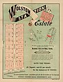 Real estate map of Wolston Station Estate, Wacol, ca. 1900 (26397909585).jpg 3,054 × 4,000; 1.4 MB
-
 Somerset Hills Estate, Stafford, Queensland, 1950.jpg 14,294 × 16,794; 104.49 MB
-

-

-
-
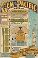
 StateLibQld 2 191855 Estate map for Pacific Ocean Estate, Southport, 1915.jpg 636 × 1,000; 137 KB
-
-
 Stephens Paddock estate map, South Brisdbane, 1890.jpg 3,812 × 6,000; 9.03 MB


_Southport_Parish_of_Nerang_County_of_Ward_to_be_sold_by_auction_by_WC_Welsh,_1903.jpg)


.jpg)
.jpg)
.jpg)
.jpg)
.jpg)
.jpg)
.jpg)
.jpg)
.jpg)
.jpg)
.jpg)
.jpg)
.jpg)
.jpg)
.jpg)
.jpg)
.jpg)
.jpg)
.jpg)
,_South_Brisbane,_1890_(25793072494).jpg)
.jpg)
.jpg)
.jpg)
.jpg)
.jpg)
.jpg)


