Category:Raunds
Jump to navigation
Jump to search
small market town in rural Northamptonshire, England  | |||||
| Upload media | |||||
| Instance of | |||||
|---|---|---|---|---|---|
| Location | North Northamptonshire, Northamptonshire, East Midlands, England | ||||
| Population |
| ||||
| Said to be the same as | Raunds (Wikimedia duplicated page, civil parish) | ||||
 | |||||
English: Raunds is a small market town in rural Northamptonshire, England. It has a population of 8,275 (2001 census), is a civil parish, and is part of the East Northamptonshire district.
Română: Raunds este un oraş în comitatul Northamptonshire, regiunea East Midlands, Anglia. Oraşul se află în districtul East Northamptonshire.
Subcategories
This category has the following 3 subcategories, out of 3 total.
R
- St Peter's Church, Raunds (13 F)
- Raunds Co-operative Society (3 F)
- Raunds War Memorial (1 F)
Media in category "Raunds"
The following 190 files are in this category, out of 190 total.
-
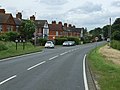
 A45 southbound - geograph.org.uk - 5366776.jpg 640 × 480; 30 KB
-
 Agricultural suppliers warehouse - geograph.org.uk - 3041219.jpg 2,560 × 1,920; 1.08 MB
-
 Brick Kiln Road (B663) heading west - geograph.org.uk - 2995700.jpg 640 × 480; 92 KB
-
 Bridge Street, Raunds - geograph.org.uk - 2545823.jpg 1,496 × 1,122; 514 KB
-
 Bridleway to Covington - geograph.org.uk - 6521736.jpg 1,024 × 768; 198 KB
-
 Bridleway to Denford - geograph.org.uk - 6524672.jpg 1,024 × 768; 355 KB
-
 Bridleway to Keyston - geograph.org.uk - 6521749.jpg 1,024 × 768; 277 KB
-
 Brook Road - geograph.org.uk - 1552391.jpg 640 × 480; 69 KB
-
 Brook Street, Raunds, Northants - geograph.org.uk - 1593738.jpg 640 × 483; 96 KB
-
 Brook Street, Raunds, Northants - geograph.org.uk - 1593764.jpg 640 × 475; 100 KB
-
 Building site on North Street, Raunds - geograph.org.uk - 5432976.jpg 2,014 × 1,490; 794 KB
-
 Building work on Clare Street, Raunds - geograph.org.uk - 4315778.jpg 3,872 × 2,592; 4.12 MB
-
 Bungalow on Orchard Road, Raunds - geograph.org.uk - 2995667.jpg 640 × 480; 62 KB
-
 Butcher's shop, Raunds - geograph.org.uk - 1224364.jpg 640 × 480; 83 KB
-
 Cemetery, Raunds - geograph.org.uk - 1224388.jpg 640 × 480; 105 KB
-
 Chelveston Road into Raunds - geograph.org.uk - 2995431.jpg 640 × 480; 70 KB
-
 Church Street, Raunds - geograph.org.uk - 2995689.jpg 640 × 480; 70 KB
-
 Churchyard path, Raunds - geograph.org.uk - 6522562.jpg 1,024 × 768; 265 KB
-
 Churchyard, Raunds, with cat - geograph.org.uk - 1223928.jpg 640 × 480; 122 KB
-
 Clare Street, Raunds - geograph.org.uk - 4315762.jpg 3,872 × 2,592; 3.99 MB
-
 Conservative Club, Manor Street, Raunds - geograph.org.uk - 6522619.jpg 1,024 × 768; 152 KB
-
 Cottages, Manor Street, Raunds - geograph.org.uk - 6522615.jpg 1,024 × 768; 197 KB
-
 Council Offices, Raunds, Northants - geograph.org.uk - 1593730.jpg 640 × 480; 84 KB
-
 Disused Railway - geograph.org.uk - 129884.jpg 640 × 480; 60 KB
-
 Entrance to Friendly Lodge Farm - geograph.org.uk - 4736349.jpg 640 × 480; 61 KB
-
 Entrance to Lodge Farm - geograph.org.uk - 6521738.jpg 1,024 × 768; 295 KB
-
 Entrance to Red Lodge - geograph.org.uk - 6521937.jpg 1,024 × 768; 284 KB
-
 Fallen tree on the bridleway to Denford - geograph.org.uk - 6524675.jpg 1,024 × 768; 380 KB
-
 Farm entrance on the edge of Raunds - geograph.org.uk - 6521916.jpg 1,024 × 768; 327 KB
-
 Field alongside Brooks Road - geograph.org.uk - 6521740.jpg 1,024 × 768; 226 KB
-
 Field of ripening barley - geograph.org.uk - 6524760.jpg 1,024 × 768; 186 KB
-
 Fields by Station Road, Raunds - geograph.org.uk - 5427470.jpg 1,904 × 1,316; 654 KB
-
 Footpath across Darsdale - geograph.org.uk - 143577.jpg 640 × 480; 97 KB
-
 Footpath and fences - geograph.org.uk - 225184.jpg 640 × 480; 101 KB
-
 Footpath and oil seed rape - geograph.org.uk - 225189.jpg 640 × 480; 85 KB
-
 Footpath to Raunds - geograph.org.uk - 1552397.jpg 640 × 480; 111 KB
-
 Footpath to Raunds - geograph.org.uk - 2995425.jpg 640 × 480; 94 KB
-
 Footpath towards Darsdale Farm - geograph.org.uk - 1552313.jpg 640 × 480; 84 KB
-
 Former Carlton Cinema, Raunds - geograph.org.uk - 6522627.jpg 1,024 × 761; 201 KB
-
 Former Chambers Heel Factory (geograph 6521909).jpg 1,024 × 715; 140 KB
-
 Gells garage, Raunds - geograph.org.uk - 5432975.jpg 2,048 × 1,536; 1.5 MB
-
 Grass covered road junction near Hargrave - geograph.org.uk - 3041200.jpg 2,560 × 1,920; 1.04 MB
-
 Green space by Brick Kiln Lane - geograph.org.uk - 3036073.jpg 2,244 × 1,277; 1.05 MB
-
 Heritage Way, Raunds - geograph.org.uk - 2545816.jpg 1,496 × 1,122; 589 KB
-
 High Street, Raunds - geograph.org.uk - 5424632.jpg 2,048 × 1,536; 1.52 MB
-
 High Street, Raunds - geograph.org.uk - 6522692.jpg 1,024 × 768; 171 KB
-
 Hollington Street, Raunds - geograph.org.uk - 4315741.jpg 3,872 × 2,592; 4.65 MB
-
 House on Park Road, Raunds - geograph.org.uk - 2995677.jpg 640 × 480; 80 KB
-
 House on Station Road near Raunds - geograph.org.uk - 5424636.jpg 1,895 × 1,376; 662 KB
-
 Houses on Midland Road, Raunds - geograph.org.uk - 5427467.jpg 1,772 × 1,296; 510 KB
-
 Houses on Midland Road, Raunds - geograph.org.uk - 5427469.jpg 2,048 × 1,536; 1.5 MB
-
 Joining the B645 - geograph.org.uk - 1189797.jpg 640 × 480; 86 KB
-
 Kimberly Cottages, Raunds - geograph.org.uk - 4316275.jpg 3,872 × 2,592; 4.03 MB
-
 Layby on the A45, Denford Ash - geograph.org.uk - 6212931.jpg 1,906 × 1,260; 1.26 MB
-
 Layby on the A45, Denford Ash - geograph.org.uk - 6212933.jpg 1,884 × 1,222; 1.28 MB
-
 Layby on the A45, Denford Ash - geograph.org.uk - 6534602.jpg 1,920 × 1,280; 1.3 MB
-
 Layby on the A45, Raunds - geograph.org.uk - 6212937.jpg 1,874 × 1,206; 1.14 MB
-
 Layby on the A45, Raunds - geograph.org.uk - 6534608.jpg 1,878 × 1,212; 1.25 MB
-
 Layby on the A45, Stanwick - geograph.org.uk - 6212940.jpg 1,842 × 1,152; 982 KB
-
 Layby on the A45, Stanwick - geograph.org.uk - 6212941.jpg 1,878 × 1,216; 984 KB
-
 Layby on the A45, Stanwick - geograph.org.uk - 6534618.jpg 1,872 × 1,204; 1.34 MB
-
 Layby on the A45, Stanwick - geograph.org.uk - 6534621.jpg 1,920 × 1,280; 1.49 MB
-
 Layby on the A45, Stanwick - geograph.org.uk - 6627146.jpg 1,848 × 1,162; 1.21 MB
-
 Library Plus, Raunds - geograph.org.uk - 6522669.jpg 1,024 × 768; 164 KB
-
 London Road - geograph.org.uk - 1552321.jpg 640 × 480; 61 KB
-
 London Road entering Raunds - geograph.org.uk - 5430603.jpg 2,014 × 1,490; 736 KB
-
 London Road, Raunds - geograph.org.uk - 2995661.jpg 640 × 480; 79 KB
-
 Looking towards Raunds from the south east - geograph.org.uk - 4514146.jpg 4,320 × 3,240; 3.82 MB
-
 Mallows Drive, Raunds - geograph.org.uk - 2995698.jpg 640 × 480; 43 KB
-
 Market Square, Raunds - geograph.org.uk - 6521904.jpg 1,024 × 768; 194 KB
-
 Meadow Lane at the junction of London Road - geograph.org.uk - 5430596.jpg 2,048 × 1,536; 875 KB
-
 Meadow Lane Raunds - geograph.org.uk - 143574.jpg 640 × 480; 90 KB
-
 Midland Road, Raunds - geograph.org.uk - 2995695.jpg 640 × 480; 63 KB
-
 Millennium Gateway, Raunds, Northants - geograph.org.uk - 1593748.jpg 640 × 488; 147 KB
-
 New bungalow under construction - geograph.org.uk - 4315786.jpg 3,872 × 2,592; 3.65 MB
-
 New housing development - geograph.org.uk - 4514169.jpg 4,320 × 3,240; 2.92 MB
-
 North Street at the junction of High Street, Raunds - geograph.org.uk - 5424630.jpg 2,048 × 1,536; 1.48 MB
-
 Old railway line and bridge parapet - geograph.org.uk - 1290557.jpg 640 × 480; 94 KB
-
 Old style road direction and numbering signs - geograph.org.uk - 2657396.jpg 2,560 × 1,920; 1,000 KB
-
 Orchard Road, Raunds - geograph.org.uk - 2995671.jpg 640 × 480; 65 KB
-
 Ordnance Survey Trig Pillar 11003 - geograph.org.uk - 3323509.jpg 4,000 × 3,000; 4.43 MB
-
 Park Road, Raunds - geograph.org.uk - 2545808.jpg 1,496 × 1,122; 549 KB
-
 Park Road, Raunds - geograph.org.uk - 2995683.jpg 640 × 480; 57 KB
-
 Parking area on the A45 west of Raunds - geograph.org.uk - 5430601.jpg 2,048 × 1,536; 1.49 MB
-
 Post Office, Brook St, Raunds, Northants - geograph.org.uk - 1593757.jpg 640 × 480; 107 KB
-
 Pre-Worboys Signs - geograph.org.uk - 2956497.jpg 1,024 × 768; 198 KB
-
 Pre-Worboys Signs - geograph.org.uk - 2956509.jpg 1,024 × 768; 156 KB
-
 Pre-Worboys signs on the corner of North Street - geograph.org.uk - 5424631.jpg 2,048 × 1,536; 1.51 MB
-
 Primrose Hill, Raunds - geograph.org.uk - 4316273.jpg 3,872 × 2,592; 4.25 MB
-
 Public library, Raunds - geograph.org.uk - 1224374.jpg 640 × 480; 82 KB
-
 Raunds Cemetery - geograph.org.uk - 1552326.jpg 640 × 480; 116 KB
-
 Raunds council.jpg 2,016 × 1,134; 854 KB
-
 Raunds Cross - geograph.org.uk - 6521893.jpg 1,024 × 762; 208 KB
-
 Raunds fire station - geograph.org.uk - 629767.jpg 640 × 426; 210 KB
-
 Raunds High Street - geograph.org.uk - 5715170.jpg 6,394 × 4,267; 6.29 MB
-
 Raunds march centenary plaque - geograph.org.uk - 1224903.jpg 480 × 640; 114 KB
-
 Raunds Town Council office - geograph.org.uk - 5432974.jpg 2,014 × 1,490; 870 KB
-
 Raunds, aerial 2017 - geograph.org.uk - 5444456.jpg 800 × 533; 95 KB
-
 Raunds, Eastern approach to St. Mary's Church - geograph.org.uk - 5715174.jpg 5,898 × 3,935; 6.28 MB
-

-
 Raunds, St. Mary's Church with its early Gothic steeple 1 - geograph.org.uk - 5715164.jpg 5,022 × 3,352; 3.82 MB
-
 Raunds, St. Mary's Church with its early Gothic steeple 2 - geograph.org.uk - 5715166.jpg 3,961 × 5,936; 4.08 MB
-

-

-

-
 Raunds, St. Mary's Church, c15th clock on the tower arch - geograph.org.uk - 5715284.jpg 6,850 × 4,571; 6.3 MB
-
 Raunds, St. Mary's Church, c15th clock on the tower arch - geograph.org.uk - 5715286.jpg 7,058 × 4,711; 6.13 MB
-
 Raunds, St. Mary's Church, c15th clock on the tower arch - geograph.org.uk - 5715290.jpg 6,268 × 4,183; 5.39 MB
-

-

-

-

-

-

-

-

-

-

-

-

-

-

-

-

-
 Raunds, St. Mary's Church, Stained glass window 1 (detail) - geograph.org.uk - 5715274.jpg 6,712 × 4,480; 5.19 MB
-
 Raunds, St. Mary's Church, Stained glass window 1 - geograph.org.uk - 5715272.jpg 4,634 × 6,943; 4.5 MB
-
 Raunds, St. Mary's Church, Stained glass window 2 (detail) - geograph.org.uk - 5715280.jpg 6,514 × 4,349; 4.63 MB
-
 Raunds, St. Mary's Church, Stained glass window 2 - geograph.org.uk - 5715277.jpg 5,529 × 3,691; 2.85 MB
-
 Raunds, St. Mary's Church, Stained glass window 2 - geograph.org.uk - 5715278.jpg 4,552 × 6,820; 4.62 MB
-
 Raunds, St. Mary's Church, The chancel and nave beyond - geograph.org.uk - 5715316.jpg 7,360 × 4,912; 5.79 MB
-

-
 Raunds, St. Mary's Church, The nave - geograph.org.uk - 5715313.jpg 7,058 × 4,711; 5.19 MB
-
 Red House on Station Road, Raunds - geograph.org.uk - 5424633.jpg 2,048 × 1,536; 1.31 MB
-
 Remains of Manor Brickworks, Raunds - geograph.org.uk - 755615.jpg 430 × 640; 107 KB
-
 Road junction with grass covering - geograph.org.uk - 3036046.jpg 2,560 × 1,920; 1.03 MB
-
 Road to Hargrave - geograph.org.uk - 1189764.jpg 640 × 480; 116 KB
-
 Road to Raunds - geograph.org.uk - 1189773.jpg 640 × 480; 84 KB
-
 Roadside tyre dump - geograph.org.uk - 6521930.jpg 1,024 × 768; 173 KB
-
 Roadway to Denford Ash Farm - geograph.org.uk - 6524670.jpg 1,024 × 768; 281 KB
-
 Rotton Row, Raunds - geograph.org.uk - 129916.jpg 640 × 480; 58 KB
-
 Roundabout on the A45, Raunds - geograph.org.uk - 6534615.jpg 1,854 × 1,174; 1.18 MB
-
 Roundabout on Wellington Road, Raunds - geograph.org.uk - 5430594.jpg 2,048 × 1,536; 1.49 MB
-
 Seen better days - geograph.org.uk - 1290572.jpg 640 × 480; 156 KB
-
 Shelton Road - geograph.org.uk - 1169173.jpg 640 × 512; 66 KB
-
 Shelton road - geograph.org.uk - 1169180.jpg 512 × 640; 54 KB
-
 Shops, Market Square, Raunds - geograph.org.uk - 6522629.jpg 1,024 × 768; 155 KB
-
 Snowy day in Raunds. - geograph.org.uk - 592906.jpg 640 × 425; 77 KB
-
 Spar and Greggs, Raunds - geograph.org.uk - 6522659.jpg 1,024 × 768; 131 KB
-
 St Thomas More Catholic Church, Raunds - geograph.org.uk - 2543215.jpg 1,496 × 1,122; 545 KB
-
 St. Peter's church, Raunds - geograph.org.uk - 6521883.jpg 768 × 1,024; 126 KB
-
 Station Road - geograph.org.uk - 1552402.jpg 640 × 480; 85 KB
-
 Station Road east of Raunds - geograph.org.uk - 5424635.jpg 2,048 × 1,536; 1.5 MB
-
 Station Road west of Raunds - geograph.org.uk - 5445359.jpg 1,960 × 1,412; 707 KB
-
 The A45, Raunds - geograph.org.uk - 6212936.jpg 1,848 × 1,162; 1.05 MB
-
 The beginning of a footpath to Raunds - geograph.org.uk - 6521947.jpg 1,024 × 749; 206 KB
-
 The George ^ Dragon, Raunds - geograph.org.uk - 2995676.jpg 640 × 480; 81 KB
-
 The Northants-Cambridgeshire border - geograph.org.uk - 5427477.jpg 2,048 × 1,536; 898 KB
-
 The Red Lion, Raunds - geograph.org.uk - 2995658.jpg 640 × 480; 79 KB
-
 The World Upside Down, Raunds - geograph.org.uk - 2543224.jpg 1,496 × 1,122; 602 KB
-
 Thorpe Street, Raunds - geograph.org.uk - 5447338.jpg 2,048 × 1,536; 1.49 MB
-
 Titty Ho road name - geograph.org.uk - 5432973.jpg 2,048 × 1,536; 1.53 MB
-
 Titty Ho, Raunds - geograph.org.uk - 5432972.jpg 2,048 × 1,536; 1.5 MB
-
 Today's footwear in Raunds - geograph.org.uk - 1224920.jpg 640 × 480; 109 KB
-
 Town information display, Raunds - geograph.org.uk - 6522632.jpg 1,024 × 768; 221 KB
-
 Town twinning commemorative stone - geograph.org.uk - 6522666.jpg 1,024 × 768; 305 KB
-
 Trees by the A45, Raunds - geograph.org.uk - 5430602.jpg 2,048 × 1,536; 1.49 MB
-
 Triangulation Pillar near Denford Ash - geograph.org.uk - 2341738.jpg 640 × 480; 151 KB
-
 Welcome to Cambridgeshire - geograph.org.uk - 4736329.jpg 640 × 480; 46 KB
-
 Wellington Road, Raunds - geograph.org.uk - 5447337.jpg 1,962 × 1,412; 734 KB
-
 Wheat and ripening barley - geograph.org.uk - 6521951.jpg 1,024 × 768; 205 KB
-
 Wheat field near Denford Ash Farm - geograph.org.uk - 6524671.jpg 1,024 × 768; 212 KB
-
 Wheat field near Raunds Grange - geograph.org.uk - 6521941.jpg 1,024 × 768; 189 KB
-
 B663 Site of old station ahead - geograph.org.uk - 378033.jpg 640 × 441; 68 KB
-
 Back Jitty - geograph.org.uk - 41621.jpg 480 × 640; 105 KB
-
 Cowslips - geograph.org.uk - 225165.jpg 640 × 480; 118 KB
-
 East of Black lodge - geograph.org.uk - 382994.jpg 640 × 480; 112 KB
-
 Zebra crossing on London Road, Raunds - geograph.org.uk - 5430595.jpg 1,948 × 1,392; 907 KB
-
 Footpath through Stanwick Pastures - geograph.org.uk - 41606.jpg 640 × 480; 152 KB
-
 Footpath, ditch and oil seed rape - geograph.org.uk - 225162.jpg 640 × 480; 70 KB
-
 Foster overtype, Manor Brickworks. - geograph.org.uk - 755637.jpg 429 × 640; 97 KB
-
 Hargrave Lodge farm - geograph.org.uk - 378150.jpg 640 × 469; 75 KB
-
 Kimbolton Road - geograph.org.uk - 41608.jpg 640 × 480; 137 KB
-
 Manor Farm - geograph.org.uk - 41619.jpg 640 × 480; 124 KB
-
 North gate of former RAF Chelveston - geograph.org.uk - 225174.jpg 640 × 480; 70 KB
-
 Part of Raunds - geograph.org.uk - 41613.jpg 640 × 480; 135 KB
-
 Part of Stanwick - geograph.org.uk - 41611.jpg 640 × 480; 123 KB
-
 Pasture Cottages - geograph.org.uk - 41600.jpg 640 × 480; 139 KB
-
 Radio mast Raunds - geograph.org.uk - 378169.jpg 640 × 504; 99 KB
-
 Raunds - geograph.org.uk - 378810.jpg 640 × 566; 65 KB
-
 Raunds - geograph.org.uk - 41589.jpg 640 × 480; 133 KB


_heading_west_-_geograph.org.uk_-_2995700.jpg)


.jpg)


_1_-_geograph.org.uk_-_5715322.jpg)
_2_-_geograph.org.uk_-_5716239.jpg)
_3_-_geograph.org.uk_-_5716243.jpg)
_4_-_geograph.org.uk_-_5716246.jpg)

_-_geograph.org.uk_-_5715274.jpg)

_-_geograph.org.uk_-_5715280.jpg)


