Category:Ramnageo
Jump to navigation
Jump to search
English: Ramnageo is a hamlet on the island of Unst, in the council area of the Shetland Islands, Scotland.
Media in category "Ramnageo"
The following 41 files are in this category, out of 41 total.
-
 Across the Mires of Ramnageo - geograph.org.uk - 5010468.jpg 2,592 × 1,944; 1.44 MB
-
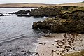
 Beach on Ness of Ramnageo - geograph.org.uk - 865232.jpg 640 × 426; 89 KB
-
-
 Boat at Ramnageo - geograph.org.uk - 319170.jpg 640 × 426; 41 KB
-
 Breck of Ramnageo - geograph.org.uk - 1498208.jpg 640 × 426; 64 KB
-
 Coastline at Ore Wick - geograph.org.uk - 786899.jpg 640 × 426; 84 KB
-
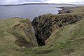
 Corbie Geo, Ramnageo - geograph.org.uk - 4817477.jpg 1,024 × 682; 255 KB
-
 Easter Stubbi Geo, Ness of Ramnageo - geograph.org.uk - 2193882.jpg 800 × 533; 242 KB
-
 Gorse Geos, Ramnageo - geograph.org.uk - 4817475.jpg 1,024 × 682; 270 KB
-
 House at Ramnageo - geograph.org.uk - 2193866.jpg 640 × 426; 52 KB
-
 Houses at Ramnageo, from the sea - geograph.org.uk - 5207795.jpg 1,024 × 682; 157 KB
-
 Littlegarth - geograph.org.uk - 335577.jpg 640 × 426; 19 KB
-
 Mires of Ramnageo - geograph.org.uk - 319164.jpg 600 × 399; 57 KB
-
 Mires of Ramnageo in the snow - geograph.org.uk - 1505185.jpg 640 × 426; 59 KB
-
 Neap of Littlegarth - geograph.org.uk - 786906.jpg 640 × 426; 70 KB
-
 Ness of Ramnageo - geograph.org.uk - 2193871.jpg 800 × 533; 163 KB
-
 Ness of Ramnageo - geograph.org.uk - 676717.jpg 640 × 426; 104 KB
-
 Ness of Ramnageo and Haaf Gruney - geograph.org.uk - 53011.jpg 640 × 430; 73 KB
-
 Ramnageo from the sea - geograph.org.uk - 2013182.jpg 800 × 534; 126 KB
-
 Ramnageo from the sea - geograph.org.uk - 5807009.jpg 1,600 × 1,065; 344 KB
-
 Ramnageo from the sea - geograph.org.uk - 6323900.jpg 1,600 × 1,067; 357 KB
-

-
 Scranklings, Ness of Ramnageo, Muness - geograph.org.uk - 3432318.jpg 1,024 × 681; 179 KB
-
 Sheep, and feeding bucket, Ramnageo - geograph.org.uk - 4817485.jpg 1,024 × 682; 140 KB
-
 Skuda Point, Ness of Ramnageo, from the sea - geograph.org.uk - 5207805.jpg 1,024 × 682; 84 KB
-
 Stubbi Geos, Ramnageo - geograph.org.uk - 2193878.jpg 800 × 534; 262 KB
-
 Stubbi Geos, Ramnageo, Muness - geograph.org.uk - 3432316.jpg 1,024 × 682; 198 KB
-
 The road to Ramnageo - geograph.org.uk - 5010458.jpg 2,592 × 1,944; 1.36 MB
-
 The ruin at Fauld, Ramnageo - geograph.org.uk - 5287799.jpg 1,024 × 682; 124 KB
-
 Tur Ness, Uyea, from the Ness of Littlegarth - geograph.org.uk - 3432356.jpg 1,024 × 682; 148 KB
-
 Uyea, late afternoon, from Ramnageo on Unst - geograph.org.uk - 6316091.jpg 1,600 × 1,067; 216 KB
-

-
 View towards Muness from Ramnageo - geograph.org.uk - 1498218.jpg 640 × 426; 55 KB
-
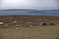
 Waiting for the Round-up - geograph.org.uk - 607901.jpg 640 × 426; 97 KB
-
 West Stubbi, Ramnageo, Uyeasound - geograph.org.uk - 6807020.jpg 1,600 × 720; 608 KB
-
 Wester Stubbi Geo, Ness of Ramnageo - geograph.org.uk - 2193880.jpg 800 × 534; 208 KB
-
 Wick of Fauld - geograph.org.uk - 676754.jpg 426 × 640; 113 KB
-

-
 Wick of Fauld from Ramnageo - geograph.org.uk - 865236.jpg 640 × 426; 95 KB
-
 Wick of Fauld, Ramnageo, Muness - geograph.org.uk - 4817479.jpg 1,024 × 682; 283 KB
-
 Wick of Fauld, Ramnagoe, Muness - geograph.org.uk - 3432341.jpg 1,024 × 681; 230 KB


