Category:Rainier Valley, Seattle, Washington
Jump to navigation
Jump to search
human settlement in Washington, United States of America | |||||
| Upload media | |||||
| Instance of | |||||
|---|---|---|---|---|---|
| Location | Washington, Pacific Northwest, Washington, Pacific States Region | ||||
 | |||||
Subcategories
This category has the following 13 subcategories, out of 13 total.
A
B
C
- Cao Dai Temple (Seattle) (3 F)
G
- Genesee Park (Seattle) (2 F)
H
- Hill Brick Works (3 F)
J
- John Muir School (6 F)
M
O
- Othello (Link station) (12 F)
R
S
- Sick's Stadium (10 F)
W
Media in category "Rainier Valley, Seattle, Washington"
The following 79 files are in this category, out of 79 total.
-
1-car Link train near Walden Street.jpg 3,264 × 2,448; 2.61 MB
-
9053 Yukon Ave. S., Seattle, circa 1930 (2).jpg 1,200 × 912; 352 KB
-
Aerial of Rainier Avenue in Seattle, 2001.jpg 787 × 1,200; 270 KB
-
Aerial of Rainier Valley, 1970.jpg 2,247 × 1,788; 412 KB
-
Bambi Drive-in, 1949 (14467395300).jpg 1,200 × 944; 253 KB
-
Brighton Beach School, ca 1910 (MOHAI 6111).jpg 695 × 543; 54 KB
-
Brighton School, ca. 1907 - DPLA - 49877bbee02eaa71099b267fda112e21.jpg 5,948 × 4,718; 1.86 MB
-
Brighton School, ca. 1907 - DPLA - eb24f7e9af591c63bf335a39f07a8466.jpg 5,840 × 4,670; 1.26 MB
-
Brighton School., ca. 1895 - DPLA - 583cc017dfbc8bab472f229eb1aa1b24.jpg 4,230 × 3,045; 691 KB
-
Chief Sealth Trail, looking east on S. Raymond St.jpg 6,000 × 4,000; 11.73 MB
-
Chief Sealth Trail.jpg 2,125 × 4,073; 4.36 MB
-
CM Okamoto Visits SE Seattle Senior Center (19136219333).jpg 2,988 × 5,312; 3.57 MB
-
CM Okamoto Visits SE Seattle Senior Center (19761809021).jpg 2,988 × 5,312; 1.93 MB
-
CM Okamoto Visits SE Seattle Senior Center (19761809551).jpg 5,312 × 2,988; 4.08 MB
-
CM Okamoto Visits SE Seattle Senior Center (19761810521).jpg 2,988 × 5,312; 2.11 MB
-
FERA Office Building in Beacon Hill (5178716405).jpg 640 × 503; 49 KB
-
First Red Light Camera (8891831765).jpg 1,704 × 2,272; 934 KB
-
Grand Tombola poster, Seattle circa 1940 (49305908662).jpg 2,298 × 3,540; 2.29 MB
-
House on Davis Place, 1961 (3641828618).gif 1,200 × 819; 964 KB
-
IMG00032-20100920-1248.jpg - panoramio.jpg 2,048 × 1,536; 485 KB
-
Looking south on Chief Sealth Trail near S. Brandon St. 01.jpg 4,000 × 6,000; 8.33 MB
-
Looking south on Chief Sealth Trail near S. Brandon St. 02.jpg 6,000 × 4,000; 9.32 MB
-
Looking south on Chief Sealth Trail near S. Brandon St. 03.jpg 4,000 × 6,000; 10.08 MB
-
Looking south on Chief Sealth Trail near S. Brandon St. 04.jpg 6,000 × 4,000; 12.23 MB
-
Meet at the curve (4021034163).jpg 4,272 × 2,848; 5.91 MB
-
Mini Link (4021842758).jpg 4,272 × 2,848; 1.64 MB
-
Mt. Rainier-2.jpg 3,082 × 2,055; 1.81 MB
-
New Holly Mixed-Use (4575069503).jpg 1,000 × 750; 700 KB
-
New Holly Sharrow street transition SFD--MF housing (4575069891).jpg 1,000 × 729; 789 KB
-
Not stopped (4021795416).jpg 4,272 × 2,848; 4.63 MB
-
One Way (4283914465).jpg 4,272 × 2,848; 3.17 MB
-
Pacing (4021796214).jpg 4,272 × 2,848; 4.08 MB
-
Pre-drill briefing -Movie- (3225144514).jpg 640 × 480; 158 KB
-
Rainier Valley flood, Seattle, 1914.jpg 1,200 × 1,006; 293 KB
-
Red Light Camera Press Briefing (8894246405).jpg 280 × 204; 20 KB
-
Seattle - 4837 S Rainier Ave - CIMG4145.JPG 2,560 × 1,712; 1.48 MB
-
Seattle - A&W, 1960.jpg 1,355 × 908; 112 KB
-
Seattle - Atlantic Street Center 01.jpg 3,264 × 2,448; 2.04 MB
-
Seattle - Atlantic Street Center 02.jpg 3,264 × 2,448; 2.04 MB
-
Seattle - Atlantic Street Center 03.jpg 3,264 × 2,448; 2.1 MB
-
Seattle - Borracchini's Bakery, circa 1970s (52181017347).jpg 700 × 465; 66 KB
-
Seattle - Brighton map.jpg 675 × 765; 114 KB
-
Seattle - Corwin Place S, 1955 (53381994331).jpg 700 × 556; 69 KB
-
Seattle - Dearborn Park International School sign.jpg 6,000 × 4,000; 13.42 MB
-
Seattle - Dearborn Park International School.jpg 6,000 × 4,000; 12.62 MB
-
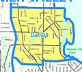
Seattle - Dunlap map.jpg 783 × 687; 127 KB
-
Seattle - Gardener at Rainier Vista P-Patch, 1990 (52016830485).jpg 700 × 1,036; 162 KB
-
Seattle - Hill Street looking east from Rainier Avenue, 1914 (23635307395).jpg 1,200 × 951; 353 KB
-
Seattle - House on Lake Washington below Rainier Avenue interurban, 1936 (52099196515).jpg 3,049 × 2,400; 2.17 MB
-
Seattle - panoramic view from Chief Sealth Trail near South Chicago Street.jpg 14,539 × 3,412; 33.1 MB
-
Seattle - Rainier and Jackson, 1967 (50397608348) (cropped).jpg 1,127 × 898; 243 KB
-
Seattle - Rainier and Jackson, 1967 (50397608348).jpg 1,200 × 960; 171 KB
-
Seattle - Rainier and Weller, 1918 (51103141597).jpg 3,160 × 2,370; 2.86 MB
-
Seattle - Rainier Avenue and Weller Street, 1918 (27359558348).jpg 1,200 × 913; 351 KB
-
Seattle - Rainier Valley map.jpg 1,703 × 3,248; 731 KB
-
Seattle - S Martin Luther King Jr. Way - Viet Wah supermarket - CIMG4163.jpg 2,560 × 1,712; 1.42 MB
-
Seattle - S Rainier Ave - a monument - CIMG4141.JPG 2,048 × 1,536; 1.14 MB
-
Seattle - S Rainier Ave - Nation of Islam - CIMG4140.JPG 2,048 × 1,536; 1.11 MB
-
Seattle - S Rainier Ave - Pathfinder Books - CIMG4142.JPG 2,048 × 1,536; 1.12 MB
-
Seattle - Server at Joy Palace, 2009 (54000409369).jpg 2,912 × 4,368; 7.39 MB
-
Seattle - Workers on Henderson Street trunk sewer, 1937 (14794826877).jpg 1,200 × 922; 419 KB
-
Seattle Chinese Alliance Church 01.jpg 6,000 × 4,000; 10.3 MB
-
Seattle Chinese Alliance Church 02.jpg 6,000 × 4,000; 10.4 MB
-
Seattle Chinese Alliance Church 03.jpg 6,000 × 4,000; 11.02 MB
-
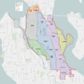
Seattle City Council District 2 neighborhoods.png 3,610 × 3,610; 5.32 MB
-
Seattle Map - Rainier Valley.png 394 × 698; 15 KB
-
Seattle-Columbia-Center-looking-SE-2326.jpg 1,600 × 1,200; 612 KB
-
Sound Transit Link Light Rail Train.jpg 4,000 × 3,000; 3.79 MB
-
Sound Transit Police.jpg 4,000 × 3,000; 5.35 MB
-
Sukkah frame.jpg 1,600 × 1,200; 704 KB
-
Trail sign on Chief Sealth Trail 01.jpg 6,000 × 4,000; 7.08 MB
-
Waiting for the drill to start (3224288845).jpg 3,264 × 2,448; 3.51 MB
-
Waiting for the drill to start (3224289155).jpg 3,264 × 2,448; 3.8 MB


