Category:Railway bridges in Buckinghamshire
Jump to navigation
Jump to search
Ceremonial counties of England: Bedfordshire · Berkshire · Buckinghamshire · Cambridgeshire · Cheshire · Cornwall · Cumbria · Derbyshire · Devon · Dorset · Durham · East Riding of Yorkshire · East Sussex · Essex · Gloucestershire · Greater London · Greater Manchester · Hampshire · Herefordshire · Hertfordshire · Kent · Lancashire · Leicestershire · Lincolnshire · Merseyside · Norfolk · North Yorkshire · Northamptonshire · Northumberland · Nottinghamshire · Oxfordshire · Rutland · Shropshire · Somerset · South Yorkshire · Staffordshire · Suffolk · Surrey · Tyne and Wear · Warwickshire · West Midlands · West Sussex · West Yorkshire · Wiltshire · Worcestershire
City-counties: Bristol · City of London
Former historic counties:
Other former counties:
City-counties: Bristol · City of London
Former historic counties:
Other former counties:
Wikimedia category | |||||
| Upload media | |||||
| Instance of | |||||
|---|---|---|---|---|---|
| Category combines topics | |||||
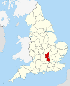
| Buckinghamshire | |||||
ceremonial county in England, UK (use Q21694636 for administrative unitary authority) | |||||
| Instance of | |||||
| Location |
| ||||
| Capital | |||||
| Population |
| ||||
| Area |
| ||||
| Different from | |||||
| Said to be the same as | Buckinghamshire (historic county of England, ceremonial county of England, 1844) | ||||
| official website | |||||
 | |||||
Subcategories
This category has the following 11 subcategories, out of 11 total.
Media in category "Railway bridges in Buckinghamshire"
The following 57 files are in this category, out of 57 total.
-
A4, approaching railway bridge - geograph.org.uk - 3560483.jpg 640 × 430; 49 KB
-
A41 looking west towards railway bridge - geograph.org.uk - 58055.jpg 640 × 480; 105 KB
-
Amerden Lane, Taplow geograph-6680452-by-N-Chadwick.jpg 1,024 × 684; 233 KB
-
Bourne End Railway and Foot Bridge.JPG 2,272 × 1,704; 1.43 MB
-
Bradenham Road Bridge.jpg 4,000 × 3,000; 5.48 MB
-
Bridge 143, Euston Main Line - geograph.org.uk - 810059.jpg 640 × 480; 70 KB
-
Burnham, Lent Rise Road bridge - geograph.org.uk - 206687.jpg 640 × 480; 101 KB
-
Chesham Bois, Hollow Way Lane - geograph.org.uk - 131749.jpg 640 × 480; 95 KB
-
Denham Golf Club Railway Station - geograph.org.uk - 1475655.jpg 640 × 480; 100 KB
-
Former Waddesdon Station site - geograph.org.uk - 261783.jpg 640 × 480; 90 KB
-
High Wycombe, Bowden Lane railway bridge - geograph.org.uk - 925447.jpg 640 × 480; 128 KB
-
Lane heading under railway bridge - geograph.org.uk - 1051727.jpg 640 × 480; 101 KB
-
Lodge Lane - geograph.org.uk - 1065177.jpg 640 × 480; 110 KB
-
Loudwater, Magpie Lane railway bridge - geograph.org.uk - 583025.jpg 640 × 480; 151 KB
-
Low railway bridge, Taplow geograph-6680457-by-N-Chadwick.jpg 1,024 × 684; 289 KB
-
Mailtrain on Bridego Bridge - geograph.org.uk - 1305.jpg 640 × 480; 46 KB
-
Old railway bridge, Woodham - geograph.org.uk - 134632.jpg 640 × 480; 86 KB
-
Railway Arch - geograph.org.uk - 446406.jpg 640 × 480; 128 KB
-
Railway at Haddenham - geograph.org.uk - 53716.jpg 640 × 480; 110 KB
-
Railway bridge - geograph.org.uk - 60119.jpg 640 × 480; 154 KB
-
Railway Bridge Buckinghamshire - geograph.org.uk - 581041.jpg 640 × 480; 108 KB
-
Railway Bridge near Ludgershall - geograph.org.uk - 219595.jpg 640 × 427; 124 KB
-
Railway bridge near Shipton Lee - geograph.org.uk - 387356.jpg 640 × 480; 161 KB
-
Railway bridge over Bath Road, Taplow - geograph.org.uk - 2811995.jpg 1,600 × 1,200; 590 KB
-
Railway bridge, Little Kingshill - geograph.org.uk - 147211.jpg 640 × 480; 126 KB
-
Railway bridge, West Wycombe - geograph.org.uk - 686596.jpg 480 × 640; 132 KB
-
Railway, Little Missenden - geograph.org.uk - 150405.jpg 640 × 480; 130 KB
-
Road under Rail Bridge - geograph.org.uk - 229294.jpg 640 × 480; 169 KB
-
2012 at Taplow station - Bath Road bridge north side.jpg 1,024 × 512; 194 KB
-
The Cattle Arch - geograph.org.uk - 448206.jpg 640 × 480; 119 KB
-
The South Bucks Way - geograph.org.uk - 848983.jpg 640 × 480; 117 KB
-
Train Robbers Bridge Network Rail plaque.jpg 1,880 × 1,510; 827 KB
-
Train Robbers' Bridge.jpg 1,872 × 2,016; 1.44 MB
-
Wolverton2.jpg 1,388 × 1,038; 252 KB
-
Beacon Hill Railway Bridge - geograph.org.uk - 303768.jpg 640 × 480; 81 KB
-
Bledlow, Perry Lane railway bridge - geograph.org.uk - 752039.jpg 640 × 480; 125 KB
-
Entering Towersey - geograph.org.uk - 713034.jpg 640 × 425; 93 KB
-
Railway bridge in Nash Lee Road - geograph.org.uk - 83738.jpg 640 × 427; 144 KB
-
Railway bridge looking east - geograph.org.uk - 60120.jpg 640 × 480; 122 KB
-
Railway bridge near Greatmoor - geograph.org.uk - 420325.jpg 640 × 480; 125 KB
-
Station House and railway bridge - geograph.org.uk - 559628.jpg 640 × 480; 78 KB


