Category:Railroad maps of Boston
Jump to navigation
Jump to search
Media in category "Railroad maps of Boston"
The following 26 files are in this category, out of 26 total.
-
 1840s Grand Junction Railroad map.jpg 4,436 × 3,767; 7.96 MB
-
 1865 Boston railroads map.jpg 7,966 × 6,823; 95.33 MB
-
 1866 Boston horsecar map.png 3,500 × 3,195; 29.26 MB
-
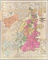
 1871 Boston map by H. F. Walling & Orm Gray.jpg 8,552 × 5,531; 14.07 MB
-
 1880 Boston railroads map.jpg 1,546 × 1,554; 654 KB
-
 Boston, Winthrop and Shore Railroad Company share certificate, 1885.jpg 900 × 637; 111 KB
-

-
 1888 Boston map showing proposed NY&B Rapid Transit route.jpg 8,672 × 10,761; 19.97 MB
-
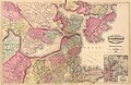
 1893 Map showing the terminal facilities of Boston.jpg 7,568 × 5,968; 16.32 MB
-
 1899 Map showing the terminal facilities of Boston.jpg 7,310 × 6,186; 18.65 MB
-
 1900 Boston and Maine Railroad freight terminals map.png 3,500 × 1,877; 14.03 MB
-
 1902 Map showing the terminal facilities of Boston.jpg 9,252 × 6,728; 30.67 MB
-
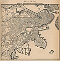
 1903 Boston map.jpg 7,960 × 11,560; 25.49 MB
-
 1911 map of proposed tunnel to East Boston.png 5,000 × 792; 6.22 MB
-
 1914 BTC subway map.png 3,500 × 3,092; 18.78 MB
-
 1917 BTC subway map.png 3,500 × 3,094; 21.29 MB
-
 Charlestown Branch Railroad plan, 1835.jpg 2,739 × 1,660; 1.03 MB
-
 Grand Junction Railroad and Depot Company map.png 1,020 × 670; 1.29 MB
-
 Medford st ward map 1922.jpg 750 × 524; 124 KB
-
 Plan and profile of the proposed alterations of the Brighton Branch Railroad.jpg 9,589 × 3,446; 4.34 MB
-
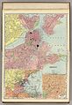
 Steam railroads in Boston 1888 (7557402048).jpg 4,486 × 4,140; 19.75 MB
-
 Sullivan.png 430 × 394; 15 KB
-
 Survey for a proposed branch railroad between Allston and Newton.jpg 8,901 × 4,700; 3.86 MB
-
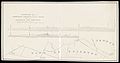
 The Street railway journal (1899) (14758546072).jpg 3,344 × 1,249; 286 KB
-
 View of Boston freight terminals, The New York, New Haven & Hartford railroad LCCN2003677979.jpg 10,878 × 7,392; 12.3 MB
-
 View of Boston freight terminals, The New York, New Haven & Hartford railroad LCCN2003677979.tiff 10,878 × 7,392; 230.08 MB


.jpg)


_(14758546072).jpg)