Category:Rail transport maps of Vosges
Jump to navigation
Jump to search
Media in category "Rail transport maps of Vosges"
The following 6 files are in this category, out of 6 total.
-
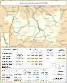
 Railway map of France - 88 - 1900 - fr - small.svg 705 × 861; 7.6 MB
-
 Railway map of France - 88 - 1910 - fr - small.svg 705 × 861; 7.68 MB
-
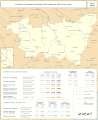
 Railway map of France - 88 - 1932 - fr - small.svg 705 × 861; 7.87 MB
-
 Railway map of France - 88 - 1980 - fr - small.svg 705 × 861; 7.83 MB
-
 Railway map of France - 88 - 2020 - fr - small.svg 705 × 861; 7.59 MB
-
 Railway map of France - 88 - animated - fr.gif 1,566 × 1,913; 5.2 MB


