Category:Rail transport maps of Surrey
Jump to navigation
Jump to search
Media in category "Rail transport maps of Surrey"
The following 20 files are in this category, out of 20 total.
-
Alton line.png 1,935 × 1,358; 2.02 MB
-
Ascot-Guildford line.png 1,506 × 1,930; 2.52 MB
-
Epsom Downs Branch.png 1,669 × 1,196; 1.22 MB
-
Hampton Court branch line.png 1,287 × 1,030; 891 KB
-
New Guildford line.png 1,634 × 1,514; 2.69 MB
-
Brighton main line.png 1,797 × 2,374; 4.28 MB
-
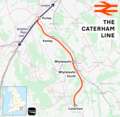
Caterham line.png 1,655 × 1,615; 1.5 MB
-
Chertsey branch line.png 1,685 × 1,386; 2.03 MB
-
Cranleigh line.png 1,068 × 1,163; 83 KB
-
Crossrail2 Greater London.png 1,385 × 1,056; 448 KB
-
Epsom&leather1859.png 956 × 735; 24 KB
-
Epsom&leather1867.png 956 × 735; 28 KB
-
Epsom&leather1885.png 956 × 735; 30 KB
-
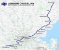
London Crosslink.png 2,353 × 1,992; 5.2 MB
-
Oxted line.png 1,552 × 1,707; 2.6 MB
-
Rail transport infrastructure map - UK - South East England.svg 1,247 × 983; 8.83 MB
-
Redhill–Tonbridge line.png 2,340 × 1,527; 2.92 MB
-
Shepperton branch line.png 2,239 × 1,416; 2.24 MB
-
Staines–Windsor line.png 1,808 × 1,417; 1.53 MB
-
Tattenham Corner line.png 2,184 × 1,418; 1.76 MB


