Category:Rail transport maps of Suffolk
Jump to navigation
Jump to search
Media in category "Rail transport maps of Suffolk"
The following 15 files are in this category, out of 15 total.
-
Aldeburgh branch line.png 1,558 × 1,190; 737 KB
-
Beccles to Yarmouth railway.jpg 624 × 516; 25 KB
-
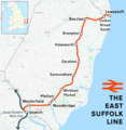
East Suffolk line.png 1,575 × 1,615; 1.33 MB
-
East West Rail Consortium Eastern map.jpg 618 × 463; 43 KB
-
East West Rail Consortium overview map.jpg 1,024 × 768; 107 KB
-
Felixstowe branch line.png 2,078 × 1,724; 1.9 MB
-
Felixstowe railway development.png 720 × 960; 38 KB
-
Felixstowe to Nuneaton developments.png 726 × 415; 227 KB
-
Felixstowe to Nuneaton rail link.png 750 × 500; 321 KB
-
Great Eastern Main Line.png 1,936 × 1,905; 3.44 MB
-
Ipswich-Ely line.png 2,207 × 1,426; 2.14 MB
-
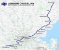
London Crosslink.png 2,353 × 1,992; 5.2 MB
-
Lowestoft Corporation Tramways.svg 2,085 × 2,315; 250 KB
-
Rail transport infrastructure map - UK - East of England.svg 907 × 1,209; 5.78 MB
-
Wherry Lines.svg 1,425 × 937; 900 KB


