Category:Rail transport maps of Staffordshire
Jump to navigation
Jump to search
Media in category "Rail transport maps of Staffordshire"
The following 18 files are in this category, out of 18 total.
-
Birmingham & West Mids Passenger Railway Map (no Metro).svg 1,304 × 1,039; 298 KB
-
Birmingham & West Mids Passenger Railway Map.JPG 1,248 × 1,142; 472 KB
-
Birmingham & West Mids Passenger Railway Map.svg 1,374 × 1,056; 315 KB
-
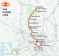
Chase line.png 1,277 × 1,208; 1.4 MB
-
Crewe–Derby line.png 2,025 × 1,481; 2.22 MB
-
Cross-City Line Map (alt version).png 1,240 × 1,244; 1.5 MB
-
Cross-City Line.png 1,391 × 1,347; 1.87 MB
-
Leicester–Burton upon Trent line.png 1,535 × 1,225; 1.47 MB
-
Midland at walsall.png 1,296 × 1,070; 119 KB
-
Rail transport infrastructure map - UK - West Midlands.svg 1,059 × 869; 5.49 MB
-
Rugby–Birmingham–Stafford line.png 2,022 × 1,730; 3.15 MB
-
Stafford & uttox 1867.png 1,524 × 989; 100 KB
-
Stafford & uttox 1881.png 1,524 × 989; 102 KB
-
Stafford–Manchester line.png 1,546 × 1,868; 2.31 MB
-
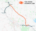
Stone-Colwich Line.png 1,819 × 1,598; 1.29 MB
-
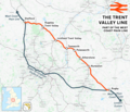
Trent Valley line.png 2,022 × 1,730; 3.15 MB
-
West Midlands and CrossCountry Network Map.svg 1,400 × 1,120; 262 KB
-
West Mids Metro and Rail Passenger Railway Map.svg 660 × 432; 315 KB


