Category:Rail transport maps of Nottinghamshire
Jump to navigation
Jump to search
Media in category "Rail transport maps of Nottinghamshire"
The following 20 files are in this category, out of 20 total.
-
Ambergate line 1850.png 4,663 × 2,203; 179 KB
-
Ambergate line 1857.png 4,663 × 2,203; 200 KB
-
Ambergate line 1879.png 4,663 × 2,203; 281 KB
-
Bawtry - haxey.png 1,075 × 688; 61 KB
-
Lancashire, Derbyshire and East Coast Railway.png 1,502 × 702; 111 KB
-
Leen-valley-1882.png 643 × 1,491; 69 KB
-
Leen-valley-1901.png 643 × 1,491; 92 KB
-
Leen-valley-now.png 643 × 1,491; 81 KB
-
Mansfield-rly.png 1,230 × 1,025; 90 KB
-
Mcrmap.jpg 400 × 886; 31 KB
-
Midland Railway Ilkeston.jpg 300 × 412; 24 KB
-
Nott-sub-1889.png 1,058 × 878; 74 KB
-
Nott-sub-1900.png 1,058 × 878; 89 KB
-
Nottingham–Grantham line.png 2,369 × 1,364; 1.87 MB
-
Nottingham–Lincoln line.png 1,923 × 1,499; 1.91 MB
-
Pinxton 1819.png 1,337 × 1,069; 50 KB
-
Pinxton.png 1,337 × 1,069; 42 KB
-
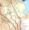
Rail transport infrastructure map - UK - East Midlands.svg 983 × 1,020; 6.31 MB
-
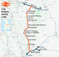
Robin Hood Line.png 1,486 × 1,439; 1.74 MB
-
Sheffield–Lincoln line.png 2,977 × 2,159; 4.28 MB


