Category:Rail transport maps of Northumberland
Jump to navigation
Jump to search
Media in category "Rail transport maps of Northumberland"
The following 8 files are in this category, out of 8 total.
-
Allendale branch.png 1,421 × 1,091; 70 KB
-
Border Counties Rly.png 1,868 × 1,512; 133 KB
-
HS3-2017-map.png 2,157 × 1,440; 3.51 MB
-
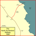
N Sunderland.png 1,056 × 1,054; 45 KB
-
Northern Powerhouse rail.png 2,000 × 1,250; 512 KB
-
Northumberland Line.png 1,992 × 2,001; 2.26 MB
-
Rail transport infrastructure map - UK - North East England.svg 756 × 869; 1.72 MB
-
Tyne Valley line.png 3,019 × 1,265; 2.48 MB


