Category:Rail transport maps of New Jersey
Jump to navigation
Jump to search
States of the United States: Alabama · Alaska · Arizona · Arkansas · California · Colorado · Connecticut · Delaware · Florida · Georgia · Idaho · Illinois · Indiana · Iowa · Kansas · Kentucky · Louisiana · Maine · Maryland · Massachusetts · Michigan · Minnesota · Mississippi · Missouri · Montana · Nevada · New Hampshire · New Jersey · New Mexico · New York · North Carolina · North Dakota · Ohio · Oklahoma · Oregon · Pennsylvania · Rhode Island · South Carolina · Tennessee · Texas · Utah · Vermont · Virginia · Washington · West Virginia · Wisconsin · Wyoming – Washington, D.C.
Subcategories
This category has the following 4 subcategories, out of 4 total.
M
- Maps of Conrail (10 F)
- Maps of Metro-North Railroad (17 F)
T
- Tram maps of New Jersey (13 F)
Pages in category "Rail transport maps of New Jersey"
This category contains only the following page.
Media in category "Rail transport maps of New Jersey"
The following 93 files are in this category, out of 93 total.
-
Rockaway Valley Railroad map.jpg 758 × 760; 96 KB
-
00075.BK-- (eac0da92-d430-4cf7-a1c1-37b7413d750e).jpg 5,231 × 4,314; 2.68 MB
-
1887 map of NJ railroads (newark excerpt).jpg 1,145 × 999; 363 KB
-
1890s Philadelphia, Wilmington and Baltimore map.jpg 1,000 × 1,393; 920 KB
-
1891 Poor's Delaware, Lackawanna and Western Railroad.jpg 4,166 × 2,716; 2.83 MB
-
1893 New Jersey and New York Railroad Timetable with Map.jpg 1,600 × 926; 343 KB
-
1893 Poor's Delaware, Lackawanna and Western Railroad.jpg 4,074 × 2,612; 1.92 MB
-
1901 Poor's Delaware, Lackawanna and Western Railroad.jpg 3,340 × 2,164; 2.08 MB
-
1903 Poor's Delaware, Lackawanna and Western Railroad.jpg 3,282 × 2,134; 1.96 MB
-
54339.BB--Encroachment on land--Netcong, NJ (3638ea87-b9d7-45f3-b9f3-57031934251b).jpg 2,560 × 1,565; 362 KB
-
54339.BB--Encroachment on land--Netcong, NJ (cfe8ecd1-d1a1-4b65-8896-ac92fd0412d2).jpg 2,567 × 1,558; 381 KB
-
62 of 'Popular Resorts and how to reach them, etc. (Second edition.)' (11251378074).jpg 1,045 × 1,833; 495 KB
-
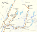
Aldene Connection Map.svg 1,461 × 748; 100 KB
-
Atlantic City Railroad - System Index Map.jpg 3,292 × 5,100; 3.31 MB
-
B&O Royal Blue map.png 1,091 × 729; 1.29 MB
-
Bay Shore Connecting Railroad - System Index Map.jpg 3,292 × 5,100; 3.44 MB
-
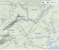
CNJ Iron Mine RRs.png 576 × 504; 77 KB
-
D&H-Canal.svg 1,100 × 936; 761 KB
-
Delaware and Hudson Canal Map.png 1,100 × 936; 672 KB
-
Delaware Lackawanna & Western Railroad - System Index Map.jpg 3,292 × 5,100; 3.68 MB
-
DLW map 1922.gif 751 × 509; 87 KB
-
DLW SUBURBAN NJ 19451028.png 1,620 × 1,178; 1.12 MB
-
Easton and Amboy Railroad.svg 400 × 400; 276 KB
-
Erie Railroad - System Index Map.jpg 17,062 × 7,504; 17.07 MB
-
Erie Terminals Railroad - System Index Map.jpg 3,292 × 5,100; 6.47 MB
-
Freehold & Jamesburg Agricultural Railroad - System Index Map.jpg 3,292 × 5,100; 6.54 MB
-
Hoboken Shore Road Route Map.jpg 1,191 × 510; 234 KB
-
Jersey City Newark and Western Railway.svg 400 × 400; 278 KB
-
Lehigh and New England Railroad - System Index Map.jpg 4,087 × 2,635; 4.19 MB
-
Lehigh Valley Jersey City Terminal.png 800 × 600; 282 KB
-
Lehigh Valley Railroad System Map.svg 800 × 600; 447 KB
-
Lehigh Valley Terminal Railway.svg 400 × 400; 313 KB
-
New Jersey and New York Railroad - System Index Map.jpg 3,292 × 5,100; 3.18 MB
-
New Jersey Junction Railroad - System Index Map.jpg 3,292 × 5,100; 4.17 MB
-
New Jersey railroad map.png 4,794 × 10,214; 2.83 MB
-
New Jersey Southern Railroad.svg 576 × 720; 791 KB
-
New York City Railroads ca 1900.png 600 × 600; 184 KB
-
New York, Susquehanna and Western Railway - System Index Map.jpg 3,292 × 5,100; 3.04 MB
-
Newark and Passaic Railway.svg 400 × 400; 256 KB
-
Newark and Roselle Railway.svg 400 × 400; 290 KB
-
Newark Railway.svg 400 × 400; 296 KB
-
NY Tunnel Extension & Connections PRR 1912.jpg 1,003 × 639; 568 KB
-
NYSW Wilkes-Barre and Eastern.svg 800 × 600; 731 KB
-
Pennsylvania and Atlantic Railroad - System Index Map.jpg 3,292 × 5,100; 4.65 MB
-
Perth Amboy and Woodbridge Railroad - System Index Map.jpg 3,292 × 5,100; 6.66 MB
-
PRR Bel-Del Branch Stations and Interchanges.png 1,275 × 2,100; 154 KB
-
PRSL on US map cropped.png 150 × 161; 7 KB
-
Rahway Valley Railroad - System Index Map.jpg 3,292 × 5,100; 1.5 MB
-
Roselle and South Plainfield Railroad.svg 400 × 400; 240 KB
-
Staten Island Rapid Transit Railway - System Index Map.jpg 3,292 × 5,100; 3.37 MB
-
Sussex County NJ Railroad Map.svg 768 × 768; 584 KB
-
Transportation Map of New Jersey - DPLA - 810e855d24117fd0be028c97414065ea (page 1).jpg 2,702 × 3,500; 2.73 MB
-
Treat's illustrated New York, Philadelphia and surroundings (1876) (14763152295).jpg 4,480 × 2,596; 1.2 MB
-
Union county light rail.png 1,475 × 1,204; 87 KB
-
United NJ RR and Canal Co map.png 209 × 896; 21 KB
-
West Jersey & Seashore Railroad - System Index Map.jpg 3,292 × 5,100; 3.23 MB
-
Wharton and Northern Railroad - System Index Map.jpg 3,292 × 5,100; 3.18 MB


