Category:Rail transport maps of Devon
Jump to navigation
Jump to search
Media in category "Rail transport maps of Devon"
The following 22 files are in this category, out of 22 total.
-
Avocet Line.png 1,502 × 1,661; 1.73 MB
-
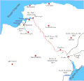
B&ER 1876.gif 1,338 × 1,038; 105 KB
-
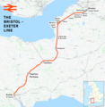
Bristol–Exeter line.png 2,351 × 2,403; 3.08 MB
-
Cornish Main Line.png 2,600 × 1,595; 1.19 MB
-
Dartmoor Line.png 3,250 × 1,920; 2.6 MB
-
Devonrailways.png 942 × 489; 84 KB
-
East Devon branch lines.png 820 × 440; 35 KB
-
Exeter–Plymouth line.png 2,296 × 1,801; 2.38 MB
-
Exmouth 1908 mod.gif 1,194 × 968; 67 KB
-
Exmouth branch 1861.gif 800 × 978; 65 KB
-
Exmouth branch 1903.gif 800 × 978; 71 KB
-
GWR map Devon.jpg 768 × 837; 353 KB
-
North Devon and Cornwall Junction Light Railway map.gif 1,400 × 1,997; 83 KB
-
North devon rly.gif 600 × 579; 21 KB
-
Rail transport infrastructure map - UK - South West England.svg 1,209 × 945; 6.67 MB
-
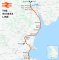
Riviera Line.png 1,978 × 2,027; 2.09 MB
-
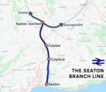
Seaton branch line.png 1,160 × 1,003; 640 KB
-
SR west of salis.gif 1,467 × 951; 76 KB
-
St germans deviation.png 1,507 × 658; 93 KB
-
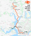
Tamar Valley Line.png 1,578 × 1,812; 1.79 MB
-
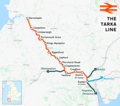
Tarka Line.png 1,789 × 1,580; 1.46 MB
-
West of England line.png 2,578 × 1,481; 3.19 MB


