Category:Rail transport maps of Bavaria
Jump to navigation
Jump to search
Federal states of Germany:
Subcategories
This category has the following 5 subcategories, out of 5 total.
M
- Munich Metro maps (28 F)
N
- U-Bahn maps of Nuremberg (48 F)
Media in category "Rail transport maps of Bavaria"
The following 200 files are in this category, out of 239 total.
(previous page) (next page)-
Allgäubahn Karte.png 2,712 × 1,407; 5.27 MB
-
Amberg-Lauterhofen.png 2,789 × 1,754; 1.68 MB
-
Amberg-Schmidmühlen.png 1,423 × 2,684; 1.28 MB
-
Amberg-Schnaittenbach.png 1,797 × 1,851; 1.09 MB
-
Ammergaubahn.png 2,024 × 1,672; 1.08 MB
-
Ammerseebahn 1904.svg 1,196 × 2,410; 1.4 MB
-
Ammerseebahn.png 1,225 × 2,997; 2.25 MB
-
S-Bahn Augsburg Liniennetzplan.jpg 871 × 957; 214 KB
-
Ausbaustrecke München–Lindau.png 1,129 × 544; 1.29 MB
-
Außerfernbahn.png 4,135 × 2,602; 3.51 MB
-
Badendorfobing.png 730 × 825; 67 KB
-
Bahnen im Bayerisches Oberland.png 4,000 × 3,181; 5.45 MB
-
Bahnhoefe Wuerzburg.png 990 × 751; 679 KB
-
Bahnhof Ebermannstadt, ORM-Map.png 1,362 × 957; 512 KB
-
Bahnhof Freilassing Karte.jpg 1,030 × 323; 148 KB
-
Bahnkarte Deutschland 1861 Ausschnitt Oberbayern.jpg 707 × 530; 396 KB
-
Bahnkarte Deutschland 1899 Ausschnitt Oberbayern.jpg 672 × 489; 364 KB
-
Bahnkarte Isartalbahn.jpg 1,579 × 2,160; 2.14 MB
-
Bahnprojekt Ulm–Augsburg Karte.svg 1,400 × 734; 7.55 MB
-
Bahnstrecke Altenerding–Pfrombach.png 1,500 × 2,182; 1.25 MB
-
Bahnstrecke Aschaffenburg - Höchst (Odenwald).svg 343 × 379; 11.11 MB
-
Bahnstrecke Aufhausen-Kroehstorf.png 2,372 × 1,971; 2.15 MB
-
Bahnstrecke Augsburg–Ulm Karte.png 3,058 × 1,481; 4.08 MB
-
Bahnstrecke Augsburg–Welden.png 1,499 × 926; 205 KB
-
Bahnstrecke Bamberg–Hof Karte.png 2,916 × 1,954; 6.35 MB
-
Bahnstrecke Bayreuth–Neuenmarkt-Wirsberg (Karte).svg 248 × 751; 682 KB
-
Bahnstrecke Biessenhofen–Füssen.png 2,176 × 3,720; 3.46 MB
-
Bahnstrecke Bodenwöhr–Nittenau.png 2,325 × 2,324; 2.4 MB
-
Bahnstrecke Bodenwöhr–Rötz.png 2,325 × 2,324; 2.44 MB
-
Bahnstrecke Breitengüßbach–Dietersdorf.png 2,500 × 3,837; 2.47 MB
-
Bahnstrecke Breitengüßbach–Maroldsweisach.png 2,500 × 3,837; 2.49 MB
-
Bahnstrecke Cham-Lam.png 2,999 × 3,278; 5.72 MB
-
Bahnstrecke Cham–Waldmünchen.png 2,074 × 1,779; 1.62 MB
-
Bahnstrecke Dachau–Altomünster.png 2,148 × 1,962; 1.37 MB
-
Bahnstrecke Deggendorf–Metten.png 2,014 × 2,380; 1.73 MB
-
Bahnstrecke Dinkelscherben-Thannhausen.jpg 1,701 × 1,265; 537 KB
-
Bahnstrecke Dorfen–Velden.png 1,975 × 2,282; 1.76 MB
-
Bahnstrecke Eggmuehl-Langquaid.png 1,883 × 1,194; 934 KB
-
Bahnstrecke Erlangen-Bruck–Herzogenaurach.png 3,000 × 1,392; 2.02 MB
-
Bahnstrecke Erlangen–Eschenau.png 2,924 × 3,163; 3.68 MB
-
Bahnstrecke Feucht–Altdorf.png 2,000 × 805; 656 KB
-
Bahnstrecke Flieden–Gemünden.png 1,743 × 2,725; 2.46 MB
-
Bahnstrecke Gotteszell-Blaibach.png 2,999 × 3,278; 5.72 MB
-
Bahnstrecke Grafing–Glonn.png 1,784 × 1,968; 1.23 MB
-
Bahnstrecke Grafing–Wasserburg.png 1,180 × 523; 115 KB
-
Bahnstrecke Holenbrunn Leupoldsdorf.png 1,690 × 1,022; 190 KB
-
Bahnstrecke Ingolstadt-Treuchtlingen.png 1,821 × 1,213; 1.6 MB
-
Bahnstrecke Kaufbeuren Schongau Karte.png 3,000 × 2,000; 3.72 MB
-
Bahnstrecke Kaufbeuren Schongau.png 3,000 × 2,000; 4.2 MB
-
Bahnstrecke Kitzingen–Schweinfurt.png 979 × 1,295; 783 KB
-
Bahnstrecke Landau-Arnstorf2.png 2,372 × 1,971; 2.19 MB
-
Bahnstrecke Landshut-Plattling.png 1,997 × 1,031; 1.91 MB
-
Bahnstrecke Ludwigsstadt - Lehesten.svg 1,997 × 1,160; 10.01 MB
-
Bahnstrecke Ludwigsstadt–Lehesten.png 2,087 × 1,261; 1.93 MB
-
Bahnstrecke Markt Schwaben–Erding.png 1,164 × 1,916; 1.05 MB
-
Bahnstrecke Memmingen Legau.png 1,217 × 1,941; 321 KB
-
Bahnstrecke Mühldorf–Burghausen.png 1,040 × 523; 173 KB
-
Bahnstrecke Mühldorf–Burghausen2.png 4,810 × 2,136; 5.13 MB
-
Bahnstrecke Mühldorf–Simbach am Inn.png 4,810 × 2,136; 5.11 MB
-
Bahnstrecke München-Giesing – Kreuzstraße.png 1,136 × 1,973; 528 KB
-
Bahnstrecke München–Augsburg Karte.png 2,994 × 1,684; 4.19 MB
-
Bahnstrecke München–Herrsching.png 2,057 × 1,690; 1.98 MB
-
Bahnstrecke München–Regensburg.png 1,359 × 1,390; 1.81 MB
-
Bahnstrecke München–Rosenheim.png 3,619 × 2,174; 3.19 MB
-
Bahnstrecke Nabburg–Schönsee.png 3,651 × 1,921; 2.18 MB
-
Bahnstrecke Neufahrn–Radldorf.png 2,508 × 1,584; 1.55 MB
-
Bahnstrecke Neukirchen–Weiden (Karte).svg 1,548 × 752; 2.82 MB
-
Bahnstrecke Nürnberg-Augsburg.png 943 × 1,989; 2.01 MB
-
Bahnstrecke Nürnberg-Crailsheim.png 2,000 × 1,102; 1.75 MB
-
Bahnstrecke Nürnberg–Bamberg.png 3,578 × 6,162; 9.98 MB
-
Bahnstrecke Obernburg-Heimbuchenthal.svg 724 × 382; 4.18 MB
-
Bahnstrecke Regensburg–Nürnberg Karte.svg 1,693 × 1,133; 13.82 MB
-
Bahnstrecke Regensburg–Weiden (Karte).svg 315 × 751; 14.73 MB
-
Bahnstrecke Rosenheim-Salzburg.png 6,387 × 1,431; 2.39 MB
-
Bahnstrecke Rosenheim–Staatsgrenze bei Kufstein.png 2,079 × 3,120; 1.76 MB
-
Bahnstrecke Schongau-Peißenberg.png 1,881 × 1,076; 1.33 MB
-
Bahnstrecke Schwandorf–Furth im Wald.png 5,349 × 2,324; 5.74 MB
-
Bahnstrecke Schweinfurt-Meiningen.png 704 × 704; 535 KB
-
Bahnstrecke Seligenstadt–Volkach.png 1,475 × 608; 578 KB
-
Bahnstrecke Sonneberg–Stockheim.png 5,115 × 3,630; 3.23 MB
-
Bahnstrecke Straubing-Miltach.png 2,999 × 3,278; 5.72 MB
-
Bahnstrecke Strullendorf.png 4,344 × 1,896; 2.27 MB
-
Bahnstrecke Wallersdorf-Muenchshofen.png 1,923 × 1,577; 945 KB
-
Bahnstrecke Weiden–Bayreuth (Karte).svg 985 × 751; 7.15 MB
-
Bahnstrecke Weiden–Oberkotzau (Karte).svg 400 × 751; 12.09 MB
-
Bahnstrecke Weilheim-Peißenberg.png 1,881 × 1,076; 1.33 MB
-
Bahnstrecke Zwiesel–Bodenmais.png 1,426 × 1,077; 599 KB
-
Bahnstrecke Zwiesel–Grafenau.png 1,697 × 2,268; 1.54 MB
-
Bahnstrecken Oberfranken (Karte).svg 1,006 × 752; 192 KB
-
Bahnstrecken-Coburger-Land.png 2,017 × 1,525; 149 KB
-
Bahnverbindungen BahnhofWeiden(Oberpf).png 653 × 666; 28 KB
-
Bahnverlauf der Isartalbahn.JPG 585 × 1,052; 53 KB
-
Banhstrecke Nördlingen - Dombühl.png 525 × 443; 22 KB
-
Bauplan Zahnradbahn Baustelle.jpg 803 × 480; 100 KB
-
Bayerische Zugspitzbahn.png 5,200 × 3,350; 7.11 MB
-
Bayreuth-Hollfeld.png 3,989 × 1,512; 2.42 MB
-
Bayreuth-Kulmbach.png 3,468 × 3,773; 4.95 MB
-
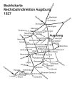
Bezirkskarte RBD Augsburg 1927.svg 886 × 1,052; 99 KB
-
BS Augsburg-Buchloe.png 960 × 1,776; 73 KB
-
BS Augsburg-Buchloe.svg 963 × 1,779; 204 KB
-
Chiemseebahn.png 2,486 × 1,694; 1.18 MB
-
DB 1733 railway map.png 1,350 × 984; 2.28 MB
-
Deggendorf-Kalteneck.png 6,185 × 2,980; 7.01 MB
-
DeutschesEck.png 1,330 × 764; 1.43 MB
-
Dollnstein-Rennertshofen.png 1,494 × 3,024; 1.03 MB
-
E-Netz Augsburg.svg 767 × 1,062; 24 KB
-
Eisenbahnloses Viereck 1866.png 3,076 × 2,544; 856 KB
-
Floß-Flossenbürg.png 1,485 × 701; 273 KB
-
Forchheim-Beringersmühle.png 1,929 × 1,353; 1.59 MB
-
Franken-Sachsen-Express-Route.PNG 926 × 268; 39 KB
-
Frankenwald-Nebenbahnen.jpg 312 × 322; 27 KB
-
Frankenwald-Nebenbahnen.svg 744 × 1,052; 227 KB
-
Frankenwaldbahn.png 4,318 × 3,341; 5.78 MB
-
Fünfstetten-Monheim.png 2,757 × 1,199; 549 KB
-
Gleisdreieck Penzberg.png 1,439 × 682; 32 KB
-
GleisplanChiemseebahn2019.png 1,139 × 622; 58 KB
-
GleisplanWachtl2016.png 2,741 × 1,248; 131 KB
-
Gräfenbergbahn.png 2,924 × 3,163; 3.69 MB
-
Gundelfingen–Sontheim-Brenz.png 2,288 × 1,659; 779 KB
-
Günzburg-Mindelheim.png 1,296 × 1,998; 1.78 MB
-
Hallertauerlokalbahn.png 1,178 × 1,212; 1.51 MB
-
Immenstadt–Oberstdorf.png 1,381 × 2,544; 1.46 MB
-
Ingolstadt-Riedenburg.png 2,048 × 2,419; 2.14 MB
-
Isartalbahn (Karte).png 578 × 690; 489 KB
-
Karte Bahnstrecke Bamberg–Würzburg.png 1,835 × 950; 1.89 MB
-
Karte Bahnstrecke Burgthann–Allersberg.png 1,143 × 1,386; 186 KB
-
Karte Bahnstrecke Rosenheim–Salzburg.png 3,210 × 836; 2.4 MB
-
Karte Bahnstrecke Würzburg-Treuchtlingen.png 1,473 × 1,600; 3.53 MB
-
Karte der Bahnstrecke München-Garmisch-Partenkirchen.png 1,300 × 2,274; 3.17 MB
-
Karte der Bahnstrecke Regensburg - Falkenstein.png 2,180 × 1,311; 1.32 MB
-
Karte der Werrabahn.jpg 1,858 × 2,279; 1.2 MB
-
Karte Eisenbahnnetz Rosenheim.png 396 × 289; 32 KB
-
Karte Eisenbahnunfall von Burgrain.png 753 × 664; 496 KB
-
Karte Franken-Thüringen-Express.png 1,520 × 2,540; 206 KB
-
Karte Kleber-Express.png 1,316 × 752; 1.31 MB
-
Karte Maintalbahn Bhf Miltenberg.svg 653 × 357; 124 KB
-
Karte Materialseilbahn Kochel.png 3,042 × 1,074; 3.43 MB
-
Karte neumarkt bahnhoefe.png 2,400 × 1,729; 772 KB
-
Karte Nord-Süd-Strecke und Hannover–Würzburg.png 1,087 × 2,778; 4.88 MB
-
Karte Seenlandbahn.png 954 × 474; 300 KB
-
Karte Spessartrampe.png 2,000 × 772; 836 KB
-
Karte Verkehrsprojekt Deutsche Einheit Nr. 8.png 748 × 1,011; 1.35 MB
-
Karte Wasserburger Altstadtbahn.png 4,677 × 3,307; 2.12 MB
-
Karte Werntalbahn.png 1,601 × 1,329; 2.97 MB
-
Karte-Frankenwaldbahn.png 688 × 410; 244 KB
-
Karte-Sonneberg-Stockheim.png 656 × 359; 104 KB
-
Karte-Strecke-Erfurt-Schweinfurt.png 454 × 447; 134 KB
-
KBS993 Donautalbahn-Verlauf.png 737 × 430; 45 KB
-
Kellmünz-Babenhausen.png 2,106 × 1,116; 792 KB
-
Kempten-Isny.png 3,605 × 2,038; 3.03 MB
-
Kochelseebahn.png 1,458 × 2,678; 1.84 MB
-
Landsberg-Schongau.png 877 × 2,200; 1.28 MB
-
Landshutrottenburg.png 755 × 702; 137 KB
-
Lechfeldbahn.png 1,024 × 2,048; 97 KB
-
Lehestenludwigstadt.jpg 582 × 272; 87 KB
-
Lokalbahn Bad Aibling-Feilnbach.svg 512 × 380; 47 KB
-
Lokalbahn Pasing–Herrsching Projektierungsvarianten.jpg 1,900 × 1,766; 2.99 MB
-
Ludwigs Bahnen 2.jpg 2,000 × 3,085; 777 KB
-
Main-Spessart-Bahn.png 1,718 × 1,412; 353 KB
-
Mangfalltalbahn Karte.png 1,934 × 823; 922 KB
-
Map of the German railways, Sheet 44 Karlsruhe, May 1945 (148034568).png 4,068 × 3,578; 21.37 MB
-
Map-of-5050-Weiden-Oberkotzau.png 1,188 × 882; 1.49 MB
-
Map-of-5102-Bamberg-Rottendorf.png 1,520 × 883; 924 KB
-
Map-of-5121-Coburg-Lauscha.png 694 × 644; 434 KB
-
Map-of-5860-Regensburg–Weiden.png 1,106 × 881; 1.41 MB
-
Map-RoyalBavarianEasternRailwayCompany.png 566 × 594; 444 KB
-
Marktoberdorf - Lechbruck.png 4,577 × 4,273; 4.57 MB
-
Max-Bahn (Neu).png 2,290 × 1,115; 299 KB
-
Max-Bahn.JPG 2,290 × 1,115; 202 KB
-
Mittenwaldbahn-Karte.png 1,820 × 1,621; 753 KB
-
Mühldorf-Pilsting.png 1,130 × 2,000; 1.78 MB
-
München–Buchloe (en).png 2,612 × 1,092; 531 KB
-
München–Buchloe.png 2,612 × 1,092; 531 KB
-
München–Simbach.png 2,323 × 908; 466 KB
-
Nantenbacher Kurve.png 1,580 × 2,014; 1.11 MB
-
NBS-Ulm-Augsburg.png 3,203 × 1,053; 3.77 MB
-
Nebenbahnen Vilshofen.png 1,267 × 1,019; 154 KB
-
NetzentwicklungChiemseebahn.png 855 × 467; 48 KB
-
Neufahrner spange.png 2,827 × 1,780; 1.51 MB
-
Neufahrn–Massenhausen.png 3,242 × 4,063; 2.73 MB
-
Neumarkt-Sankt Veit–Landshut.png 2,395 × 1,975; 2.78 MB
-
Neuses–Weißenbrunn.png 1,291 × 1,032; 355 KB
-
Neustadt-Eslarn.png 3,325 × 2,240; 2.39 MB
-
Noerdlingen-Gunzenhausen.png 525 × 443; 24 KB
-
Noerdlingen-Pleinfeld.png 525 × 443; 26 KB
-
Noerdlingen-wemding.png 525 × 443; 22 KB
-
Nürnberg–Cheb Bahnstrecke Karte.png 2,416 × 1,760; 5.37 MB
-
Oberlandbahn.png 353 × 648; 202 KB
-
OpenStreetMap der Feld- und Waldbahn Riedlhütte.png 467 × 293; 63 KB
-
OSM Karte Ehemalige Bahnlinie Burgthann-Allersberg.jpg 828 × 841; 171 KB
-
OSM Karte Ehemalige Bahnlinie Feucht-Wendelstein.jpg 1,025 × 666; 147 KB
-
OSM Karte Ehemalige Trümmerbahn Nürnberg.jpg 965 × 534; 120 KB
-
Paartalbahn Karte.png 398 × 404; 64 KB
-
Passau-Freyung.png 3,996 × 3,311; 6.5 MB
-
Passau–Neumarkt-Sankt Veit.png 7,605 × 4,058; 10.13 MB
-
Paussau-Hauzenberg.png 3,996 × 3,311; 6.49 MB
-
Pfälzische Ludwigsbahn.png 3,846 × 1,296; 2.61 MB
-
Plattling–Bayerisch Eisenstein.png 1,955 × 2,500; 2.95 MB
-
Prienaschau.png 797 × 1,186; 196 KB
-
Railway line Munich–Garmisch-Partenkirchen.png 1,300 × 2,277; 3.17 MB


