Category:Rail transport maps
Jump to navigation
Jump to search
Wikimedia category | |||||
| Upload media | |||||
| Instance of | |||||
|---|---|---|---|---|---|
| Category combines topics | |||||
| |||||
See also:
- Category:Public transport maps for all kind of public transport maps
- Category:Rapid transit maps for Metro and light rail maps
- Category:Tram maps for tramway maps
- Category:Trolleybus maps for trolleybus maps
- Category:Bus maps for bus maps
Subcategories
This category has the following 18 subcategories, out of 18 total.
Pages in category "Rail transport maps"
This category contains only the following page.
Media in category "Rail transport maps"
The following 156 files are in this category, out of 156 total.
-
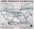
1908 Gospel Temperance Railroad.jpg 6,045 × 5,073; 6.65 MB
-
1917CW ThroughRedwoods page 14.jpg 1,567 × 1,809; 528 KB
-
1918 ICC YHF system map.png 1,891 × 1,614; 2.06 MB
-
1990 NPS EBT railroad map.jpg 1,373 × 893; 896 KB
-
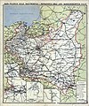
20200804 112345 Second Polish Republic.jpg 2,511 × 3,135; 2.74 MB
-
A guide to Florida (1873) (14574218758).jpg 1,302 × 1,144; 357 KB
-
Anales de la Sociedad Científica Argentina (1890) (17979077250).jpg 2,908 × 2,098; 1.47 MB
-
Anales de la Sociedad Científica Argentina (1900) (18163642742).jpg 1,862 × 2,778; 690 KB
-
Anlagenklassen RailMap Trassenabschnitte.tif 1,282 × 802; 262 KB
-
Anlagenklassifizierung RailMap.jpg 1,282 × 802; 155 KB
-
Az Északi Járműjavító területén iparvágányok vázlatos rajza.png 2,352 × 1,108; 44 KB
-
B&LLR map 01.jpg 2,561 × 1,695; 361 KB
-
Bangalore Suburban Rail map 20130928.png 989 × 697; 106 KB
-
Border Counties Railway map Hexham to Saughtree.jpeg 6,786 × 4,653; 8.11 MB
-
British main lines railway diagram.svg 1,765 × 2,513; 164 KB
-
Brockhaus and Efron Encyclopedic Dictionary b54 360-1.jpg 2,552 × 3,068; 2.33 MB
-
BSicon mTINT saffron+green.svg 500 × 500; 354 bytes
-
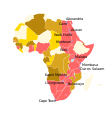
Cape to Cairo.svg 720 × 780; 65 KB
-
CarteUnionInternationaleDesCheminsDeFer.svg 856 × 433; 1.22 MB
-
Case mapa 2.jpg 800 × 534; 152 KB
-
CBTC Project Map Jul11 v1.1.jpg 1,167 × 576; 96 KB
-
Chicago Express.png 740 × 428; 51 KB
-
China Belt Road Initiative Landkarte Projekte 2018.jpg 2,067 × 1,724; 654 KB
-
Ciudades con Metro en América Latina.svg 512 × 621; 395 KB
-
Ciudades con metro LatAm.svg 793 × 963; 699 KB
-
Ciudades con suburbano LatAm.svg 512 × 621; 353 KB
-
Ciudades con Tren Ligero en América Latina.svg 512 × 621; 583 KB
-
Congo Transport Map.PNG 1,129 × 987; 170 KB
-
CorcovadoRailway2024OSM.png 1,324 × 804; 972 KB
-
Cutoff-map.JPG 3,600 × 2,515; 514 KB
-
CZ railway line 010.jpg 572 × 377; 54 KB
-
Dominican Republic rail map 1925.jpg 830 × 543; 159 KB
-
East African Rail.svg 512 × 425; 339 KB
-
Eisenbahn Bruck Leitha Petronell Canuntum 1944 M 1-300000.jpg 422 × 340; 57 KB
-
Eisenbahn Wien Preßburg 1944 M 1-300000.jpg 2,507 × 924; 361 KB
-
Eisenbahnen- und Telegraphendichte der Erde um 1900.jpg 1,200 × 858; 785 KB
-
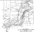
El Paso and Southwestern system map 1910.png 1,200 × 1,145; 59 KB
-
El Salvador rail map 1925.jpg 843 × 541; 156 KB
-
Europe rail map.PNG 786 × 317; 21 KB
-
Fahrordnung weltweit doppel.png 1,518 × 770; 339 KB
-
Fahrordnung weltweit.png 11,479 × 5,826; 4.19 MB
-
Gospel.temperance.railroad.map.jpg 6,045 × 5,073; 6.64 MB
-
Guatemala rail map 1925.jpg 620 × 668; 110 KB
-
Haiti rail map 1925.jpg 779 × 580; 150 KB
-
Handedness of rail traffic and share of multi-track railway.png 5,740 × 2,913; 1.61 MB
-
Handedness of rail traffic worldwide.png 5,000 × 2,537; 1.32 MB
-
High-speed-railway-overview.svg 2,560 × 1,314; 1.13 MB
-
Highway Grade Crossings Across Railroads in a part of the City of Northampton.jpg 3,323 × 2,182; 2.41 MB
-
Honduras rail map 1925.jpg 993 × 513; 164 KB
-
Hong Kong–Shenzhen Western Express Railway (2012 plan).png 3,840 × 2,500; 442 KB
-
Honmoku.svg 512 × 362; 865 KB
-
IDC Mumbai Railmap V5 english web.pdf 1,752 × 1,239; 1.15 MB
-
Interior of Dorasan Station 01.jpg 6,000 × 4,000; 5.75 MB
-
JavaMapRail 1893.jpg 2,666 × 936; 2.2 MB
-
Kanagawa Rinkai Tetsudo Map.svg 512 × 362; 634 KB
-
KdyMsr.png 1,200 × 1,074; 799 KB
-
Khalili Collection Hajj and Arts of Pilgrimage arc.pt 0626.jpg 2,500 × 3,718; 528 KB
-
Kunming-Singapore.png 668 × 866; 626 KB
-
La ferrovia decauville nella Foresta Umbra (superimposed onto OpenStreetMap).png 1,416 × 1,080; 577 KB
-
Lansing Manufacturers Railroad Route Map, 1916.gif 521 × 744; 85 KB
-
LineasSFM.jpg 800 × 479; 47 KB
-
LineasSFM2.jpg 479 × 484; 34 KB
-
Logo du site "De lignes en ligne".jpg 981 × 1,074; 67 KB
-
Länder-mit-UIC-Mitgliedern.png 1,406 × 655; 43 KB
-
Map I&WN and Pend Oreille region 1910.jpg 578 × 1,082; 93 KB
-
Map of Grand View Beach Railroad based on NY Ontario Beach 148068 1912 62500.png 1,257 × 904; 2.19 MB
-
Map of the Mississippi River & Bonne Terre Railway.jpg 709 × 1,063; 162 KB
-
Map of the world (Europe and Asia) from 'The Cosmopolitan Railway'.jpg 546 × 831; 195 KB
-
Map showing from Richmond to Fredericksburg, Va. LOC gvhs01.vhs00249.tif 4,376 × 5,320; 66.61 MB
-
Map showing route of New York and Pennsylvania Railroad.jpg 617 × 614; 181 KB
-
Mapa Ferrocarriles Secundarios de Castilla.svg 1,515 × 1,326; 482 KB
-
Mapa OSŻD 2024.jpg 1,417 × 920; 132 KB
-
Mapa PKP 1939.jpg 3,960 × 4,734; 6.66 MB
-
Mappa da Região Principal da Provincia de S. Paulo.jpg 3,267 × 2,625; 1,019 KB
-
MAPPA DIAGRAMMA CIRCUMVESUVIANA VETTORIALE.svg 3,970 × 2,993; 105 KB
-
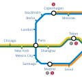
Metro map example.svg 300 × 300; 30 KB
-
Moscow Central Diameters Map Future.jpg 1,130 × 1,600; 411 KB
-
México, mapa de las líneas de Ferrocarril Central Mexicano y Conexiones (1884).jpg 7,782 × 5,334; 11.15 MB
-
Network length example map.svg 672 × 419; 11 KB
-
New River Railroad Map.jpg 1,393 × 1,137; 316 KB
-
Nicaragua rail map 1925.jpg 636 × 671; 113 KB
-
NJMidlandRail(NYS&W)1872servicemap.tiff 307 × 497; 219 KB
-
Northern Railway of Canada map.jpg 1,071 × 1,679; 403 KB
-
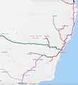
NSW Trains Map.jpg 1,136 × 1,238; 429 KB
-
Ontario railway map 1875.jpg 3,220 × 1,905; 2.39 MB
-
OpenRailwayMap North America OSI Legend.png 250 × 170; 19 KB
-
OpenRailwayMap North America OSI yard complex.png 1,000 × 360; 16 KB
-
OpenRailwayMap North America OSI yard simple.png 1,000 × 300; 13 KB
-
OpenRailwayMap North America OSI yard simplecurved.png 1,000 × 350; 11 KB
-
Optics Valley Suspended Monorail map.png 527 × 755; 265 KB
-
Ordnance Survey 1 inch Nottingham 1947.jpg 2,550 × 3,600; 7.95 MB
-
Organization for Cooperation of Railways, Eurasia.png 786 × 317; 17 KB
-
Orienterings Plan over den sjellandske Jernbane fra Kjøbenhavn til Korsør.jpg 6,900 × 1,913; 2.66 MB
-
Orsha.png 707 × 775; 20 KB
-
OTIS SMGS.svg 863 × 443; 1.54 MB
-
Panama Canal Railway.svg 800 × 746; 219 KB
-
Pferde-FeldbahnNetzentwicklungRosenburgDröbel.png 5,218 × 4,997; 527 KB
-
Phase 1 CLR zh.png 1,530 × 512; 65 KB
-
Phase 1 CLR.png 765 × 256; 50 KB
-
Port rail line cy map.png 2,769 × 1,761; 327 KB
-
Postal Map of Shanghai Showing Sectional Divisions in 1930 (cropped).jpg 14,920 × 11,259; 18.1 MB
-
Proposed 1834 Plan Newcastle to North Shields Railway Tracts vol 57 p298 crop js.jpg 1,781 × 1,010; 806 KB
-
Rail density map.png 1,350 × 625; 25 KB
-
Rail density map.svg 2,100 × 1,050; 1.17 MB
-
Rail Lines - Arab League.PNG 821 × 468; 49 KB
-
Rail sens circulation.svg 940 × 477; 1.62 MB
-
Railroad map of Harpers Ferry in 1859.jpg 781 × 439; 104 KB
-
RailroadsNEVermont.jpg 656 × 517; 105 KB
-
Railway and shipping routes for the Georgian Bay Ship Canal.jpg 6,344 × 3,600; 10.43 MB
-
Railway map Chernivtsi Ocnița.png 1,329 × 701; 721 KB
-
Railway map of koto city shiohama.jpg 959 × 1,040; 176 KB
-
Railway size world map.PNG 1,350 × 630; 40 KB
-
Railway Wigan Newton Leigh 1911 edited-2.jpg 1,200 × 1,224; 906 KB
-
Railways in Albania.png 364 × 577; 232 KB
-
Railways, passengers carried (passenger-km), OWID.svg 850 × 600; 141 KB
-
Railways-passengers-carried-passenger-km.png 3,400 × 2,400; 802 KB
-
RAMAL.svg 720 × 480; 86 KB
-
RamalBAOvar.png 722 × 722; 321 KB
-
Rendsburg1925.jpg 584 × 509; 39 KB
-
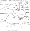
Rockaway Valley railroad Map.tif 1,504 × 1,573; 6.77 MB
-
Sens de circulation des trains dans le monde entier.png 5,000 × 2,538; 1.38 MB
-
SMGS.png 786 × 317; 17 KB
-
SMGS.svg 863 × 443; 1.54 MB
-
Spoorlijn Bilthoven-Zeist.PNG 1,111 × 636; 35 KB
-
Spoorlijn Bilthoven-Zeist.svg 1,112 × 636; 6 KB
-
Texas Southern Railway Map.jpg 1,200 × 1,670; 429 KB
-
The assassination of Abraham Lincoln (1865) (14574406507).jpg 2,688 × 1,480; 520 KB
-
The War of the Rebellion Map plate CLV.jpg 2,195 × 1,369; 950 KB
-
Tramway between Glengonnar Shaft (Lead) and Wilson's Shaft (around 1910).jpg 1,103 × 690; 67 KB
-
Trimmed part (Netherlands) of HSR Europe.png 403 × 285; 55 KB
-
Trinidad rail map 1925.jpg 1,026 × 868; 173 KB
-
Turin Europe train map.gif 1,012 × 939; 560 KB
-
Virginia and Tennessee Railroad map Dublin.png 857 × 478; 856 KB
-
World metro system cities.png 1,983 × 1,014; 279 KB
-
World Metro systems November 2021.svg 940 × 415; 1.53 MB
-
World Metro systems.png 940 × 415; 116 KB
-
World Metro systems.svg 940 × 415; 1.53 MB
-
World railway network.png 1,461 × 832; 1.1 MB
-
World railway network.svg 4,294 × 2,049; 6.26 MB
-
World RR Gauge Map.agr.png 3,783 × 2,110; 4.11 MB
-
Zsuzsi Vasút poster 20230729 142417.jpg 2,576 × 1,932; 1.48 MB
-
Новогрудская узкоколейка.jpg 648 × 395; 45 KB
-
Схема Ковельской железной дороги.jpg 3,272 × 4,901; 3.53 MB
-
福建省海峡西岸城际铁路网规划示意图.pdf 1,239 × 1,752; 1.63 MB
