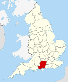
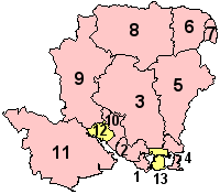
Category:Rail transport in Hampshire
Jump to navigation
Jump to search
Ceremonial counties of England: Bedfordshire · Berkshire · Buckinghamshire · Cambridgeshire · Cheshire · Cornwall · Cumbria · Derbyshire · Devon · Dorset · Durham · East Riding of Yorkshire · East Sussex · Essex · Gloucestershire · Greater London · Greater Manchester · Hampshire · Herefordshire · Hertfordshire · Kent · Lancashire · Leicestershire · Lincolnshire · Merseyside · North Yorkshire · Northamptonshire · Northumberland · Nottinghamshire · Oxfordshire · Rutland · Shropshire · Somerset · South Yorkshire · Staffordshire · Suffolk · Surrey · Tyne and Wear · Warwickshire · West Midlands · West Sussex · West Yorkshire · Wiltshire · Worcestershire
City-counties: Bristol · City of London
Former historic counties: Huntingdonshire ·
Other former counties:
City-counties: Bristol · City of London
Former historic counties: Huntingdonshire ·
Other former counties:
Wikimedia category | |||||
| Upload media | |||||
| Instance of | |||||
|---|---|---|---|---|---|
| Category combines topics | |||||
| Hampshire | |||||
ceremonial county of England | |||||
| Instance of | |||||
| Location | South East England, England | ||||
| Capital | |||||
| Highest point |
| ||||
| Population |
| ||||
| Area |
| ||||
| Different from | |||||
| Said to be the same as | Hampshire (historic county of England, ceremonial county of England, 1844) | ||||
| official website | |||||
 | |||||
Subcategories
This category has the following 17 subcategories, out of 17 total.
Media in category "Rail transport in Hampshire"
The following 41 files are in this category, out of 41 total.
-
66794 working 4Y19 Mountfield to Southampton Western Docks passes Basingstoke 01-02-22.jpg 5,472 × 3,648; 5.42 MB
-
Colour light signal by railway line - geograph.org.uk - 881957.jpg 640 × 480; 84 KB
-
Fratton Traincare Depot (geograph 4412061).jpg 640 × 426; 61 KB
-
Lineside equipment - geograph.org.uk - 880591.jpg 640 × 427; 85 KB
-
Looking down the railway - geograph.org.uk - 1801905.jpg 640 × 480; 92 KB
-
Narrow bridge - geograph.org.uk - 1519169.jpg 640 × 480; 120 KB
-
Netley hosp.jpg 1,024 × 764; 137 KB
-
Portsmouth Line - geograph.org.uk - 409686.jpg 640 × 480; 34 KB
-
Railway bridge at Finchdean - geograph.org.uk - 1230404.jpg 640 × 480; 140 KB
-
Railway bridge at Hamble - geograph.org.uk - 1464023.jpg 640 × 480; 68 KB
-
Railway Bridge near Otterbourne Farm - geograph.org.uk - 864758.jpg 427 × 640; 170 KB
-
Railway bridge within Heberdens - geograph.org.uk - 1230364.jpg 640 × 480; 115 KB
-
Railway Bridge, Pound Lane - geograph.org.uk - 1780264.jpg 640 × 480; 109 KB
-
Railway line heading for Hamble Station - geograph.org.uk - 1464611.jpg 640 × 480; 127 KB
-
Railway line towards Bedhampton - geograph.org.uk - 683651.jpg 640 × 480; 37 KB
-
Railway line view from near the A30 bridge - geograph.org.uk - 1745591.jpg 2,848 × 2,144; 1.43 MB
-
Railway Staff, Havant.jpg 700 × 438; 270 KB
-
Railway tracks and bridges - geograph.org.uk - 1182945.jpg 480 × 640; 95 KB
-
Railway, Oakley - geograph.org.uk - 808439.jpg 480 × 640; 184 KB
-
Reading to Basingstoke - geograph.org.uk - 664786.jpg 640 × 465; 85 KB
-
Semaphore signalling - geograph.org.uk - 1332157.jpg 640 × 427; 104 KB
-
Single-track railway line at Battramsley - geograph.org.uk - 1452353.jpg 427 × 640; 226 KB
-
Towards Alresford - geograph.org.uk - 1332061.jpg 640 × 427; 80 KB
-
60 and a half miles from Waterloo - geograph.org.uk - 880599.jpg 640 × 427; 119 KB
-
Hook, Railway west of Hook station - geograph.org.uk - 119500.jpg 640 × 480; 125 KB
-
Pedestrian Railway Crossing - geograph.org.uk - 322623.jpg 640 × 480; 113 KB
-
Railway at Old Basing - geograph.org.uk - 173357.jpg 640 × 480; 180 KB
-
Railway from Spaniard's Lane bridge - geograph.org.uk - 265400.jpg 640 × 480; 119 KB
-
Southampton to Romsey Railway Line. - geograph.org.uk - 164065.jpg 640 × 480; 134 KB
-
The railway near Bentley - geograph.org.uk - 282184.jpg 640 × 478; 184 KB
-
Vaggs Lane Bridge - geograph.org.uk - 109197.jpg 640 × 481; 128 KB


