Category:Radar images of snow storms
Jump to navigation
Jump to search
Media in category "Radar images of snow storms"
The following 19 files are in this category, out of 19 total.
-
Aphid storm radar lightning.png 277 × 266; 117 KB
-
Bourrasque-neige.png 525 × 353; 140 KB
-
Caspian-lake-effect.gif 679 × 445; 2.8 MB
-
Connecticut Maximum 24-hour Snowfall (Radar image).png 644 × 489; 194 KB
-
DENVER102606SNOWRADAR.png 598 × 455; 30 KB
-
Feb242007 blizzard.gif 3,400 × 1,600; 2.89 MB
-
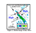
Great Salt Lake effect radar image.png 215 × 196; 23 KB
-
Jan 30-31 2021 Chicago snowstorm radar loop.gif 1,152 × 821; 7.29 MB
-
LakeEffectSnowBuffalo101206.gif 773 × 455; 332 KB
-
Northeast Snowfall Impact Scale.gif 640 × 480; 1.9 MB
-
October 12-13 radarloop kbuf.gif 820 × 775; 8.32 MB
-
Precip total october12 13 06.png 1,242 × 2,217; 233 KB
-
Radar loop Dec 16 storm.gif 633 × 475; 429 KB
-
Radar of Jan-28th-2019 Winter storm.gif 960 × 684; 25.07 MB
-
Snowband anim.gif 300 × 275; 813 KB
-
Snowsquall line-Bourrasque neige frontal NOAA.png 1,041 × 821; 288 KB
-
Snowsquall20101207 ontario.jpg 826 × 708; 191 KB
-
Snowsquall20101207.jpg 599 × 370; 85 KB
-
Utah Snow Storm on 2006-09-22.png 596 × 455; 32 KB


