Category:Racial maps
Jump to navigation
Jump to search
English: Apply caution: Older maps tend to depict forms of scientific racism. Maps of ethnic groups may have been manipulated by the original or a later author, for political reasons.
Subcategories
This category has the following 7 subcategories, out of 7 total.
A
E
R
S
Media in category "Racial maps"
The following 67 files are in this category, out of 67 total.
-
MACCOUN(1899) p025 DISPERSION OF THE RACE.jpg 2,002 × 3,594; 2.96 MB
-
63 of 'China in Transformation ... With ... maps and diagrams' (11245961986).jpg 1,430 × 1,802; 698 KB
-
BlackPopulation.png 1,350 × 625; 42 KB
-
Brazilcolorpeople.jpg 676 × 600; 40 KB
-
Ca. 1837 French ethnographic map of the world.jpg 11,466 × 8,223; 11.74 MB
-
Carleton Coon races after Pleistocene.PNG 1,357 × 628; 36 KB
-
Carleton S. Coon Racial Definitions4.jpg 300 × 197; 9 KB
-
Elementary physical geography; (1908) (14761567296).jpg 2,496 × 1,586; 807 KB
-
Human races Berghaus.jpg 6,103 × 5,118; 23.66 MB
-
Huxley races.png 1,350 × 625; 29 KB
-
Huxley whites.png 430 × 296; 9 KB
-
Huxleyraces.gif 405 × 263; 29 KB
-
Huxleyraces.png 405 × 263; 58 KB
-
Ilirski rasni tip.gif 1,280 × 1,024; 95 KB
-
IQ by Country.png 1,800 × 820; 138 KB
-
JaphethShemHam.JPG 3,098 × 2,280; 1.41 MB
-
Mankind1ma6.jpg 1,160 × 951; 187 KB
-
Map of racial types by country of the world according to the majority.png 6,460 × 5,920; 3.17 MB
-
Map of the City of Washington Showing Location of Fatal Cases of Consumption.jpg 8,520 × 8,940; 12.86 MB
-
Map of the racial composition of populations by country according to the majority.png 6,460 × 3,445; 1.76 MB
-
Map of White Americans.png 1,480 × 740; 45 KB
-
Meyers b11 s0476a.jpg 1,500 × 1,187; 629 KB
-
Meyers-L2.jpg 570 × 539; 92 KB
-
Neger und Negermischlinge.JPG 1,215 × 1,749; 386 KB
-
Ohio counties by race.svg 230 × 260; 25 KB
-
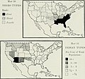
Passing of the Great Race - Map 2.jpg 2,474 × 1,619; 3.46 MB
-
Passing of the Great Race - Map 3.jpg 2,057 × 1,531; 2.34 MB
-
Passing of the Great Race - Map 4.jpg 2,192 × 1,533; 2.58 MB
-
Poblacion China en Venezuela (2011).gif 1,404 × 993; 31 KB
-
Porcentaje Chinos en Venezuela (2011).png 3,745 × 2,649; 492 KB
-
PSM V85 D314 Boundaries of central europe and the distribution of races.png 1,618 × 1,489; 569 KB
-
Races of Mankind Cropped.png 2,887 × 1,569; 6.31 MB
-
Races-humaines.jpg 2,349 × 1,445; 1.65 MB
-
Racial and ethnicity distribution map okc 2020.jpg 799 × 938; 218 KB
-
Racial map including Ural-Altaic theory.png 1,280 × 1,016; 1.68 MB
-
Racial map of the world.png 5,888 × 2,464; 1.5 MB
-
Racial map of the world2.png 13,226 × 6,176; 10.64 MB
-
Rasi bg.png 1,646 × 1,322; 152 KB
-
Rassenkarte von Europa.jpg 970 × 863; 173 KB
-
Richardreinmap.png 785 × 695; 1.49 MB
-
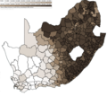
RSA 2001 Share BlackAfrican.png 1,844 × 1,638; 163 KB
-
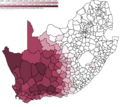
RSA 2001 Share Coloured.png 1,844 × 1,638; 158 KB
-
RSA 2001 Share Indian.png 1,844 × 1,638; 153 KB
-
Stanley M. Garn racial classification.png 1,357 × 628; 49 KB
-
Stoddard race map 1920.jpg 800 × 448; 138 KB
-
Sudanesse blacks in Africa.jpg 341 × 341; 50 KB
-
The American Museum journal (c1900-(1918)) (18135157696).jpg 1,928 × 1,800; 540 KB
-
The Growth of Aryan Predominance.jpg 3,242 × 2,112; 744 KB
-
The Races of Mankind Before European Expansion.jpg 3,232 × 2,112; 733 KB
-
Troe-map8b.jpg 600 × 895; 202 KB
-
White American by state in the USA in 2010.svg 981 × 589; 482 KB


