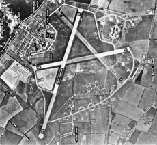
Category:RAF Polebrook
Jump to navigation
Jump to search
| Object location | | View all coordinates using: OpenStreetMap |
|---|
airport in Northamptonshire, England | |||||
| Upload media | |||||
| Instance of | |||||
|---|---|---|---|---|---|
| Location | |||||
| Operator | |||||
| Inception |
| ||||
| Dissolved, abolished or demolished date |
| ||||
| Elevation above sea level |
| ||||
 | |||||
Subcategories
This category has only the following subcategory.
Media in category "RAF Polebrook"
The following 14 files are in this category, out of 14 total.
-
Airfield defence structure - geograph.org.uk - 2743563.jpg 3,648 × 2,736; 2.22 MB
-
Boeing B-17G-95-BO Fortress 43-38846-351st BG.jpg 875 × 464; 86 KB
-
Boeing Fortress Mk.I Royal Air Force Bomber Command, 1939-1941. CH3121.jpg 1,772 × 1,846; 811 KB
-
Plb-1048.jpg 700 × 761; 167 KB
-
Plb-ca1.jpg 400 × 300; 27 KB
-
Plb-stewart-gable.jpg 294 × 416; 47 KB
-
RAF Polebrook - Control Tower.jpg 852 × 679; 126 KB
-
Visitors book - geograph.org.uk - 896473.jpg 640 × 480; 84 KB
-
Remnants of a Thor Missile Launch Pad - geograph.org.uk - 451443.jpg 640 × 480; 124 KB


