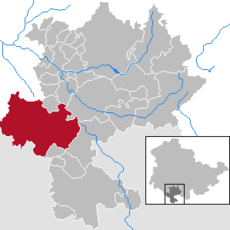
Category:Römhild
Jump to navigation
Jump to search
municipality in Thuringia, Germany | |||||
| Upload media | |||||
| Instance of |
| ||||
|---|---|---|---|---|---|
| Location | Hildburghausen, Thuringia, Germany | ||||
| Population |
| ||||
| Area |
| ||||
| Elevation above sea level |
| ||||
| Different from | |||||
| official website | |||||
 | |||||
Landkreis Hildburghausen  Ahlstädt · Auengrund · Beinerstadt · Bischofrod · Brünn/Thür. · Dingsleben · Ehrenberg · Eichenberg · Eisfeld · Grimmelshausen · Grub · Heldburg · Henfstädt · Hildburghausen · Kloster Veßra · Lengfeld · Marisfeld · Masserberg · Oberstadt · Reurieth · Römhild · Schlechtsart · Schleusegrund · Schleusingen · Schmeheim · Schweickershausen · St. Bernhard · Straufhain · Themar · Ummerstadt · Veilsdorf · Westhausen ·
Subcategories
This category has the following 12 subcategories, out of 12 total.
Media in category "Römhild"
The following 20 files are in this category, out of 20 total.
-
De-Römhild.ogg 2.1 s; 21 KB
-
Einwohnerentwicklung von Römhild (log10).svg 800 × 400; 57 KB
-
Einwohnerentwicklung von Römhild - ab 1871.svg 800 × 400; 49 KB
-
Einwohnerentwicklung von Römhild.svg 800 × 400; 59 KB
-
Griebelstraße mit Kirchturm.JPG 1,286 × 2,530; 964 KB
-
Herbstadt, NES - Breitensee südl - Römhild, HBN - Eicha v W 01.jpg 5,472 × 3,648; 2.21 MB
-
Höchheim, NES - Rothausen nw - Gr Gleichberg, Römhild, HBN - Mendhausen v W.jpg 5,472 × 3,648; 1.07 MB
-
Karl Höfer, Die Gleichberge bei Römhild-Haina (1926).jpg 1,800 × 1,000; 479 KB
-
Main-Werra-Kanal Römhild Planungen 1924-1961.jpg 2,937 × 2,202; 4.04 MB
-
ROEMHILD nieder.svg 512 × 427; 21 KB
-
Römhild 01.JPG 2,304 × 3,456; 3.56 MB
-
Römhild 02.JPG 3,456 × 2,304; 3.84 MB
-
Römhild 03.JPG 3,456 × 2,304; 3.97 MB
-
Römhild 04.JPG 3,456 × 2,304; 4.94 MB
-
Römhild 05.JPG 3,456 × 2,304; 3.83 MB
-
Römhild 06.JPG 2,304 × 3,456; 3.19 MB
-
Römhild in HBN.png 299 × 299; 6 KB
-
RömHild Marktbrunnen.jpg 1,871 × 1,403; 1.02 MB
-
Römhild-gesangbuch.jpg 619 × 314; 107 KB
-
Wappen Roemhild.png 238 × 284; 26 KB


