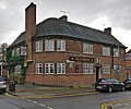
Category:Queens Road, Leicester
Jump to navigation
Jump to search
English: Queens Road is a street in Leicester, in the unparished area of Leicester, in the Leicester district, in the county of Leicestershire, England.
main shopping area for the Clarendon Park area in Leicester | |||||
| Upload media | |||||
| Instance of | |||||
|---|---|---|---|---|---|
| Location | Clarendon Park, Leicester, City of Leicester, Leicestershire, East Midlands, England | ||||
 | |||||
Media in category "Queens Road, Leicester"
The following 71 files are in this category, out of 71 total.
-
Annex at ^14 Knighton Park Road - geograph.org.uk - 5985081.jpg 1,024 × 683; 231 KB
-
Benchmark on wall of ^2 St Mary's Road - geograph.org.uk - 6522090.jpg 960 × 540; 160 KB
-
Benchmark on ^14 Knighton Park Road - geograph.org.uk - 5985075.jpg 1,024 × 683; 214 KB
-
Benchmark on ^14 Knighton Park Road - geograph.org.uk - 6524599.jpg 960 × 540; 191 KB
-
Benchmark on ^2 Knighton Park Road - geograph.org.uk - 5985034.jpg 1,024 × 683; 238 KB
-
Benchmark on ^64 Clarendon Park Road - geograph.org.uk - 5985303.jpg 676 × 1,024; 208 KB
-
Blue plaque on Thorncroft - geograph.org.uk - 5372160.jpg 609 × 800; 134 KB
-
Building work at Freemen's Common - geograph.org.uk - 6595057.jpg 768 × 1,024; 220 KB
-
Clarendon Park Road in Leicester - geograph.org.uk - 6477717.jpg 800 × 579; 141 KB
-
Close up of a multi-storey car park - geograph.org.uk - 6638552.jpg 800 × 412; 89 KB
-
Construction along Putney Road - geograph.org.uk - 6371304.jpg 780 × 800; 139 KB
-
Construction along Putney Road - geograph.org.uk - 6433610.jpg 800 × 481; 47 KB
-
Construction along Putney Road - geograph.org.uk - 6433656.jpg 471 × 800; 54 KB
-
Construction along Putney Road - geograph.org.uk - 6433665.jpg 800 × 457; 64 KB
-
Construction at Putney Road - geograph.org.uk - 6370549.jpg 428 × 800; 45 KB
-
Cycle Route 63 through Victoria Park, Leicester - geograph.org.uk - 6245938.jpg 3,776 × 2,520; 4.23 MB
-
Footbridge across the Midland Main Line - geograph.org.uk - 5301742.jpg 800 × 683; 145 KB
-
Gravestones at Welford Road Cemetery - geograph.org.uk - 5301712.jpg 800 × 554; 146 KB
-
Gravestones at Welford Road Cemetery - geograph.org.uk - 5301728.jpg 800 × 593; 175 KB
-
Gravestones at Welford Road Cemetery - geograph.org.uk - 6694892.jpg 800 × 476; 142 KB
-
Homebase car park towards entrance - geograph.org.uk - 5119670.jpg 640 × 448; 76 KB
-
Homebase entrance and car park - geograph.org.uk - 5119672.jpg 640 × 466; 74 KB
-
Homebase with Halfords at the end - geograph.org.uk - 5119673.jpg 640 × 452; 76 KB
-
Junction of The Avenue and North Avenue - geograph.org.uk - 5985109.jpg 1,024 × 683; 269 KB
-
Leicester, Clarendon Park Road - geograph.org.uk - 5835051.jpg 1,024 × 819; 938 KB
-
Leicester, Cross Road - geograph.org.uk - 5835309.jpg 1,024 × 819; 1.02 MB
-
Leicester, Shree Gita Bhavan Hindu Temple - geograph.org.uk - 5835058.jpg 1,024 × 1,024; 1.19 MB
-
London Road in to Leicester - geograph.org.uk - 6245934.jpg 3,776 × 2,520; 4 MB
-
London Road, Leicester - geograph.org.uk - 6610673.jpg 1,860 × 1,182; 1.21 MB
-
Multi-storey car park under construction - geograph.org.uk - 6638544.jpg 800 × 487; 110 KB
-
New Nixon Court tower under construction - geograph.org.uk - 6737859.jpg 3,264 × 2,176; 3.34 MB
-
Path through the Welford Road Cemetery - geograph.org.uk - 6694895.jpg 800 × 508; 191 KB
-
Path through Victoria Park, Leicester - geograph.org.uk - 5605117.jpg 729 × 800; 237 KB
-
Path through Welford Road Cemetery - geograph.org.uk - 5179290.jpg 800 × 607; 278 KB
-
Path through Welford Road Cemetery - geograph.org.uk - 6371314.jpg 800 × 514; 209 KB
-
Queens Road, Clarendon Park - geograph.org.uk - 6147894.jpg 768 × 1,024; 193 KB
-
Queens Road, Leicester - geograph.org.uk - 1323147.jpg 640 × 348; 320 KB
-
Queens Road, Leicester - geograph.org.uk - 1409051.jpg 640 × 402; 242 KB
-
Queens Road, Leicester - geograph.org.uk - 455061.jpg 640 × 421; 85 KB
-
Sandicliffe garage in Leicester - geograph.org.uk - 5534120.jpg 640 × 640; 85 KB
-
Saturday morning queuing - geograph.org.uk - 5850111.jpg 833 × 1,024; 162 KB
-
Shops along Queens Road - geograph.org.uk - 732905.jpg 640 × 377; 59 KB
-
St Mary's Triangle - geograph.org.uk - 5332348.jpg 800 × 550; 148 KB
-
Stone wall beside University Road - geograph.org.uk - 6508844.jpg 1,024 × 688; 275 KB
-
The Arch of Remembrance in Victoria Park - geograph.org.uk - 5179303.jpg 800 × 630; 268 KB
-
The Arch of Remembrance in Victoria Park - geograph.org.uk - 6694905.jpg 800 × 787; 143 KB
-
The Clarendon - geograph.org.uk - 5301673.jpg 800 × 666; 149 KB
-
Thomas Cook blue plaque - geograph.org.uk - 5372149.jpg 800 × 694; 129 KB
-
Thorncroft, Thomas Cook's Leicester home - geograph.org.uk - 5372128.jpg 800 × 565; 184 KB
-
Tree lined paths at Victoria Park - geograph.org.uk - 5253984.jpg 800 × 579; 175 KB
-
University Road at steps into cemetery - geograph.org.uk - 6508831.jpg 1,024 × 683; 246 KB
-
Victoria Park Pond - geograph.org.uk - 5301690.jpg 800 × 638; 190 KB
-
Victoria Park Road in Leicester - geograph.org.uk - 5576149.jpg 800 × 431; 123 KB
-
Victoria Park, Leicester - geograph.org.uk - 6245936.jpg 3,776 × 2,520; 3.44 MB
-
^2 Knighton Park Road - geograph.org.uk - 5985054.jpg 1,024 × 683; 275 KB


