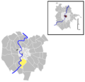
Category:Quartiere X - Ostiense
Jump to navigation
Jump to search
Quarters of Rome: Flaminio (I) · Parioli (II) · Pinciano (III) · Salario (IV) · Nomentano (V) · Tiburtino (VI) · Prenestino-Labicano (VII) · Tuscolano (VIII) · Appio-Latino (IX) · Ostiense (X) · Portuense (XI) · Gianicolense (XII) · Aurelio (XIII) · Trionfale (XIV) · Della Vittoria (XV) · Monte Sacro (XVI) · Trieste (XVII) · Tor di Quinto (XVIII) · Prenestino-Centocelle (XIX) · Ardeatino (XX) · Pietralata (XXI) · Collatino (XXII) · Alessandrino (XXIII) · Don Bosco (XXIV) · Appio Claudio (XXV) · Appio-Pignatelli (XXVI) · Primavalle (XXVII) · Monte Sacro Alto (XXVIII) · Ponte Mammolo (XXIX) · San Basilio (XXX) · Giuliano-Dalmata (XXXI) · Europa (XXXII) · Lido di Ostia Ponente (XXXIII) · Lido di Ostia Levante (XXXIV) · Lido di Castel Fusano (XXXV)
10th quarter of Rome, Italy | |||||
| Upload media | |||||
| Instance of | |||||
|---|---|---|---|---|---|
| Location |
| ||||
| Inception |
| ||||
| Population |
| ||||
| Area |
| ||||
| Different from | |||||
 | |||||
Subcategories
This category has the following 10 subcategories, out of 10 total.
Media in category "Quartiere X - Ostiense"
The following 17 files are in this category, out of 17 total.
-
CoA Quartiere X Ostiense.svg 289 × 320; 202 KB
-
Le città illuminate (Rome) - Pietro De Laurentiis.jpg 4,788 × 3,456; 4.73 MB
-
OSM 2019 — San Francesco Saverio alla Garbatella.jpg 1,074 × 695; 234 KB
-
OSM 2019 — Santa Galla.jpg 835 × 723; 177 KB
-
Ostiense.png 886 × 848; 105 KB
-
Q10 cisterna romana a via Cristoforo Colombo 1000990.JPG 2,816 × 2,112; 2.28 MB
-
Quartiere X Ostiense, Roma, Italy - panoramio - Laci30.jpg 2,048 × 1,536; 464 KB
-
Quartiere X Ostiense, Roma, Italy - panoramio.jpg 1,536 × 2,048; 474 KB
-
Roma - Parcheggio FS Ostiense.jpg 4,470 × 2,980; 2.17 MB
-
Roma Quartiere X Ostiense locator map.svg 1,404 × 1,141; 131 KB
-
Rome subdivisions locator map - Q. X Ostiense.svg 799 × 832; 727 KB
-
Stazione ostiense.jpg 800 × 600; 104 KB
-
Suburb (Explored) - Flickr - Franck Michel.jpg 5,760 × 3,840; 7.1 MB
-
V d Porto fluviale 55 - ruderi Federconsorzi da dietro P1040739.JPG 2,048 × 1,536; 2.4 MB
-
V d Porto fluviale 55 - ruderi Federconsorzi P1040708.JPG 2,048 × 1,536; 2.24 MB
-
V d Porto fluviale 55 - ruderi Federconsorzi P1040709.JPG 2,048 × 1,536; 2.29 MB
-
Veduta delle antiche Mura di Roma - Plate 099 - Giuseppe Vasi.jpg 734 × 400; 278 KB


