Category:Pustý hrad (Zvolen)
Jump to navigation
Jump to search
| Object location | | View all coordinates using: OpenStreetMap |
|---|
| This category shows the protected monument with the number 611-1131/1 (other) in the Slovak Republic. |
castle in Slovakia .jpg) Vstupní brána horního Pustého hradu | |||||
| Upload media | |||||
| Instance of | |||||
|---|---|---|---|---|---|
| Location | Zvolen, Zvolen District, Banská Bystrica Region, Slovakia | ||||
| Architectural style | |||||
| Owned by | |||||
| Heritage designation |
| ||||
| Inception |
| ||||
 | |||||
Subcategories
This category has the following 6 subcategories, out of 6 total.
Media in category "Pustý hrad (Zvolen)"
The following 45 files are in this category, out of 45 total.
-
 Archeology works - panoramio.jpg 800 × 600; 307 KB
-
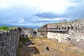
 Dolný Pustý hrad.jpg 3,888 × 2,592; 6.16 MB
-

-
 Part Doncs castle - panoramio.jpg 1,024 × 768; 428 KB
-
 Pustý hrad - sever.JPG 4,000 × 3,000; 4.75 MB
-
 Pustý hrad 1.JPG 4,000 × 3,000; 4.82 MB
-
 Pustý hrad 2.JPG 4,000 × 3,000; 4.65 MB
-
 Pustý hrad 3.JPG 4,000 × 3,000; 4.6 MB
-
 Pustý hrad a Zvolenska kotlina.JPG 4,000 × 3,000; 4.82 MB
-
 Pustý hrad panorama.jpg 10,430 × 3,123; 9.2 MB
-
 Pustý hrad vrchol.JPG 4,000 × 3,000; 4.1 MB
-
 Pustý hrad, Zvolen 02.jpg 3,264 × 2,448; 1.9 MB
-
 Pustý hrad, Zvolen 03.jpg 3,264 × 2,448; 1.87 MB
-
 Pustý hrad.png 945 × 630; 1.43 MB
-
 Pustý hrad3 (from video) - panoramio.jpg 640 × 480; 127 KB
-
 Reconstruction schema - panoramio.jpg 800 × 734; 222 KB
-
 Repliky zbraní - panoramio.jpg 1,024 × 640; 396 KB
-
 Rytieri - knights - panoramio.jpg 800 × 600; 284 KB
-
 Schema of Pusty hrad - panoramio.jpg 1,200 × 564; 290 KB
-
 View from balkony - panoramio.jpg 1,024 × 768; 385 KB
-
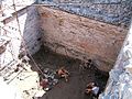 Water cisterna - panoramio.jpg 800 × 600; 298 KB
-
 Zvolen - Deserted Castle (1).jpg 4,608 × 3,072; 3.41 MB
-
 Zvolen - Deserted Castle (2).jpg 4,608 × 3,072; 3.59 MB
-
 Zvolen - Deserted Castle (3).jpg 4,608 × 3,072; 3.49 MB
-
 Zvolen - Deserted Castle (4).jpg 4,608 × 3,072; 3.57 MB
-
 Zvolen - Deserted Castle (5).jpg 4,608 × 3,072; 3.49 MB
-
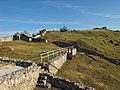
 Zvolen - Deserted Castle - Enter gate.jpg 4,608 × 3,072; 3.54 MB
-
 Zvolen - Deserted Castle.jpg 4,608 × 3,072; 3.58 MB
-
 Zvolen - Donč Castle - palace and cistern (1).jpg 4,608 × 3,072; 3.5 MB
-
 Zvolen - Donč Castle - palace and cistern (2).jpg 3,072 × 4,608; 3.52 MB
-
 Zvolen - Donč Castle - palace and cistern (3).jpg 3,072 × 4,608; 3.52 MB
-
 Zvolen - Donč Castle - palace and cistern (4).jpg 4,608 × 3,072; 3.57 MB
-
 Zvolen - Pustý hrad -1.jpg 4,608 × 3,072; 3.51 MB
-
 Zvolen - Pustý hrad -2.jpg 4,608 × 3,072; 3.47 MB
-
 Zvolen - Pustý hrad -3.jpg 4,608 × 3,072; 3.57 MB
-
 Zvolen 2018 17.jpg 4,896 × 3,672; 6.79 MB
-
 Zvolen 2018 18.jpg 4,896 × 3,672; 6.46 MB
-
 Zvolen 2018 19.jpg 4,896 × 3,672; 6.99 MB
-
 Zvolen 2018 20.jpg 4,896 × 3,672; 6.61 MB
-
 Zvolen 2018 21.jpg 4,896 × 3,672; 6.12 MB
-
 Zvolen 2018 22.jpg 4,896 × 3,672; 7 MB
-
 Zvolen, Pustý hrad (01).jpg 5,184 × 3,888; 7.11 MB
-
 Zvolen, Pustý hrad, enirpordego (deekstere).jpg 3,540 × 2,655; 4.34 MB
-
 Zvolen, Pustý hrad, korto apud enirpordego.jpg 3,648 × 2,736; 4.74 MB
-
 Zvolen, Pustý hrad, korto.jpg 3,648 × 2,736; 4.88 MB


_-_panoramio.jpg)


.jpg)
.jpg)
.jpg)
.jpg)
.jpg)


.jpg)
.jpg)
.jpg)
.jpg)


.jpg)

