Category:Pudsey
town in the City of Leeds, West Yorkshire, England  | |||||
| Upload media | |||||
| Instance of | |||||
|---|---|---|---|---|---|
| Location | Leeds, West Yorkshire, Yorkshire and the Humber, England | ||||
 | |||||
Pudsey is a market town in West Yorkshire, England. Created as an urban district in 1894, it became a municipal borough in 1900, and was incorporated into the City of Leeds in 1974. It is located midway between Bradford city centre and Leeds city centre. Historically in the West Riding of Yorkshire, it had a population of 22,408 in 2011. The Municipal Borough of Pudsey consisted only of addresses with an LS28 postcode, specifically Calverley, Farsley, Pudsey and Stanningley. Addresses with an LS28 postcode use the Leeds 0113 telephone prefix. It also lends its name to the local parliamentary constituency of Pudsey, of which it is a part.
Subcategories
This category has the following 24 subcategories, out of 24 total.
A
B
- Black Carr Wood (12 F)
C
F
- Fences in Pudsey (9 F)
- Fulneck Golf Course (13 F)
M
- Moorside, Leeds (10 F)
N
- North Wood, Tong, Bradford (2 F)
O
- Owlcotes Hill, Pudsey (7 F)
P
- Post boxes in Pudsey (9 F)
- Pudsey Bear (6 F)
S
T
Media in category "Pudsey"
The following 200 files are in this category, out of 375 total.
(previous page) (next page)-
 10 Para DZ Flash.jpg 125 × 121; 5 KB
-
 1879 building, Fulneck - geograph.org.uk - 6483150.jpg 1,024 × 768; 146 KB
-
 A hidden railway - geograph.org.uk - 6483105.jpg 1,024 × 768; 210 KB
-
 A pair of horses - geograph.org.uk - 4852789.jpg 1,024 × 767; 127 KB
-
 Access road off Tyersal Lane - geograph.org.uk - 6462082.jpg 1,024 × 768; 278 KB
-
 Acres Hall Avenue - geograph.org.uk - 6698189.jpg 1,024 × 768; 159 KB
-
 Adas Place - Arthur Street - geograph.org.uk - 1158073.jpg 640 × 480; 275 KB
-
 Alley running from Lowtown to Claremont Grove - geograph.org.uk - 5661137.jpg 674 × 1,024; 162 KB
-
 Allotments - Crimbles Place - geograph.org.uk - 450887.jpg 640 × 423; 118 KB
-
 Allotments - end of Longfield Road - geograph.org.uk - 2132605.jpg 640 × 480; 87 KB
-
 Allotments behind Pudsey cemetery - geograph.org.uk - 6033474.jpg 1,024 × 768; 260 KB
-
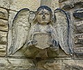 Angel, Pudsey (7171947976).jpg 2,697 × 2,270; 5.49 MB
-
 Armafix, Swinnow View - geograph.org.uk - 6719626.jpg 1,024 × 768; 114 KB
-
 Arms of the Municipal Borough of Pudsey.svg 628 × 886; 1.38 MB
-
 Bankhouse Bottom - Lower Bankhouse - geograph.org.uk - 2313607.jpg 640 × 480; 60 KB
-
 Bankhouse Farm - Scholebrook Lane - geograph.org.uk - 2314769.jpg 640 × 480; 87 KB
-

-
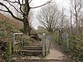 Barrier on the Leeds Country Way - geograph.org.uk - 4852097.jpg 1,024 × 768; 339 KB
-
 Bench Mark on Windmill Hill Railway Bridge - geograph.org.uk - 6490507.jpg 1,600 × 1,200; 520 KB
-
 Benchmark at No.13 Chapeltown, Pudsey - geograph.org.uk - 6688066.jpg 2,448 × 3,264; 2.74 MB
-
 Benchmark No91 Smalewell Gardens, Pudsey - geograph.org.uk - 6626973.jpg 2,448 × 3,264; 3.58 MB
-
 Benchmark on Greenside Primary School, Carlisle Road, Pudsey - geograph.org.uk - 6719188.jpg 2,448 × 3,264; 3.65 MB
-
 Benchmark on Railway Bridge, Carlisle Road, Pudsey - geograph.org.uk - 6719184.jpg 2,448 × 3,264; 4.43 MB
-
 Benchmark on Tyersal Road, Bradford - geograph.org.uk - 6710228.jpg 2,448 × 3,264; 2.29 MB
-
 Benchmark on Vicarage Outbuilding, Tofts Road Pudsey - geograph.org.uk - 6688062.jpg 2,448 × 3,264; 1.79 MB
-
 Benchmark on ^23 Southroyd Park - geograph.org.uk - 6524923.jpg 1,024 × 683; 261 KB
-
 Benchmark on ^7 Southroyd Park - geograph.org.uk - 6524959.jpg 677 × 1,024; 227 KB
-
 Benchmark Scholebrook Lane, Pudsey - geograph.org.uk - 6626911.jpg 2,448 × 3,264; 3.46 MB
-
 Bentley's Fish and Chips, Swinnow Road - geograph.org.uk - 6708568.jpg 1,024 × 768; 171 KB
-
 Best One, Swinnow Road - geograph.org.uk - 6487659.jpg 1,024 × 768; 180 KB
-
 Bilingual sign in Pudsey - geograph.org.uk - 5946802.jpg 1,024 × 768; 190 KB
-
 Black Hey Farm, Tyersal Lane - geograph.org.uk - 6462063.jpg 1,024 × 768; 239 KB
-
 BM Cut Windmill Hill Railway Bridge - geograph.org.uk - 6490503.jpg 1,200 × 1,600; 256 KB
-
 Boys Brigade Hall Inscription, Fulneck, Pudsey - geograph.org.uk - 6709526.jpg 1,024 × 768; 207 KB
-
 Brick Mill Barbers, Robin Lane, Pudsey - geograph.org.uk - 6698198.jpg 1,024 × 768; 144 KB
-
 Bridleway - Tong Road - geograph.org.uk - 2324848.jpg 640 × 480; 106 KB
-
 Bridleway approaching Smalewell Road - geograph.org.uk - 5906084.jpg 1,024 × 768; 228 KB
-
 Bridleway From Priesthorpe Lane - geograph.org.uk - 1320113.jpg 640 × 480; 155 KB
-
 Bridleway to Tong from Bankhouse Bottom - geograph.org.uk - 2313604.jpg 480 × 640; 108 KB
-
 Bridleway, Bankhouse Bottom - geograph.org.uk - 5108972.jpg 1,024 × 682; 303 KB
-
 Broken drainpipe - geograph.org.uk - 6483181.jpg 768 × 1,024; 231 KB
-
 BT installation off Pudsey Road - geograph.org.uk - 6488037.jpg 1,024 × 768; 357 KB
-
 Bus stop out of use on Pudsey Road - geograph.org.uk - 6504617.jpg 1,024 × 768; 265 KB
-
 Busy Bees nursery, Littlemoor Road - geograph.org.uk - 6483227.jpg 1,024 × 768; 146 KB
-
 Calves at Woodlands Farm - geograph.org.uk - 6483098.jpg 1,024 × 768; 295 KB
-
 Causeway alongside a beck - geograph.org.uk - 4852459.jpg 768 × 1,024; 393 KB
-
 Chapel Green. Pudsey - geograph.org.uk - 6392123.jpg 800 × 490; 71 KB
-
 Chaucer Avenue, Pudsey - geograph.org.uk - 6698193.jpg 1,024 × 768; 163 KB
-
 Claremont, Pudsey, Leeds - geograph.org.uk - 5088447.jpg 1,280 × 853; 567 KB
-
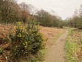 Clearing with gorse - geograph.org.uk - 4852415.jpg 1,024 × 768; 312 KB
-
 Clock tower, Kent Road, Pudsey - geograph.org.uk - 6698184.jpg 1,024 × 768; 172 KB
-
 Construction site off Tyersal Lane - geograph.org.uk - 6462114.jpg 1,024 × 768; 140 KB
-

-

-
 Crop field, Littlemoor Bottom - geograph.org.uk - 6392150.jpg 800 × 600; 147 KB
-
 Damaged Hough Top trig point on playing fields - geograph.org.uk - 5661529.jpg 1,024 × 683; 158 KB
-
 Dawn over Yorkshire. - geograph.org.uk - 134091.jpg 640 × 480; 34 KB
-
 Dead end off Lidget Hill, Pudsey - geograph.org.uk - 6091519.jpg 1,024 × 768; 117 KB
-
 Delph End - geograph.org.uk - 1396270.jpg 640 × 480; 138 KB
-
 Derelict barn at Wild Grove Farm - geograph.org.uk - 4852045.jpg 1,024 × 768; 247 KB
-
 Derelict building, Bankhouse Bottom - geograph.org.uk - 5370746.jpg 1,024 × 768; 265 KB
-
 Derelict house on Littlemoor Road - geograph.org.uk - 6483222.jpg 1,024 × 768; 327 KB
-
 Derelict wall at Woodlands Farm - geograph.org.uk - 6483109.jpg 1,024 × 768; 265 KB
-
 Disused filling station, Robin Lane, Pudsey - geograph.org.uk - 6698199.jpg 1,024 × 768; 142 KB
-
 Disused quarry at Windmill Hill (Detail) - geograph.org.uk - 4852257.jpg 768 × 1,024; 298 KB
-
 Disused quarry at Windmill Hill - geograph.org.uk - 4852250.jpg 1,024 × 768; 375 KB
-
 Driveway to Pudsey Congs Cricket Club, Pudsey - geograph.org.uk - 6112231.jpg 1,716 × 1,224; 543 KB
-
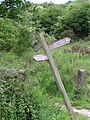 Drunken Sign at Bankhouse Bottom - geograph.org.uk - 442551.jpg 480 × 640; 146 KB
-
 Dry stone wall beside Valley Road opposite ^216 - geograph.org.uk - 5892324.jpg 1,024 × 683; 131 KB
-
 East end of Christ the Saviour church, Swinnow - geograph.org.uk - 6708565.jpg 768 × 1,024; 207 KB
-
 East View Cottages - Priestley Gardens - geograph.org.uk - 1175822.jpg 640 × 449; 199 KB
-
 Eastern end of the Fulneck estate - geograph.org.uk - 6483203.jpg 1,024 × 768; 237 KB
-
-

-
 Engineering Utilities, Swinnow Lane - geograph.org.uk - 6719602.jpg 1,024 × 768; 161 KB
-
 Entrance to Grove View - geograph.org.uk - 4852051.jpg 1,024 × 768; 204 KB
-
 Entrance to Meadowhurst - geograph.org.uk - 6698991.jpg 1,024 × 768; 208 KB
-
 Entrance to the former Smalewell sewage works - geograph.org.uk - 4852086.jpg 1,024 × 768; 356 KB
-
 Entrance to Tyersal Hall - geograph.org.uk - 6462095.jpg 1,024 × 768; 284 KB
-
 Entrance to Woodlands Farm - geograph.org.uk - 6483091.jpg 1,024 × 768; 350 KB
-
 Evening grasses by Bankhouse Lane - geograph.org.uk - 5906120.jpg 1,024 × 768; 98 KB
-
 Failing wall on Littlemoor Road - geograph.org.uk - 6483223.jpg 1,024 × 768; 372 KB
-
 Fallen tree across the Pudsey Beck - geograph.org.uk - 4852829.jpg 1,024 × 768; 401 KB
-
 Falling trees blocking the beck - geograph.org.uk - 4852812.jpg 1,024 × 768; 396 KB
-
 Field - Tong Road - geograph.org.uk - 2324856.jpg 640 × 480; 71 KB
-
 Field gate off Tyersal Lane - geograph.org.uk - 6462036.jpg 1,024 × 768; 333 KB
-
 Field of buttercups at Woodlands Farm - geograph.org.uk - 6483102.jpg 1,024 × 768; 247 KB
-
 Fieldmoor Lodge, off Littlemoor Road - geograph.org.uk - 6483242.jpg 1,024 × 768; 160 KB
-
 Fields south of Tyersal Lane - geograph.org.uk - 6462078.jpg 1,024 × 768; 234 KB
-
 Fields west of Pudsey Beck at Troydale - geograph.org.uk - 5645163.jpg 1,024 × 768; 97 KB
-
 Fields west of Tyersal Beck - geograph.org.uk - 4852042.jpg 1,024 × 768; 179 KB
-
 Fire Tank valve - geograph.org.uk - 6483209.jpg 1,024 × 768; 218 KB
-
 First4Cars, Pudsey - geograph.org.uk - 6699006.jpg 1,024 × 768; 154 KB
-
 Fish off the menu - geograph.org.uk - 6462076.jpg 1,024 × 768; 303 KB
-
 Football pitches behind St Joseph's school - geograph.org.uk - 4985971.jpg 1,024 × 768; 176 KB
-
 Footpath - Owlcotes Gardens - geograph.org.uk - 1296614.jpg 480 × 640; 211 KB
-
 Footpath - School Street - geograph.org.uk - 1287191.jpg 480 × 640; 297 KB
-
 Footpath alongside Cemetery Wall - geograph.org.uk - 623164.jpg 480 × 640; 43 KB
-
 Footpath from Ashdene Close to Fulneck, Pudsey - geograph.org.uk - 6709325.jpg 1,024 × 768; 249 KB
-

-
 Footpath from Tofts Road to Uppermoor - geograph.org.uk - 6699002.jpg 768 × 1,024; 110 KB
-
 Footpath off Bankhouse - geograph.org.uk - 6483113.jpg 1,024 × 768; 376 KB
-
 Footpath off Roker Lane, Pudsey - geograph.org.uk - 6112224.jpg 2,000 × 1,500; 926 KB
-

-
 Footpath to Fulneck from Ashdene Close - geograph.org.uk - 6084001.jpg 640 × 480; 104 KB
-

-

-
 Footpath to Tofts Road - geograph.org.uk - 6698983.jpg 1,024 × 768; 219 KB
-
 Footpath to Vicarage Drive - geograph.org.uk - 6698981.jpg 768 × 1,024; 259 KB
-
 Footpath to Woodlands Farm - geograph.org.uk - 6483110.jpg 768 × 1,024; 280 KB
-
 Ford and clapper bridge on Tyersal Lane - geograph.org.uk - 6462056.jpg 1,024 × 768; 409 KB
-

-
 Former Park Spring Quarry - geograph.org.uk - 6488017.jpg 1,024 × 768; 254 KB
-
 Former Phoenix Park Golf Course - geograph.org.uk - 6129690.jpg 800 × 637; 129 KB
-
 Former quarry below Westroyd Hill - geograph.org.uk - 4852354.jpg 1,024 × 768; 392 KB
-
 Former Sunday School, Pudsey - geograph.org.uk - 6392144.jpg 800 × 600; 139 KB
-
 Foundation stones (1) - geograph.org.uk - 5906130.jpg 1,024 × 768; 108 KB
-
 Foundation stones (2) - geograph.org.uk - 5906131.jpg 1,024 × 768; 153 KB
-
 Frog - Wildlife in Pudsey - geograph.org.uk - 2522671.jpg 640 × 502; 128 KB
-
 Fulneck Cemetery, Sarah Gurney - geograph.org.uk - 6483188.jpg 1,024 × 768; 364 KB
-
 Fulneck Cemetery, signs of life - geograph.org.uk - 6483194.jpg 768 × 1,024; 409 KB
-
 Fulneck Cemetery, tree trunk and grave markers - geograph.org.uk - 6483190.jpg 1,024 × 768; 322 KB
-
 Fulneck centery - geograph.org.uk - 6483182.jpg 1,024 × 768; 419 KB
-
 Fulneck Gallery - geograph.org.uk - 6483198.jpg 1,024 × 768; 298 KB
-
 Gable End Terrace, Pudsey - geograph.org.uk - 6698183.jpg 1,024 × 768; 202 KB
-
 Gate at the end of Swinnow View - geograph.org.uk - 6719631.jpg 1,024 × 768; 198 KB
-
 Gateposts or boundary stones^ - geograph.org.uk - 4852422.jpg 1,024 × 768; 373 KB
-
 Georgian postbox in Fulneck - geograph.org.uk - 6483127.jpg 1,024 × 768; 217 KB
-
 Gibraltar Road - geograph.org.uk - 4852093.jpg 1,024 × 768; 383 KB
-

-
 Ginnel from Windmill Hill to Moorfield Gardens - geograph.org.uk - 5906078.jpg 1,024 × 768; 199 KB
-
 Glimpse of a hidden railway - geograph.org.uk - 6483107.jpg 1,024 × 768; 256 KB
-
 Go Local Extra, Kent Road, Pudsey - geograph.org.uk - 6461509.jpg 1,024 × 768; 181 KB
-
 Grove View - geograph.org.uk - 4852072.jpg 1,024 × 768; 163 KB
-
 Hare Lane, Pudsey - geograph.org.uk - 6483205.jpg 1,024 × 768; 250 KB
-
 Harper Gate from Tyersal Lane - geograph.org.uk - 6462112.jpg 1,024 × 768; 222 KB
-
 Heights House, Pudsey, Leeds - geograph.org.uk - 4916670.jpg 1,280 × 720; 750 KB
-
 Hillfoot Cottages - geograph.org.uk - 412675.jpg 640 × 453; 123 KB
-
 Himalayan balsam at the side of a bridleway - geograph.org.uk - 5906088.jpg 1,024 × 768; 387 KB
-
 Horse in a field at Windmill Hill - geograph.org.uk - 5906086.jpg 1,024 × 768; 270 KB
-
 Horse-drawn hearse, Lowtown, Pudsey - geograph.org.uk - 6426051.jpg 1,024 × 768; 101 KB
-
 Horses at Tyersal House Farm - geograph.org.uk - 6462099.jpg 1,024 × 768; 146 KB
-
 Horses grazing - off Bradley Lane - geograph.org.uk - 3916930.jpg 640 × 480; 98 KB
-
 Horses on a bridleway - geograph.org.uk - 4852433.jpg 1,024 × 768; 217 KB
-
 Hough Top Trig Pillar - Pudsey - geograph.org.uk - 431598.jpg 640 × 473; 118 KB
-
 Hough Tree Terrace, off Swinnow Lane - geograph.org.uk - 6488026.jpg 1,024 × 768; 231 KB
-
 House with defibrillator, Kent Road, Pudsey - geograph.org.uk - 6461499.jpg 1,024 × 768; 191 KB
-
 Houses on Brick Mill Road, Pudsey - geograph.org.uk - 6698194.jpg 1,024 × 768; 166 KB
-
 Houses on Earlswood Chase - geograph.org.uk - 6483262.jpg 1,024 × 768; 285 KB
-
 Houses on Owlcotes Terrace - geograph.org.uk - 6565015.jpg 1,024 × 768; 112 KB
-
 Houses on Swinnow Walk - geograph.org.uk - 6719650.jpg 1,024 × 768; 191 KB
-
 Houses on Windmill Hill - geograph.org.uk - 390394.jpg 638 × 521; 92 KB
-
 Housing off Hough Side Road, Pudsey - geograph.org.uk - 5946894.jpg 1,024 × 768; 137 KB
-
 JT's Lounge ^ Sports Bar - Lowtown - geograph.org.uk - 5756097.jpg 577 × 640; 81 KB
-
 Kinder Haven, Waterloo Road - geograph.org.uk - 6565037.jpg 1,024 × 768; 104 KB
-
 Lambs at Woodlands Farm - geograph.org.uk - 6483095.jpg 1,024 × 768; 176 KB
-

-

-
 Leeds Country Way beside Pudsey Beck - geograph.org.uk - 1141488.jpg 640 × 480; 87 KB
-

-
 Leeds Country Way heading East towards Windmill Hill - geograph.org.uk - 5210891.jpg 1,600 × 1,067; 716 KB
-
 Leeds Country Way towards Pudsey - geograph.org.uk - 3968685.jpg 1,600 × 1,064; 876 KB
-
 Leeds Country Way towards Pudsey - geograph.org.uk - 3968687.jpg 1,600 × 1,064; 807 KB
-
 Leeds Country Way towards Pudsey - geograph.org.uk - 3968690.jpg 1,600 × 1,064; 858 KB
-
 Littlemoor Crescent - geograph.org.uk - 6483218.jpg 1,024 × 768; 106 KB
-
 Littlemoor Gardens - geograph.org.uk - 6483215.jpg 1,024 × 768; 102 KB
-
 Lock-ups at the end of Swinnow Walk - geograph.org.uk - 6719654.jpg 1,024 × 768; 214 KB
-
 Low-rise housing on Kent Road, Pudsey - geograph.org.uk - 6698187.jpg 1,024 × 768; 161 KB
-
 Lower Bankhouse BM nr Newstead House - geograph.org.uk - 6466624.jpg 1,200 × 1,600; 430 KB
-
 Lower end of Swinnow Lane - geograph.org.uk - 6488022.jpg 1,024 × 768; 241 KB
-
 Lowtown Primary School, Pudsey - geograph.org.uk - 6698182.jpg 1,024 × 768; 156 KB
-
 Lynnwood Gardens - geograph.org.uk - 473077.jpg 640 × 377; 68 KB
-
 Mare with foal by Tyersal Lane - geograph.org.uk - 6462117.jpg 1,024 × 768; 250 KB
-
 Marsh View, Pudsey - geograph.org.uk - 6392113.jpg 800 × 600; 100 KB
-
 Meadowhurst Gardens, Tofts Road, Pudsey - geograph.org.uk - 6698988.jpg 1,024 × 768; 224 KB
-
 Meadowhurst House and Oliver Croft. Pudsey - geograph.org.uk - 6033484.jpg 1,024 × 768; 296 KB
-
 Meadowhurst, Tofts Road, Pudsey - geograph.org.uk - 6698986.jpg 1,024 × 768; 173 KB
-
 Mill Cottage, Mount Pleasant Road - geograph.org.uk - 5752423.jpg 1,024 × 666; 196 KB
-
 Mill Gates.jpg 1,920 × 1,920; 1.76 MB
-
 Modern housing on Kent Road, Pudsey - geograph.org.uk - 6698186.jpg 1,024 × 768; 177 KB
-
 Motto on the former Pudsey Grammar School - geograph.org.uk - 6091502.jpg 1,024 × 768; 162 KB
-
 Narrow stile on the Leeds Country Way - geograph.org.uk - 4852369.jpg 1,024 × 768; 366 KB
-
 Nelson's House, Fulneck - detail - geograph.org.uk - 6483178.jpg 768 × 1,024; 219 KB
-
 Netball in Pudsey.jpg 2,896 × 1,944; 4.82 MB
-
 New houses off Tyersal Lane (1) - geograph.org.uk - 6462123.jpg 1,024 × 768; 194 KB
-
 New houses off Tyersal Lane (2) - geograph.org.uk - 6462127.jpg 1,024 × 768; 230 KB
-
 New housing on Waterloo Grove - geograph.org.uk - 6565029.jpg 1,024 × 768; 113 KB
-
 New housing on Waterloo Mount - geograph.org.uk - 6565028.jpg 1,024 × 768; 119 KB
-
 Newly planted trees - geograph.org.uk - 6483253.jpg 1,024 × 768; 270 KB
-
 Norseman, Swinnow Lane - geograph.org.uk - 6719610.jpg 1,024 × 768; 183 KB
-
 Northern end of the footpath past Woodlands Farm - geograph.org.uk - 6483094.jpg 768 × 1,024; 294 KB
-
 Nos. 24 and 23 Southroyd Park - geograph.org.uk - 6524942.jpg 1,024 × 683; 150 KB
-
 Nos. 27-19 (odds) Fulneck - geograph.org.uk - 6524986.jpg 1,024 × 682; 217 KB
-
 Nos. 39-29 (odds) Fulneck - geograph.org.uk - 6525005.jpg 1,024 × 683; 213 KB
-
 Nos. 8 and 7 Southroyd Park - geograph.org.uk - 6524971.jpg 1,024 × 661; 175 KB
-
 Old Marsh - Marsh - geograph.org.uk - 1296789.jpg 640 × 480; 292 KB
-
 Old railway bridge abutment, Tyersal Lane - geograph.org.uk - 6462062.jpg 1,024 × 768; 421 KB
-

-
 Omega Stone and Otley Stoves - geograph.org.uk - 4852063.jpg 1,024 × 768; 225 KB
-
 On Leeds Country Way alongside Pudsey Beck - geograph.org.uk - 5162810.jpg 1,024 × 768; 127 KB


.jpg)


_-_geograph.org.uk_-_4852257.jpg)


_-_geograph.org.uk_-_5906130.jpg)
_-_geograph.org.uk_-_5906131.jpg)


_-_geograph.org.uk_-_6462123.jpg)
_-_geograph.org.uk_-_6462127.jpg)


_Fulneck_-_geograph.org.uk_-_6524986.jpg)
_Fulneck_-_geograph.org.uk_-_6525005.jpg)


