Category:Pubs in the Metropolitan Borough of Wigan
Jump to navigation
Jump to search
Subcategories
This category has the following 17 subcategories, out of 17 total.
*
H
- Hare and Hounds, Longshaw (9 F)
K
- Kirkless Hall Inn (5 F)
L
- Leigh Wharf (13 F)
T
- The Orwell, Wigan Pier (15 F)
Media in category "Pubs in the Metropolitan Borough of Wigan"
The following 200 files are in this category, out of 208 total.
(previous page) (next page)-
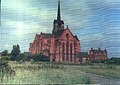
 All changed - geograph.org.uk - 85603.jpg 640 × 426; 101 KB
-
 Another pub under threat^ - geograph.org.uk - 1334481.jpg 640 × 426; 104 KB
-
 Astley Green, canal and pub - geograph.org.uk - 803916.jpg 640 × 480; 74 KB
-
 Baby Elephant - geograph.org.uk - 2271607.jpg 1,000 × 669; 154 KB
-
 Baby Elephant pub, Gathurst (1).JPG 4,320 × 3,240; 3.07 MB
-
 Baby Elephant pub, Gathurst (2).JPG 4,320 × 3,240; 2.58 MB
-
-
 Balcarres Arms - geograph.org.uk - 1537081.jpg 640 × 494; 74 KB
-
 Balcarres Arms - geograph.org.uk - 2636941.jpg 1,280 × 960; 667 KB
-
 Bowling Green pub, Wigan.JPG 4,320 × 3,240; 2.47 MB
-
 Bridgewater Canal, Astley Green - geograph.org.uk - 2317231.jpg 640 × 480; 168 KB
-
 Bridgewater Canal, Astley Green - geograph.org.uk - 924713.jpg 640 × 429; 147 KB
-
 Bryn Hall Pub, Bryn Gates - geograph.org.uk - 5287797.jpg 1,024 × 768; 213 KB
-
 Bucks Head, Abram - geograph.org.uk - 2818366.jpg 640 × 480; 453 KB
-
 Bulls Head, Astley - geograph.org.uk - 558715.jpg 640 × 480; 98 KB
-
 Cart and Horses - geograph.org.uk - 1092279.jpg 640 × 462; 80 KB
-
 Cart and Horses - geograph.org.uk - 2969575.jpg 640 × 480; 513 KB
-
 Charnley Arms, Shevington Moor - geograph.org.uk - 2086186.jpg 800 × 600; 243 KB
-
 Colliers Arms - geograph.org.uk - 2781818.jpg 640 × 480; 408 KB
-
 Colliers, Arms on Wigan Road - geograph.org.uk - 3045313.jpg 800 × 600; 99 KB
-
 Crooke Hall Inn - geograph.org.uk - 1034767.jpg 640 × 479; 74 KB
-
 Crown Hotel - geograph.org.uk - 2781821.jpg 640 × 480; 338 KB
-
 Down the Wigan Flight-06 - geograph.org.uk - 852606.jpg 640 × 426; 90 KB
-
 Eagle and Child - geograph.org.uk - 924482.jpg 640 × 444; 145 KB
-
 Ellesmere Inn - geograph.org.uk - 2806807.jpg 640 × 480; 404 KB
-
 Fishergate Inn, Pemberton.JPG 4,320 × 3,240; 3.12 MB
-
 Frontages on Warrington Road - geograph.org.uk - 158092.jpg 640 × 426; 77 KB
-
 Gathurst Canal Bridge - geograph.org.uk - 40849.jpg 640 × 480; 233 KB
-
 Gerrard Arms - geograph.org.uk - 2802974.jpg 640 × 480; 373 KB
-
 Gerrard Arms, Dicconson Lane, Aspull - geograph.org.uk - 2967034.jpg 640 × 480; 51 KB
-
 Half Moon Inn - geograph.org.uk - 1310775.jpg 640 × 418; 75 KB
-
 Halfway House pub on Ormskirk Road, Wigan.jpg 640 × 426; 55 KB
-
 Hare & Hounds, Pemberton.jpg 4,320 × 3,240; 3.64 MB
-
 Hare and Hounds Hotel - geograph.org.uk - 2803316.jpg 640 × 480; 387 KB
-
 Harry's Bar, Wigan.jpg 3,240 × 4,320; 3.44 MB
-
 Horse Shoe Tavern, Hindley - geograph.org.uk - 2806811.jpg 640 × 480; 426 KB
-
-
 Kirkless Hall Inn - geograph.org.uk - 6181669.jpg 1,600 × 1,065; 517 KB
-
 Kirkless Hall Inn - geograph.org.uk - 6181671.jpg 1,235 × 1,600; 557 KB
-
 Last Orders - geograph.org.uk - 1737528.jpg 2,661 × 1,996; 747 KB
-
 Last Orders on City Road - geograph.org.uk - 2109879.jpg 1,600 × 1,198; 355 KB
-
 Longshaw, Holts Arms - geograph.org.uk - 6310520.jpg 800 × 600; 607 KB
-
 Lowton Road ends at The Red Lion - geograph.org.uk - 3387045.jpg 640 × 481; 50 KB
-
 Masons Arms, Atherton - geograph.org.uk - 109465.jpg 640 × 427; 74 KB
-
 Mechanics Arms - geograph.org.uk - 2868680.jpg 640 × 480; 385 KB
-
 Miners Arms - geograph.org.uk - 1737517.jpg 2,816 × 2,112; 809 KB
-
 Miners Arms - geograph.org.uk - 1737537.jpg 2,051 × 1,539; 474 KB
-
 Nevison Inn, Plank Lane - geograph.org.uk - 3043977.jpg 800 × 600; 123 KB
-
 New Inn - geograph.org.uk - 2870570.jpg 640 × 480; 426 KB
-
 New sign for Bickershaw village - geograph.org.uk - 1334498.jpg 640 × 426; 66 KB
-
 No lock-in here - geograph.org.uk - 921335.jpg 640 × 426; 45 KB
-
 Oddfellows Arms, Bryn.jpg 4,320 × 3,240; 2.86 MB
-
 Old Boat House - geograph.org.uk - 2317025.jpg 640 × 480; 172 KB
-
 Old Boat House, Astley Green - geograph.org.uk - 2317028.jpg 1,280 × 960; 585 KB
-
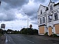
 Orrell Post Crossroads - geograph.org.uk - 42610.jpg 640 × 480; 148 KB
-
 Out of town - geograph.org.uk - 82977.jpg 640 × 426; 91 KB
-
 Park Lane Freehouse, Bryn.jpg 4,320 × 3,240; 2.87 MB
-
 Plough & Harrow, Shevington (2).JPG 4,320 × 3,240; 2.98 MB
-
 Plough & Harrow, Shevington.JPG 4,608 × 3,456; 3.47 MB
-
 Premier Inn and Stonecross Pub - geograph.org.uk - 1035139.jpg 640 × 399; 138 KB
-
 Queens Arms Inn, Boothstown - geograph.org.uk - 30983.jpg 640 × 480; 106 KB
-
 Queens Arms, Newtown, Wigan.jpg 4,320 × 3,240; 3.44 MB
-
 Queens Hotel, Abram - geograph.org.uk - 77635.jpg 640 × 426; 82 KB
-
 Quo vadis^ - geograph.org.uk - 83142.jpg 640 × 426; 98 KB
-
 Quo vadis^ - geograph.org.uk - 876133.jpg 640 × 426; 67 KB
-
 Ram's Head, Lowton - geograph.org.uk - 2816582.jpg 640 × 480; 365 KB
-
 Red Lion, Newton Road, Lowton - geograph.org.uk - 3985910.jpg 640 × 450; 62 KB
-
 Refreshment at last^ - geograph.org.uk - 143433.jpg 640 × 426; 70 KB
-
 Revolution bar, Wigan.jpg 4,320 × 3,240; 3.04 MB
-
 Robin Hood, St Helens Road - geograph.org.uk - 2368870.jpg 640 × 480; 157 KB
-
 Running Horses public house - geograph.org.uk - 1037540.jpg 640 × 479; 63 KB
-
 Sign for the Victoria, Haigh - geograph.org.uk - 4410003.jpg 570 × 640; 63 KB
-
 The "Seven Stars" from the Canal - geograph.org.uk - 557343.jpg 640 × 426; 128 KB
-
 The Alexandra Hotel, Hindley Green - geograph.org.uk - 2806868.jpg 640 × 480; 453 KB
-
 The Amberswood Tavern - geograph.org.uk - 861265.jpg 640 × 425; 169 KB
-
 The Balcarres Arms, Haigh - geograph.org.uk - 4409989.jpg 640 × 480; 95 KB
-
 The Belle Green - geograph.org.uk - 1209581.jpg 640 × 426; 54 KB
-
 The Bispham Lodge Pub - geograph.org.uk - 5537053.jpg 1,024 × 769; 205 KB
-
 The Brookhouse Inn - geograph.org.uk - 4015596.jpg 640 × 480; 53 KB
-
 The Brookhouse Inn - geograph.org.uk - 4015597.jpg 640 × 480; 68 KB
-
 The Bryn Hall pub, Bryn Gates - geograph.org.uk - 3334348.jpg 640 × 480; 69 KB
-
 The Buck's Head - geograph.org.uk - 1534192.jpg 640 × 473; 85 KB
-
 The Bucks Head - Abram - geograph.org.uk - 3007038.jpg 4,099 × 2,749; 3.02 MB
-
 The Bucks Head, Abram - geograph.org.uk - 2818376.jpg 640 × 480; 429 KB
-
 The Bull's Head, Astley 1974 - geograph.org.uk - 1779859.jpg 2,336 × 1,560; 370 KB
-
 The Bulls Head, Goose Green - geograph.org.uk - 510968.jpg 640 × 480; 88 KB
-

-
 The Cart and Horses on Manchester Road - geograph.org.uk - 4108104.jpg 1,024 × 768; 163 KB
-
 The Charnley Arms at Shevington Moor - geograph.org.uk - 2081946.jpg 1,600 × 1,198; 327 KB
-
 The Charnley Arms pub - geograph.org.uk - 3334893.jpg 640 × 480; 75 KB
-
 The Church Inn - geograph.org.uk - 2815815.jpg 640 × 480; 361 KB
-
 The Colliers Arms - geograph.org.uk - 3284863.jpg 4,094 × 2,459; 1.72 MB
-

-

-

-
 The Commercial Inn - geograph.org.uk - 6181677.jpg 1,600 × 1,065; 654 KB
-
 The Commercial Inn - geograph.org.uk - 6181679.jpg 1,600 × 1,065; 565 KB
-
 The Crispin Arms - Rose Bridge - geograph.org.uk - 2735141.jpg 3,739 × 2,404; 2.94 MB
-
 The Crispin Arms on Birkett Bank - geograph.org.uk - 3045444.jpg 800 × 600; 93 KB
-
 The Crofters Arms, Wigan (1).jpg 4,320 × 3,240; 3.7 MB
-
 The Crofters Arms, Wigan (2).jpg 4,320 × 3,240; 3.59 MB
-
 The Crooke Hall Inn Pub, Crooke - geograph.org.uk - 1832062.jpg 2,048 × 1,536; 589 KB
-
 The Crown Hotel on Wigan Road - geograph.org.uk - 3045322.jpg 800 × 600; 86 KB
-
 The Dover Lock Inn - geograph.org.uk - 2817858.jpg 640 × 480; 423 KB
-
 The Dover Lock Inn - geograph.org.uk - 3007042.jpg 3,991 × 3,201; 3.39 MB
-
 The Dover Lock Inn on Aye Bridge Road - geograph.org.uk - 2097105.jpg 1,600 × 1,198; 358 KB
-
 The Dover Lock Inn, Abram - geograph.org.uk - 1832006.jpg 2,048 × 1,536; 525 KB
-

-
 The Ex-Pub With No Name - geograph.org.uk - 861260.jpg 640 × 427; 216 KB
-
 The Freemasons - geograph.org.uk - 5223457.jpg 1,024 × 683; 296 KB
-
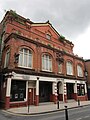
 The Griffin Hotel, Wigan.JPG 4,320 × 3,240; 3.22 MB
-
 The Hare and Hounds - Lowton - geograph.org.uk - 2735214.jpg 3,000 × 4,000; 3.9 MB
-
 The Hare and Hounds at Longshaw - geograph.org.uk - 6310519.jpg 800 × 600; 623 KB
-
 The Hare ^ Hounds pub, Lowton - geograph.org.uk - 3355321.jpg 1,024 × 768; 145 KB
-
 The Hawk pub, Hawkley, Wigan - geograph.org.uk - 5314551.jpg 1,024 × 769; 121 KB
-
 The Holts Arms on Crank Road - geograph.org.uk - 2109821.jpg 1,600 × 1,198; 507 KB
-

-
 The Hub, Wigan.JPG 3,240 × 4,320; 3.23 MB
-
 The King William - geograph.org.uk - 2818417.jpg 640 × 480; 422 KB
-
 The Last Orders Pub - geograph.org.uk - 4015602.jpg 640 × 480; 66 KB
-

-
 The Mechanics Arms pub - geograph.org.uk - 3355441.jpg 1,200 × 900; 273 KB
-
 The Miner's Arms on City Road - geograph.org.uk - 2109872.jpg 1,600 × 1,198; 391 KB
-
 The Miners Arms pub - geograph.org.uk - 4015606.jpg 640 × 480; 58 KB
-
 The Moon Under Water pub, Wigan.jpg 4,320 × 3,240; 2.99 MB
-
 The Moorgate Inn - geograph.org.uk - 2870575.jpg 640 × 480; 415 KB
-
 The Moorgate Inn, Aspull - geograph.org.uk - 4410031.jpg 640 × 480; 57 KB
-
 The Mort Arms - geograph.org.uk - 1310770.jpg 452 × 640; 62 KB
-
 The New Enfield pub, Pemberton - geograph.org.uk - 4015584.jpg 640 × 480; 63 KB
-
 The Old Boat House at Astley Green - geograph.org.uk - 4099111.jpg 1,024 × 768; 164 KB
-
 The Old Boat House Pub, Astley - geograph.org.uk - 1830950.jpg 2,048 × 1,536; 590 KB
-
 The Old Boathouse pub Astley Green - geograph.org.uk - 803928.jpg 640 × 471; 84 KB
-
 The Old Boathouse Public House - geograph.org.uk - 991478.jpg 640 × 480; 69 KB
-
 The Paddock Hotel - geograph.org.uk - 1427281.jpg 640 × 480; 95 KB
-

-

-

-
 The Prince of Wales pub, Newtown, Wigan (1).jpg 4,320 × 3,240; 3.21 MB
-
 The Prince of Wales pub, Newtown, Wigan (2).jpg 4,320 × 3,240; 3.7 MB
-
 The pubs of Wigan Lane - 06A - geograph.org.uk - 856826.jpg 640 × 426; 104 KB
-
 The pubs of Wigan Lane-02 - geograph.org.uk - 856781.jpg 640 × 426; 65 KB
-
 The pubs of Wigan Lane-03 - geograph.org.uk - 856789.jpg 640 × 426; 90 KB
-
 The pubs of Wigan Lane-04 - geograph.org.uk - 856797.jpg 640 × 527; 76 KB
-
 The pubs of Wigan Lane-04A - geograph.org.uk - 856807.jpg 640 × 426; 66 KB
-
 The pubs of Wigan Lane-05 - geograph.org.uk - 856812.jpg 640 × 426; 75 KB
-
 The pubs of Wigan Lane-06 - geograph.org.uk - 856820.jpg 640 × 426; 84 KB
-
 The Queen's Head - geograph.org.uk - 2777825.jpg 640 × 480; 417 KB
-
 The Queen's Head, Aspull - geograph.org.uk - 2777822.jpg 640 × 480; 159 KB
-

-
 The Queens - geograph.org.uk - 2868754.jpg 640 × 480; 412 KB
-
 The Queens Arms, Platt Bridge - geograph.org.uk - 2818407.jpg 640 × 480; 415 KB
-
 The Queens Head, Aspull - geograph.org.uk - 3045111.jpg 800 × 600; 89 KB
-
 The Queens Head, Aspull - geograph.org.uk - 3045114.jpg 600 × 800; 76 KB
-
 The Queens public house Bickershaw - geograph.org.uk - 2044702.jpg 1,600 × 1,198; 396 KB
-
 The Queens Public house on the B5237 - geograph.org.uk - 3007028.jpg 4,288 × 3,216; 3.42 MB
-
 The Railway - geograph.org.uk - 6219004.jpg 800 × 533; 466 KB
-
 The Railway pub, Pemberton.jpg 4,320 × 3,240; 2.73 MB
-
 The Raven pub, Wigan.jpg 3,240 × 4,320; 3.19 MB
-
 The Red Cat - geograph.org.uk - 2868690.jpg 640 × 480; 440 KB
-
 The Red Cat pub, Tamer Lane End - geograph.org.uk - 3355437.jpg 1,200 × 900; 283 KB
-
 The Red Cat Public House - Tamer - geograph.org.uk - 3006905.jpg 3,975 × 2,937; 2.86 MB
-
 The Red Lion - geograph.org.uk - 2091126.jpg 1,000 × 645; 156 KB
-
 The Red Lion - Golborne - geograph.org.uk - 2735207.jpg 3,197 × 2,605; 2.77 MB
-
 The Red Lion, Golborne - geograph.org.uk - 2816595.jpg 640 × 480; 277 KB
-
 The Red Lion, Westleigh - geograph.org.uk - 3044016.jpg 800 × 600; 126 KB
-
 The Robin Hood pub - geograph.org.uk - 3355795.jpg 640 × 480; 63 KB
-
 The Ross's Arms - geograph.org.uk - 2317014.jpg 640 × 480; 188 KB
-
 The Ross's Arms - geograph.org.uk - 2317019.jpg 640 × 480; 186 KB
-
 The Shepherds Inn - geograph.org.uk - 3025032.jpg 3,139 × 1,997; 2.56 MB
-
 The Shepherds Inn - geograph.org.uk - 3355801.jpg 640 × 480; 50 KB
-
 The Sir Charles Napier pub - geograph.org.uk - 3355335.jpg 976 × 796; 165 KB
-
 The Sir Charles Napier Public House - geograph.org.uk - 4041533.jpg 3,542 × 2,727; 3.53 MB
-
 The Station - geograph.org.uk - 1310995.jpg 640 × 414; 62 KB
-
 The Stonecross - geograph.org.uk - 2356691.jpg 1,280 × 960; 519 KB
-
 The Stonecross at Golborne - geograph.org.uk - 2726680.jpg 1,500 × 1,000; 106 KB
-
 The Swan & Railway, Wigan.jpg 3,240 × 4,320; 3.52 MB
-
 The Swan - Hindley Green - geograph.org.uk - 2735107.jpg 4,000 × 3,000; 4.12 MB
-
 The Swan at Hindley Green - geograph.org.uk - 2443655.jpg 1,600 × 1,198; 408 KB
-
 The Swinley, Wigan.JPG 4,320 × 3,240; 3.01 MB
-
 The Unicorn pub, Higher End - geograph.org.uk - 4017154.jpg 640 × 404; 45 KB
-
 The Unicorn public house - geograph.org.uk - 1037535.jpg 640 × 479; 67 KB
-
 The Vale Royal - for a cheap and cheerful carvery - geograph.org.uk - 1875620.jpg 1,600 × 1,200; 661 KB
-
 The Venture pub, Highfield - geograph.org.uk - 4015570.jpg 640 × 480; 85 KB
-
 The Venture, Highfield - geograph.org.uk - 6219126.jpg 800 × 533; 523 KB
-
 The Venue, Wigan.jpg 4,320 × 3,240; 3.74 MB
-
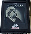
 The Victoria - geograph.org.uk - 2636926.jpg 1,280 × 960; 615 KB
-
 The Victoria, Haigh - geograph.org.uk - 4410001.jpg 640 × 480; 80 KB
-
 The Victoria, Haigh Road - geograph.org.uk - 876117.jpg 640 × 426; 81 KB
-
 The Victoria, Haigh Road, Haigh - geograph.org.uk - 956015.jpg 640 × 480; 189 KB
-
 The Wheatsheaf, Shevington Vale (1).JPG 4,608 × 3,456; 3.5 MB
-
 The Wheatsheaf, Shevington Vale (2).JPG 4,608 × 3,456; 3.64 MB
-
 The Wheatsheaf, Shevington Vale (3).JPG 4,320 × 3,240; 3.27 MB
-

-
 The White Swan, Pemberton - geograph.org.uk - 6218967.jpg 800 × 533; 554 KB
-
 The Whitesmiths Arms, Wigan.JPG 4,320 × 3,240; 2.83 MB
-
 Travellers Rest - geograph.org.uk - 2817835.jpg 640 × 480; 166 KB
-
 Vale Royal pub, Gathurst Road (1).JPG 4,320 × 3,240; 3.19 MB
-
 Vale Royal pub, Gathurst Road (2).JPG 4,320 × 3,240; 3.49 MB
-
 Warrington Road, Bucks Head - geograph.org.uk - 2818371.jpg 640 × 480; 499 KB
-
 Watch this space - geograph.org.uk - 366025.jpg 640 × 427; 89 KB


.JPG)
.JPG)


.JPG)


.jpg)
.jpg)


.jpg)
.jpg)


.JPG)
.JPG)
.JPG)


.JPG)
.JPG)

