Category:Public transport maps of Saint Paul, Minnesota
Jump to navigation
Jump to search
Media in category "Public transport maps of Saint Paul, Minnesota"
The following 6 files are in this category, out of 6 total.
-
 051907-010-Minneapolis1904.jpg 3,072 × 1,800; 5.43 MB
-
 Metro light rail lines only.svg 885 × 498; 402 KB
-
 Metro Transit Green Line train interior 02.jpg 3,024 × 4,032; 3.3 MB
-
 METROMNSystemMap.png 2,412 × 2,135; 325 KB
-
 MetroTransitMNCurrentMETROMap.png 1,045 × 920; 110 KB
-
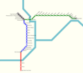
 Minnesota Metro Network.svg 512 × 341; 382 KB


