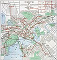
Category:Public transport maps of Perth
Jump to navigation
Jump to search
Media in category "Public transport maps of Perth"
The following 15 files are in this category, out of 15 total.
-
B15 Tram display, South Perth, January 2021 02.jpg 3,264 × 2,448; 2.87 MB
-
MapMetronet.png 505 × 556; 163 KB
-
Meltham station Transperth train system map.jpg 4,032 × 1,600; 1.17 MB
-
Metronet-Western Australia.png 600 × 689; 187 KB
-
Perth Railway map.png 2,188 × 2,797; 304 KB
-
Perth Railway map.svg 2,694 × 570; 74 KB
-
Perth tram map 1920.jpg 2,000 × 2,178; 541 KB
-
Perth Tramways 1939.jpg 2,512 × 2,651; 5.57 MB
-
Transperth B-series network map.jpg 4,032 × 3,024; 2.88 MB
-
Transperth C-series mockup network map 2.jpg 4,032 × 3,024; 1.66 MB
-
Transperth C-series mockup network map.jpg 3,933 × 1,747; 1.01 MB
-
Transperth railway map.svg 516 × 810; 653 KB
-
Transperth system map at Butler Station.jpg 4,032 × 3,024; 1.62 MB
-
Transperth system map at Redcliffe Station, Western Australia.jpg 3,965 × 3,024; 1.59 MB
-
TransperthRailwayMap.svg 650 × 1,050; 140 KB


