Category:Public transport maps of Ontario
Jump to navigation
Jump to search
Subcategories
This category has the following 4 subcategories, out of 4 total.
O
T
Media in category "Public transport maps of Ontario"
The following 15 files are in this category, out of 15 total.
-
CorridorVia.svg 1,250 × 750; 161 KB
-
Eglintoneastlrt.png 1,140 × 716; 405 KB
-
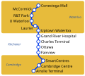
GRT iXpress Map.svg 280 × 250; 20 KB
-
ION LRT map.svg 649 × 558; 678 KB
-
Oscshuttlebus.png 868 × 790; 463 KB
-
Thunder Bay Transit Map.svg 1,000 × 2,000; 601 KB
-
TransitInAuroraAndNewmarket.png 1,072 × 1,768; 51 KB
-
VIVA Green Map.PNG 964 × 404; 20 KB
-
Viva Network Expansion Plan VNEP.jpg 1,704 × 1,126; 764 KB
-
VIVA Orange Line.png 3,973 × 1,980; 142 KB
-
VIVA Pink Line.png 2,936 × 2,074; 198 KB
-
VIVA Purple Map.PNG 1,041 × 251; 16 KB
-
VIVA Yellow Line 2.pdf 1,650 × 1,275; 229 KB
-
VIVA Yellow Line.png 2,719 × 1,365; 98 KB


