Category:Public transport maps of Nuremberg
Jump to navigation
Jump to search
Urban districts (cities): Augsburg · Landshut · Munich · Nuremberg · Regensburg ·
Subcategories
This category has the following 4 subcategories, out of 4 total.
B
- Bus maps of Nuremberg (5 F)
S
- S-Bahn maps of Nuremberg (32 F)
T
- Tram maps of Nuremberg (23 F)
U
- U-Bahn maps of Nuremberg (47 F)
Media in category "Public transport maps of Nuremberg"
The following 16 files are in this category, out of 16 total.
-
 Eisenbahnnetz Nürnberg.png 3,169 × 3,169; 2.47 MB
-
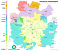 Karte Entwicklung des VGN-Verbundgebietes.png 1,618 × 1,403; 631 KB
-
 Karte Ludwigseisenbahn.png 2,535 × 2,535; 1.06 MB
-
 Liniennetz Nürnberg Fürth 30.9.1990.png 7,220 × 5,370; 698 KB
-
 Mittelfrankenbahn Streckennetz.png 2,125 × 1,875; 491 KB
-
 Nuernberg bahnhoefe.png 2,771 × 3,596; 1.52 MB
-
 Nuremberg network map.png 4,964 × 3,358; 1.78 MB
-
 R-Bahn Nürnberg Liniennetz.png 1,500 × 1,500; 573 KB
-
 R-Bahnnetz Nürnberg.png 4,970 × 4,971; 4.04 MB
-
 S-R-Bahnnetz Nürnberg.png 3,241 × 2,322; 863 KB
-
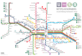
 Schnellbahnnetz Nürnberg S U.png 10,000 × 1,546; 1.06 MB
-
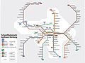 Schnellbahnnetz nürnberg.jpg 2,892 × 2,176; 578 KB
-
 Stadt Umland Bahn.png 1,877 × 1,318; 476 KB
-
 StUB-Netz 11 2023.png 3,294 × 2,415; 3.07 MB
-
 U-Straßenbahn-undOBusNetzentwicklungNürnberg.png 6,240 × 4,975; 1.95 MB
-
 U-undStraßenbahnGleisplanNürnberg2017.png 8,407 × 6,780; 2.03 MB


