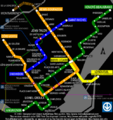
Category:Public transport maps of Montreal
Jump to navigation
Jump to search
Media in category "Public transport maps of Montreal"
The following 21 files are in this category, out of 21 total.
-
1961-MetroMontreal.png 600 × 600; 186 KB
-
Carte de la Montreal Tramways Co. 1914.jpg 2,000 × 1,097; 1.77 MB
-
Carte Mtl Blainville Saint-Jérôme.svg 1,283 × 1,192; 166 KB
-
Carte Mtl Candiac.svg 677 × 812; 85 KB
-
Carte Mtl Deux-Montagnes.svg 1,169 × 639; 128 KB
-
Carte Mtl Mascouche.svg 1,058 × 1,091; 158 KB
-
Carte Mtl Mont-Saint-Hilaire.svg 1,355 × 695; 87 KB
-
Carte Mtl Vaudreuil Hudson.svg 1,739 × 584; 158 KB
-
Dorval Transport Hubs.png 1,140 × 1,090; 481 KB
-
Montreal reseau trains banlieue.png 2,138 × 1,688; 282 KB
-
Montreal tramways company route map 1941.gif 3,203 × 1,985; 500 KB
-
Msc-network-circa-1950-fr.svg 512 × 218; 166 KB
-
Msc-network-en.svg 512 × 218; 275 KB
-
Mtl-metro-map-zh trad.svg 500 × 499; 1.05 MB
-
Mtl-metro-map.png 500 × 533; 52 KB
-
Mtl-metro-map.svg 500 × 499; 592 KB
-
Plan du métro de Montréal.pdf 3,541 × 5,341; 906 KB
-
Plan-métro-Dorval.jpg 800 × 718; 270 KB
-
Railtram carte-msc.gif 1,627 × 584; 50 KB
-
REM de l'Est - Plan.jpg 802 × 802; 142 KB
-
TMetroFutur.jpg 320 × 200; 19 KB


