Category:Public transport maps of Leipzig
Jump to navigation
Jump to search
Subcategories
This category has the following 2 subcategories, out of 2 total.
Media in category "Public transport maps of Leipzig"
The following 8 files are in this category, out of 8 total.
-
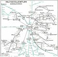
Haltestellenplan Leipzig 1969 Umland.jpg 1,200 × 1,187; 305 KB
-
Haltestellenplan Leipzig 1980 Rueckseite.jpg 1,200 × 1,181; 257 KB
-
Leipzig and Halle public transport system map (with stations).png 14,545 × 11,664; 46.75 MB
-
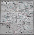
Leipzig Haltestellenplan 1980.jpg 1,280 × 1,290; 687 KB
-
Lissel Verkehrsplan Leipzig 1913.jpg 10,820 × 8,300; 22.22 MB
-
S-Bahn Leipzig bis 2002.JPG 832 × 784; 70 KB
-
S-Bahn Leipzig-Halle Map.svg 512 × 412; 57 KB
-
Straßenbahn-undOBusNetzentwicklungLeipzig.png 9,086 × 6,530; 3.3 MB


