Category:Public transport maps of Kōbe
Jump to navigation
Jump to search
Subcategories
This category has only the following subcategory.
Media in category "Public transport maps of Kōbe"
The following 9 files are in this category, out of 9 total.
-
Kobe-shinai.PNG 450 × 220; 15 KB
-
KobeU-undStraßenbahnNetzentwicklung.png 8,539 × 7,673; 2.33 MB
-
Ligne Kobe Kosoku.png 2,498 × 885; 136 KB
-
LineMap OsakaKobe.png 810 × 320; 188 KB
-
PortLiner Map.png 525 × 700; 83 KB
-
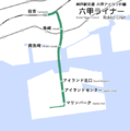
RokkoLiner Map.png 525 × 529; 50 KB
-
SannomiyaStationAreaMap.png 3,480 × 2,680; 638 KB
-
Sean Cuddeford.jpg 3,264 × 2,448; 2.96 MB
-
UBahnGleisplanKobe2014.png 9,285 × 8,661; 2.22 MB


