Category:Public transport maps of Freiburg im Breisgau
Jump to navigation
Jump to search
Urban districts (cities): Freiburg · Heidelberg · Heilbronn · Karlsruhe · Mannheim · Stuttgart · Ulm
Media in category "Public transport maps of Freiburg im Breisgau"
The following 12 files are in this category, out of 12 total.
-
Basel - Regio-S-Bahn Basel - Netzplan (mit Hintergrund).jpg 2,470 × 2,094; 3.77 MB
-
Basel - Regio-S-Bahn Basel - Netzplan.jpg 2,470 × 2,094; 1.39 MB
-
Breisgau S-bahn 2018 Liniennetz.png 3,651 × 2,856; 703 KB
-
Breisgau S-bahn 2020 Liniennetz.png 3,651 × 2,856; 731 KB
-
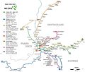
Freiburg-nahverkehr.png 1,598 × 1,172; 1.67 MB
-
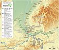
Freiburg-topographie.png 739 × 684; 702 KB
-
Liniennetz S-Bahn Breisgau.svg 3,879 × 2,424; 850 KB
-
Regioverkehrsverbundfreiburg.jpg 400 × 351; 36 KB
-
Schema Bahnstrecken Freiburger Hbf.png 728 × 451; 30 KB
-
Schema bahnstrecken.svg 536 × 453; 21 KB
-
StraßenbahnGleisplanFreiburg2019.png 4,836 × 4,724; 974 KB
-
StraßenbahnNetzentwicklungFreiburg.png 3,627 × 3,543; 730 KB


