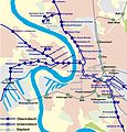
Category:Public transport maps of Düsseldorf
Jump to navigation
Jump to search
Subcategories
This category has the following 2 subcategories, out of 2 total.
- Tram maps of Düsseldorf (3 F)
M
Media in category "Public transport maps of Düsseldorf"
The following 14 files are in this category, out of 14 total.
-
Belsenplatz Haltestellen 2.jpg 3,141 × 1,841; 3.39 MB
-
Belsenplatz Plan Haltestellen 1.jpg 2,117 × 2,022; 2.7 MB
-
Buslinie 730 1.jpg 556 × 800; 157 KB
-
Düsseldorf Stadtbahn U79.svg 4,000 × 2,000; 1.05 MB
-
Hauptbahnhof U Verortung.svg 437 × 580; 66 KB
-
Heinrich Heine Allee U Verortung.svg 437 × 580; 66 KB
-
Oberbilker Markt U Verortung.svg 437 × 580; 66 KB
-
Plan Stadtbahn Düsseldorf-2.jpg 2,325 × 2,425; 1.66 MB
-
Plan Stadtbahn Düsseldorf.jpg 2,325 × 2,425; 1.66 MB
-
RB KM.png 2,081 × 301; 84 KB
-
Ruhrgebiet public transport system map (with stations).jpg 20,834 × 14,554; 94.73 MB
-
Streckenübersichtskarte Düsseldorf.jpg 600 × 400; 111 KB
-
Streckenübersichtskarte Ratingen.jpg 900 × 600; 274 KB
-
Tonhalle U Verortung.svg 437 × 580; 66 KB


