Category:Public transport maps of Andalusia
Jump to navigation
Jump to search
Subcategories
This category has the following 6 subcategories, out of 6 total.
P
Media in category "Public transport maps of Andalusia"
The following 20 files are in this category, out of 20 total.
-
C-ca plano.png 521 × 639; 21 KB
-
Cadiz Bay Local Train - de.svg 735 × 979; 61 KB
-
Cadiz Bay Local Train - es.svg 768 × 1,024; 60 KB
-
CTMCG-zonas-bahía.png 1,180 × 890; 99 KB
-
CTMCG-zonas.png 1,000 × 750; 102 KB
-
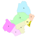
CTMCG-zonas.svg 400 × 400; 27 KB
-
Jerez Tram Project.svg 768 × 1,024; 297 KB
-
Línea 1 - Atunara Moovit.png 550 × 540; 408 KB
-
Línea 1 - Atunara.png 570 × 803; 499 KB
-
Línea 2 - Junquillo Moovit.png 550 × 540; 337 KB
-
Línea 2 - Junquillo.png 567 × 802; 501 KB
-
Línea 3 - Zabal Sta. Margarita Alcaidesa Moovit.png 550 × 540; 238 KB
-
Línea 3 - Zabal Sta. Margarita Alcaidesa.png 561 × 798; 450 KB
-
Mapa esquemático La Línea de la Concepción.png 1,137 × 820; 854 KB
-
Metro de Granada.svg 502 × 741; 41 KB
-
Plano esquemático Cercanías Cádiz.svg 512 × 683; 395 KB
-
Plano FFCC Jerez.jpg 600 × 950; 115 KB
-
Trayectos ctmcg.png 1,480 × 1,480; 307 KB
-
Urcadiz.png 861 × 585; 65 KB


