Category:Public footpaths in Castleford, West Yorkshire
Jump to navigation
Jump to search
Subcategories
This category has the following 2 subcategories, out of 2 total.
T
- Tickle Cock Bridge (7 F)
W
- Wheldale Trail (7 F)
Media in category "Public footpaths in Castleford, West Yorkshire"
The following 41 files are in this category, out of 41 total.
-
 A walk from Glass Houghton ^12 - geograph.org.uk - 1996658.jpg 800 × 600; 359 KB
-
 A walk from Glass Houghton ^14 - geograph.org.uk - 1996670.jpg 800 × 600; 289 KB
-
 A walk from Glass Houghton ^29 - geograph.org.uk - 1996782.jpg 800 × 600; 263 KB
-
 A walk from Glass Houghton ^7 - geograph.org.uk - 1996632.jpg 800 × 600; 293 KB
-
 A walk from Glass Houghton ^73 - geograph.org.uk - 1997098.jpg 800 × 600; 342 KB
-
 Footpath - Barnes Road - geograph.org.uk - 5186405.jpg 640 × 480; 101 KB
-
 Footpath - Cutsyke Avenue - geograph.org.uk - 5126692.jpg 480 × 640; 92 KB
-
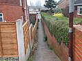
 Footpath - Green Lane - geograph.org.uk - 5186354.jpg 480 × 640; 134 KB
-
 Footpath - Leeds Road - geograph.org.uk - 5186387.jpg 640 × 480; 80 KB
-
 Footpath - Lumley Street - geograph.org.uk - 5159060.jpg 578 × 640; 87 KB
-
 Footpath - Lumley Street - geograph.org.uk - 5159069.jpg 480 × 640; 112 KB
-
 Footpath - Pontefract Road - geograph.org.uk - 5264735.jpg 640 × 480; 74 KB
-
 Footpath - Wood View Avenue - geograph.org.uk - 5158118.jpg 640 × 480; 88 KB
-
 Footpath - Wood View Avenue - geograph.org.uk - 5158185.jpg 640 × 480; 96 KB
-
 Footpath - Wood View Crescent - geograph.org.uk - 5158211.jpg 640 × 480; 82 KB
-

-
 Footpath along the floodbank - geograph.org.uk - 2163355.jpg 1,024 × 768; 115 KB
-
 Footpath on disused railway line. - geograph.org.uk - 2784666.jpg 3,216 × 4,288; 2.72 MB
-

-
 Former railway line - geograph.org.uk - 2163327.jpg 1,024 × 768; 216 KB
-
 Main footpath in Fryston wood - geograph.org.uk - 2730558.jpg 1,145 × 1,600; 588 KB
-
 Newly laid path and tree planting - geograph.org.uk - 5702086.jpg 4,608 × 3,072; 4.21 MB
-
 On the Riverside Trail - geograph.org.uk - 4912822.jpg 800 × 600; 131 KB
-
 Path along the River Calder - geograph.org.uk - 3856506.jpg 1,200 × 798; 607 KB
-
 Path from Hightown to Whitwood Mere - geograph.org.uk - 579624.jpg 460 × 640; 123 KB
-
 Path leading to Fairies Wharf - geograph.org.uk - 3856493.jpg 1,200 × 798; 519 KB
-
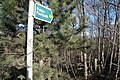
 Path to Whin Covert - geograph.org.uk - 2475392.jpg 1,024 × 768; 147 KB
-
 Path towards Castleford at The Island - geograph.org.uk - 4974772.jpg 1,600 × 1,200; 586 KB
-
 Path, Airedale - geograph.org.uk - 3830598.jpg 1,920 × 2,560; 939 KB
-
 Pathway to Glasshoughton - geograph.org.uk - 2651148.jpg 640 × 480; 111 KB
-
-
-
 Public footpath off Express Way - geograph.org.uk - 3856441.jpg 1,200 × 798; 669 KB
-
 Retaining wall for new housing development - geograph.org.uk - 5791211.jpg 4,288 × 3,216; 3.04 MB
-
 Riverside path north of Fairies Hill - geograph.org.uk - 2974141.jpg 2,048 × 1,536; 518 KB
-
 Smawthorne Swamps 2 - geograph.org.uk - 669918.jpg 454 × 640; 145 KB
-
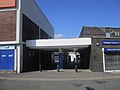
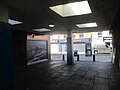
 Subway Under the Railway - geograph.org.uk - 373044.jpg 640 × 480; 93 KB
-
 The Riverside Trail - geograph.org.uk - 663132.jpg 640 × 427; 108 KB
-
 The Riverside Trail - geograph.org.uk - 663794.jpg 640 × 464; 107 KB
-
 Track - Cutsyke Crest - geograph.org.uk - 5126297.jpg 640 × 480; 100 KB
-
 Track - Pontefract Road - geograph.org.uk - 5264751.jpg 640 × 480; 77 KB


.jpg)


_001.jpg)
_002.jpg)


