Category:Precipitation effects maps
Jump to navigation
Jump to search
"Effects" means meteorological theory, impacts of certain events see Category:Maps of weather impact areas and Category:Precipitation maps
See also:
- Category:Maps of drought events (contrary)
Media in category "Precipitation effects maps"
The following 13 files are in this category, out of 13 total.
-
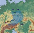
Central Europe relief map with 2013 rain.jpg 2,048 × 1,984; 3.11 MB
-
El ninjo nordamerika vetero.png 529 × 677; 118 KB
-
El nino north american weather fr.png 529 × 677; 72 KB
-
El nino north american weather.png 529 × 677; 64 KB
-
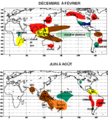
El Nino regional impacts fr.png 486 × 539; 21 KB
-
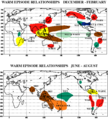
El Nino regional impacts.png 486 × 539; 23 KB
-
Great Lakes Snowbelt EPA fr.png 1,867 × 1,485; 3.63 MB
-
La Nina regional impacts fr.png 486 × 539; 21 KB
-
La Nina regional impacts.gif 486 × 539; 22 KB
-
Mjo north america rain.png 556 × 749; 28 KB
-
NYlakeeffectsnow.png 421 × 300; 29 KB
-
Snow-removal-cleveland-3.jpg 478 × 601; 109 KB
-
USA-Lake-Effect-Snow-Areas.svg 211 × 149; 3.15 MB


