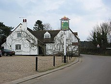
Category:Potters Crouch
Jump to navigation
Jump to search
human settlement in United Kingdom | |||||
| Upload media | |||||
| Instance of | |||||
|---|---|---|---|---|---|
| Location |
| ||||
 | |||||
English: Potters Crouch is a hamlet in the civil parish of St Michael, in the St Albans district, in the county of Hertfordshire, England.
Subcategories
This category has only the following subcategory.
T
Media in category "Potters Crouch"
The following 17 files are in this category, out of 17 total.
-
Appspond-Lane-20051002-021.jpg 3,031 × 2,006; 1.47 MB
-
Arable land near Potters Crouch - geograph.org.uk - 755542.jpg 640 × 359; 63 KB
-
Barn-like house, Potters Crouch - geograph.org.uk - 996.jpg 640 × 480; 41 KB
-
Bedmond-Lane-20051002-017.jpg 3,031 × 2,006; 1.75 MB
-
Footpath near Potters Crouch - geograph.org.uk - 755573.jpg 640 × 359; 92 KB
-
Footpath south from Appspond Lane - geograph.org.uk - 755546.jpg 640 × 480; 97 KB
-
Potters Crouch Triangulation Pillar - geograph.org.uk - 565680.jpg 640 × 466; 120 KB
-
Potters Crouch, Blunts Lane - geograph.org.uk - 566483.jpg 640 × 480; 152 KB
-
Potters-Crouch-East-Farm-20051002-015.jpg 3,031 × 2,006; 1.55 MB
-
Potters-Crouch-East-Farm-20051002-016.jpg 3,031 × 2,006; 1.69 MB
-
Potters-Crouch-Farm-20051002-018.jpg 3,031 × 2,006; 1.25 MB
-
Potters-Crouch-Farm-20051002-019.jpg 3,031 × 2,006; 1.31 MB
-
Potters-Crouch-Farm-20051002-020.jpg 3,031 × 2,006; 1.54 MB
-
Pylon and copse - geograph.org.uk - 786.jpg 640 × 480; 33 KB
-
St Albans, Public Footpath No. 36 - geograph.org.uk - 1347348.jpg 640 × 480; 125 KB


