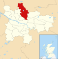
Category:Possilpark
Jump to navigation
Jump to search
district in Glasgow City, Scotland, UK | |||||
| Upload media | |||||
| Instance of | |||||
|---|---|---|---|---|---|
| Location | Glasgow City, Scotland | ||||
 | |||||
Subcategories
This category has the following 9 subcategories, out of 9 total.
Media in category "Possilpark"
The following 61 files are in this category, out of 61 total.
-
Ashfield Street, Glasgow, looking south - geograph.org.uk - 6206056.jpg 1,600 × 1,200; 296 KB
-
Blaes pitch, Ashfield Street (geograph 2942406).jpg 640 × 360; 179 KB
-
BP Petrol Station - Balmore Road - geograph.org.uk - 550477.jpg 640 × 480; 84 KB
-
Broadholm Street, off Balmore Road, Glasgow (geograph 6205862).jpg 1,600 × 1,199; 340 KB
-
Burst Water Main - geograph.org.uk - 49981.jpg 640 × 480; 115 KB
-
Canal at Firhill, Glasgow.jpg 4,032 × 3,024; 3.98 MB
-
Carlisle Street - geograph.org.uk - 5300549.jpg 1,600 × 1,200; 428 KB
-
Derelict housing, Ruchill - geograph.org.uk - 49999.jpg 640 × 419; 65 KB
-
Disused railway line (geograph 2942395).jpg 640 × 360; 284 KB
-
Doo hut under construction - geograph.org.uk - 1176507.jpg 640 × 480; 69 KB
-
Eastfield Crossing - geograph.org.uk - 592394.jpg 640 × 480; 80 KB
-
Exterieur van Possil House te Glasgow, RP-F-2001-7-426-83.jpg 5,120 × 8,270; 3.77 MB
-
Flats at the junction of Saracen Street and Keppochhill Road (geograph 6206185).jpg 1,600 × 1,200; 361 KB
-
Forth and Clyde Canal - geograph.org.uk - 1176484.jpg 640 × 480; 56 KB
-
Frozen canal (geograph 2206794).jpg 1,536 × 1,750; 881 KB
-
Gadloch Street from Coltmuir Street, Glasgow (geograph 6205884).jpg 1,600 × 1,200; 384 KB
-
Glasgow wards 2017 no16 Canal.png 2,000 × 2,040; 504 KB
-
Glasgow. Possilpark. Graffiti.jpg 6,000 × 4,000; 4.68 MB
-
Glasgow. Possilpark. Saracen Street, view towards the south.jpg 4,000 × 3,000; 2.3 MB
-
Glasgow. Possilpark. The Saracen Bar.jpg 3,845 × 2,266; 2.18 MB
-
Glasgow. Possilpark. Wester Common Road. Tower blocks.jpg 4,007 × 2,287; 2.87 MB
-
Glen Douglas, Possil Park - geograph.org.uk - 1127833.jpg 640 × 480; 118 KB
-
HamiltonHill1923.jpg 1,564 × 510; 166 KB
-
Hawthorn Quadrant, from Ashfield Street, Glasgow - geograph.org.uk - 6206075.jpg 1,600 × 1,200; 396 KB
-
Hawthorn Street at Saracen Street - geograph.org.uk - 1127864.jpg 640 × 480; 118 KB
-
Hawthorn Street, Possil Park - geograph.org.uk - 1127869.jpg 640 × 480; 97 KB
-
Hayston Street - geograph.org.uk - 49956.jpg 640 × 480; 139 KB
-
Houses in Balglass Street, Glasgow (geograph 6205847).jpg 1,600 × 1,200; 489 KB
-
Houses on the south side of Stronend Street, Glasgow (geograph 6205848).jpg 1,600 × 1,200; 423 KB
-
Houses on Walnut Road (geograph 5300564).jpg 1,600 × 980; 277 KB
-
Keppochhill Road - geograph.org.uk - 555900.jpg 640 × 480; 80 KB
-
Kinbuck Street - geograph.org.uk - 1766165.jpg 532 × 800; 92 KB
-
Kinbuck Street - geograph.org.uk - 1766198.jpg 1,000 × 664; 172 KB
-
Lock-up Garages, Possil Park - geograph.org.uk - 49995.jpg 640 × 480; 55 KB
-
Map of Glasgow and its Environs OS Map name 006-02, Ordnance Survey, 1857-1893.png 11,352 × 7,545; 21.72 MB
-
Modern flats on Panmure Road - geograph.org.uk - 1131503.jpg 640 × 480; 119 KB
-
Monday afternoon walk by the Canal (51111642694).jpg 4,032 × 3,024; 3.99 MB
-
New houses on Killearn Street, Glasgow (geograph 6206150).jpg 1,600 × 1,200; 282 KB
-
Open space, Ruchill (geograph 3207699).jpg 1,024 × 683; 190 KB
-
Possil Park Bingo Hall - geograph.org.uk - 49965.jpg 640 × 477; 68 KB
-
Rear of flats on Finlas Street (geograph 5300605).jpg 1,600 × 1,200; 315 KB
-
Stonyhurst Street - geograph.org.uk - 1766189.jpg 1,000 × 664; 193 KB
-
Stronend Road - geograph.org.uk - 2942836.jpg 640 × 360; 183 KB
-
Surf City (geograph 2126396).jpg 640 × 493; 94 KB
-
Tenement flats, Hawthorn Street - geograph.org.uk - 5300557.jpg 1,600 × 1,132; 308 KB
-
The Glasgow offices of Scottish Water (geograph 3207744).jpg 1,024 × 683; 146 KB
-
Tower Block UK photo glw1-22 (Broadholm Street 1983).jpg 2,604 × 1,731; 796 KB
-
Tower Block UK photo glw2-20 (Possil Wester Common 1983).jpg 2,604 × 1,715; 806 KB
-
Tower Block UK photo glw2-21 (Possil Wester Common 1992).jpg 2,639 × 1,766; 940 KB
-
Tower Block UK photo glw2-22 (Possil Wester Common 1982).jpg 2,612 × 1,747; 882 KB
-
Traffic management, Ashfield Street, Possil, Glasgow - geograph.org.uk - 6206096.jpg 1,600 × 1,200; 339 KB
-
View over Possil Park and beyond - geograph.org.uk - 1766175.jpg 1,000 × 664; 273 KB
-
View over the Firhill Basin (geograph 4818325).jpg 2,000 × 1,709; 4.52 MB
-
Walnut Street, from Ashfield Street, Glasgow - geograph.org.uk - 6206065.jpg 1,600 × 1,199; 392 KB
-
Westercommon Tower Blocks - geograph.org.uk - 49989.jpg 640 × 480; 126 KB


