Category:Portolan atlases of Pietro Vesconte
Jump to navigation
Jump to search
Media in category "Portolan atlases of Pietro Vesconte"
The following 15 files are in this category, out of 15 total.
-
Calendar from Pietro Vesconte 1313 atlas.jpg 613 × 512; 149 KB
-
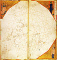
Map from Pietro Vesconte 1313 atlas.jpg 2,622 × 2,282; 1.74 MB
-
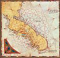
Adriatic map in Vesconte 1318 atlas.jpg 803 × 768; 243 KB
-
Atlantic map from Perrino Vesconte 1321 atlas (Zurich).jpg 733 × 752; 249 KB
-
Atlantic map from Pietro Vesconte 1321 atlas.jpg 1,007 × 1,478; 533 KB
-
North Atlantic map from Vesconte c.1321 (Lyon) atlas.jpg 2,443 × 2,576; 1.01 MB
-
West Mediterranean from Vesconte c.1321 (Lyon) atlas.jpg 3,091 × 3,192; 1.64 MB
-
Atlantic map from Pietro Vesconte 1325 atlas.jpg 1,954 × 2,848; 2.65 MB
-
1321 Vesconte BGFlag.png 243 × 296; 151 KB
-
Georgia portolane by pietro vesconte 1321.jpg 400 × 418; 510 KB
-
Nordenskiöld 1897 Plate 05(2) LOC Image 242.jpg 8,416 × 6,115; 5.27 MB
-
Nordenskiöld 1897 Plate 06 Petrus Vesconte 1318 Page232.jpg 7,452 × 5,388; 5.29 MB
-
Nordenskiöld 1897 Plate 07(1) LOC Image 249.jpg 5,760 × 8,323; 5.33 MB
-
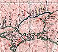
Portolan vesconte 1318 sea of Azov.jpg 1,589 × 1,416; 542 KB
-
Prvni namorni atlas.jpg 444 × 339; 50 KB


