Category:Port Sunlight
model village and suburb in the Metropolitan Borough of Wirral, Merseyside, England | |||||
| Upload media | |||||
| Instance of | |||||
|---|---|---|---|---|---|
| Location | Wirral, Merseyside, North West England, England | ||||
| Inception |
| ||||
| official website | |||||
 | |||||
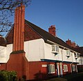
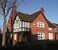
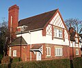
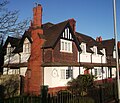
Port Sunlight is a model village and suburb in the Metropolitan Borough of Wirral, Merseyside. It was built by Lever Brothers to accommodate workers in its soap factory (now part of Unilever); work commenced in 1888. The name is derived from Lever Brothers' most popular brand of cleaning agent, Sunlight. Port Sunlight contains 900 Grade II listed buildings, and was declared a Conservation Area in 1978. The village formed part of the civil parish of Lower Bebington from 1866, and of the subsequent urban district from 1894. In 1933 it became part of Bebington Urban District, then of the Municipal Borough of Bebington from 1937. The municipal borough was abolished in 1974, becoming Bebington unparished area.
Subcategories
This category has the following 28 subcategories, out of 28 total.
!
B
- Bromborough Road bridge (6 F)
D
E
- Ellens Lane bridge (8 F)
G
H
L
- Lever House, Port Sunlight (10 F)
P
- Port Sunlight Museum (7 F)
- Port Sunlight River Park (1 F)
S
- Storeton Tramway bridge (3 F)
T
- The Leverhulme Memorial (23 F)
W
Media in category "Port Sunlight"
The following 200 files are in this category, out of 274 total.
(previous page) (next page)-
1 and 3 Windy Bank.jpg 4,000 × 3,000; 967 KB
-
1-3 Central Rd.jpg 3,295 × 1,381; 416 KB
-
1-5 Corniche.jpg 1,024 × 705; 187 KB
-
1-7 Jubilee.jpg 1,024 × 571; 92 KB
-
1-7 Lower Road.jpg 3,800 × 1,991; 950 KB
-
1-7 Park Road, Port Sunlight.jpg 3,937 × 2,911; 944 KB
-
1-7 Pool Bank.jpg 1,024 × 486; 98 KB
-
1-7 Water St.jpg 1,024 × 630; 150 KB
-
1-7 Wood St.jpg 1,024 × 624; 121 KB
-
1-9 Causeway Close Port Sunlight.jpg 1,225 × 650; 127 KB
-
10-14 Queen Mary's Drive.jpg 3,888 × 2,833; 975 KB
-
10-16 Boundary Rd.jpg 1,024 × 463; 61 KB
-
11-21 Primrose Hill.jpg 1,024 × 507; 85 KB
-
12-18 Windy Bank.jpg 4,000 × 3,000; 991 KB
-
12-20 Lodge Lane.jpg 1,024 × 548; 113 KB
-
128-132 NCR.jpg 1,024 × 776; 116 KB
-
13-31 Boundary.jpg 1,024 × 486; 72 KB
-
134-146 NCR.jpg 1,024 × 479; 73 KB
-
14-16 Church Drive.jpg 1,024 × 392; 71 KB
-
14-22 Park Rd.jpg 1,024 × 530; 92 KB
-
148-156 NCR.jpg 1,024 × 476; 80 KB
-
15 Bolton Rd.jpg 1,024 × 762; 110 KB
-
15-22 Queen Mary's Drive (2).jpg 3,717 × 2,633; 955 KB
-
15-22 Queen Mary's Drive (cropped).jpg 3,759 × 537; 200 KB
-
15-22 Queen Mary's Drive.jpg 3,759 × 2,674; 953 KB
-
15-23 Central Rd.jpg 1,024 × 552; 99 KB
-
158-168 NCR.jpg 1,024 × 580; 94 KB
-
16-22 Pool Bank.jpg 1,024 × 721; 87 KB
-
16-24 Central Road.jpg 1,024 × 678; 147 KB
-
16-28 Primrose Hill.jpg 1,024 × 437; 68 KB
-
17-23 Corniche.jpg 1,024 × 601; 91 KB
-
17-23 Wood St.jpg 1,024 × 588; 125 KB
-
170-176 NCR.jpg 1,024 × 648; 84 KB
-
178-190 NCR.jpg 1,024 × 588; 62 KB
-
18-24 Greendale Rd.jpg 1,024 × 516; 88 KB
-
2 and 4 Windy Bank.jpg 4,000 × 3,000; 930 KB
-
2-10 Lodge Lane.jpg 1,024 × 537; 88 KB
-
2-16 Circular.jpg 1,024 × 323; 55 KB
-
2-4 Park Rd.jpg 1,024 × 689; 93 KB
-
2-6 Pool Bank.jpg 1,024 × 522; 126 KB
-
2-8 Boundary.jpg 1,024 × 536; 84 KB
-
200-210 NCR.jpg 1,024 × 555; 79 KB
-
212-216 NCR.jpg 1,024 × 795; 135 KB
-
218-222 NCR.jpg 1,024 × 464; 60 KB
-
224-228 NCR.jpg 1,024 × 606; 74 KB
-
23-24 Windy Bank.jpg 1,024 × 758; 102 KB
-
23-30 Queen Mary's Drive.jpg 4,000 × 3,000; 951 KB
-
23-35 Primrose Hill.jpg 1,024 × 539; 66 KB
-
230-232 NCR.jpg 1,024 × 808; 86 KB
-
234-238 NCR.jpg 1,024 × 569; 60 KB
-
24-34 Pool Bank.jpg 1,024 × 640; 85 KB
-
240-242 NCR.jpg 1,024 × 778; 111 KB
-
244-248 NCR.jpg 1,024 × 608; 90 KB
-
25-29 Corniche.jpg 1,024 × 703; 101 KB
-
25-29 Greendale Rd.jpg 1,024 × 504; 99 KB
-
25-35 The Ginnel.jpg 1,024 × 549; 139 KB
-
250-254 NCR.jpg 1,024 × 684; 99 KB
-
256-260 NCR.jpg 1,024 × 689; 90 KB
-
26 Park Rd.jpg 1,024 × 669; 65 KB
-
26-34 Central Road.jpg 1,024 × 567; 103 KB
-
262-266 NCR.jpg 1,024 × 745; 96 KB
-
268-274 NCR.jpg 1,024 × 999; 136 KB
-
27-39 Pool Bank.jpg 1,024 × 605; 85 KB
-
28-36 Park Rd.jpg 1,024 × 751; 128 KB
-
282 NCR.jpg 1,024 × 757; 115 KB
-
286 NCR.jpg 1,024 × 748; 147 KB
-
292 NCR.jpg 1,024 × 688; 106 KB
-
296 NCR.jpg 1,024 × 754; 109 KB
-
3-11 Boundary.jpg 1,024 × 545; 101 KB
-
3-33 Bath Central Green.jpg 1,024 × 432; 65 KB
-
3-4 Brook St.jpg 1,024 × 725; 115 KB
-
3-9 Bridge Street, Port Sunlight.jpg 640 × 373; 55 KB
-
30-32 Greendale Rd.jpg 2,136 × 1,257; 441 KB
-
30-38 Primrose Hill.jpg 1,024 × 596; 70 KB
-
300 NCR.jpg 1,024 × 842; 139 KB
-
304 NCR.jpg 1,024 × 693; 117 KB
-
308 NCR.jpg 1,024 × 878; 126 KB
-
31-35 Corniche.jpg 1,024 × 706; 114 KB
-
31-46 Queen Marys Port Sunlight.jpg 1,370 × 750; 157 KB
-
312 NCR.jpg 1,024 × 850; 166 KB
-
314 NCR.jpg 1,024 × 664; 115 KB
-
322 NCR.jpg 1,024 × 688; 119 KB
-
326 NCR.jpg 1,024 × 882; 150 KB
-
33-39 Greendale Rd.jpg 1,024 × 438; 56 KB
-
35 Boundary.jpg 1,024 × 731; 105 KB
-
35-49 Lower Rd.jpg 1,024 × 390; 48 KB
-
36-44 Central Road.jpg 1,024 × 723; 153 KB
-
37-41 Corniche.jpg 1,024 × 491; 93 KB
-
37-43 Boundary.jpg 1,024 × 607; 81 KB
-
37-45 Primrose Hill.jpg 1,024 × 537; 71 KB
-
37-47 Wood St.jpg 1,024 × 590; 86 KB
-
38-48 Park Rd.jpg 1,024 × 573; 122 KB
-
40-43 Greendale Rd.jpg 1,024 × 503; 81 KB
-
40-50 Primrose Hill.jpg 1,024 × 504; 102 KB
-
41-53 Pool Bank2.jpg 1,024 × 591; 106 KB
-
43-47 Corniche Rd.jpg 1,024 × 670; 80 KB
-
44-48 Greendale Rd.jpg 1,024 × 416; 92 KB
-
45-47 Boundary.jpg 1,153 × 893; 113 KB
-
45-55 Bebington Rd.jpg 1,024 × 565; 59 KB
-
46-64 Central Rd.jpg 1,024 × 321; 55 KB
-
47-53 Primrose Hill.jpg 1,024 × 532; 130 KB
-
49-53 Corniche.jpg 1,024 × 661; 103 KB
-
49-53 Greendale Rd continuation on Causeway.jpg 1,024 × 519; 76 KB
-
49-55 Wood St.jpg 1,024 × 673; 96 KB
-
5-10 Brook St.jpg 1,024 × 451; 84 KB
-
5-13 Central Rd.jpg 1,024 × 518; 80 KB
-
5-20 King George's Drive (2).jpg 3,885 × 2,835; 969 KB
-
5-7 Bolton Rd.jpg 1,024 × 645; 103 KB
-
50 Park Rd.jpg 1,024 × 953; 99 KB
-
51-59 Lower Rd.jpg 1,024 × 467; 89 KB
-
52 Park Road.jpg 1,024 × 473; 75 KB
-
52-56 Primrose Hill.jpg 1,024 × 608; 95 KB
-
54-58 Greendale Rd.jpg 1,024 × 436; 80 KB
-
55-57 Primrose Hill.jpg 1,024 × 445; 103 KB
-
55-59 Corniche.jpg 1,024 × 730; 118 KB
-
55-67 Pool Bank.jpg 1,024 × 494; 71 KB
-
57-65 Bebington Rd.jpg 1,024 × 551; 73 KB
-
59-63 Greendale Rd.jpg 1,024 × 527; 117 KB
-
6-11 Windy Bank.jpg 4,000 × 3,000; 944 KB
-
6-12 Park Road, Port Sunlight.jpg 3,350 × 2,495; 923 KB
-
6-13 Church Drive, Port Sunlight.jpg 3,430 × 1,933; 977 KB
-
6-14 Primrose Hill.jpg 1,024 × 598; 97 KB
-
60-62 Bolton Rd.jpg 1,024 × 571; 108 KB
-
61-67 Corniche.jpg 1,024 × 634; 109 KB
-
61-69 Bolton.jpg 1,024 × 563; 137 KB
-
64-70 Greendale Rd.jpg 1,024 × 428; 68 KB
-
64-78 Bolton.jpg 1,024 × 546; 111 KB
-
67-79 Bebington Rd.jpg 1,024 × 535; 71 KB
-
69-75 Pool Bank.jpg 1,024 × 540; 69 KB
-
6a-6h Greendale Rd.jpg 1,024 × 391; 94 KB
-
6k -7 Greendale Rd.jpg 1,024 × 1,021; 138 KB
-
7-15 Corniche.jpg 1,024 × 403; 65 KB
-
7-23 The Ginnel.jpg 1,024 × 577; 139 KB
-
71-74 Greendale Port Sunlight.jpg 768 × 498; 148 KB
-
71-75 Bolton Rd.jpg 1,024 × 633; 102 KB
-
75-78 Greendale Port Sunlight.jpg 768 × 466; 171 KB
-
79-82 Greendale Port Sunlight.jpg 768 × 529; 191 KB
-
8-10 Greendale Rd.jpg 1,024 × 854; 113 KB
-
8-14 Bridge Street, Port Sunlight.jpg 1,280 × 856; 232 KB
-
8-14 Pool Bank.jpg 1,024 × 655; 75 KB
-
8-15 Jubilee.jpg 1,024 × 418; 98 KB
-
81-87 Bebington Rd.jpg 1,024 × 573; 78 KB
-
83-87 Greendale Road, Port Sunlight.jpg 3,283 × 2,254; 940 KB
-
89-92 Greendale Road, Port Sunlight.jpg 3,229 × 2,146; 956 KB
-
89-97 Bebington Rd.jpg 1,024 × 512; 60 KB
-
9-13 Bolton Rd.jpg 1,024 × 588; 80 KB
-
9-13 Lower Road.jpg 3,344 × 2,259; 951 KB
-
9-15 Wood St.jpg 1,024 × 618; 114 KB
-
9-17 Park Road, Port Sunlight.jpg 3,700 × 2,871; 973 KB
-
9-17 Pool Bank.jpg 1,024 × 677; 138 KB
-
97-100 Greendale Port Sunlight.jpg 768 × 476; 168 KB
-
99-109 Bebington Rd.jpg 1,024 × 396; 51 KB
-
Bowling Green - geograph.org.uk - 154724.jpg 640 × 480; 82 KB
-
Bridge Street, Port Sunlight.jpg 1,500 × 1,000; 145 KB
-
Bromborough Dock Branch 2020-0 - start of Bromborough Dock Branch bikeway.jpg 3,305 × 5,097; 21.34 MB
-
Careers Office (33 Boundary).jpg 1,256 × 1,204; 176 KB
-
Central Road, Port Sunlight.JPG 3,648 × 2,736; 3.49 MB
-
CH62 373 Port Sunlight.jpg 4,397 × 3,249; 1.32 MB
-
Church Drive Infant School - geograph.org.uk - 153153.jpg 640 × 480; 94 KB
-
Church Drive Primary School - geograph.org.uk - 1019183.jpg 640 × 479; 81 KB
-
Church Drive Primary School, Port Sunlight (1).JPG 4,608 × 3,456; 3.39 MB
-
Church Drive Primary School, Port Sunlight (2).JPG 4,608 × 3,456; 3.61 MB
-
Church Hall, Port Sunlight (1).JPG 4,320 × 3,240; 2.59 MB
-
Flowerbed, Lower Road, Port Sunlight.JPG 3,648 × 2,736; 3.58 MB
-
Flowers at Port Sunlight (1).JPG 4,608 × 3,456; 3.39 MB
-
Flowers at Port Sunlight (2).JPG 4,608 × 3,456; 3.45 MB
-
Flowers at Port Sunlight (3).JPG 3,456 × 4,608; 3.68 MB
-
Footpath, Port Sunlight 1.JPG 3,648 × 2,736; 3.64 MB
-
Garden Village, England (32865413957).jpg 6,721 × 3,501; 5.77 MB
-
Heritage Centre - geograph.org.uk - 154699.jpg 640 × 480; 91 KB
-
House at Port Sunlight (at Windy Bank) - geograph.org.uk - 1489206.jpg 473 × 640; 103 KB
-
House at Port Sunlight - geograph.org.uk - 1489492.jpg 505 × 640; 88 KB
-
Houses at Port Sunlight (Riverside) - geograph.org.uk - 1492954.jpg 640 × 481; 68 KB
-
Houses at Port Sunlight (Riverside) - geograph.org.uk - 1492982.jpg 640 × 480; 69 KB
-
Houses at Port Sunlight - geograph.org.uk - 1489186.jpg 640 × 480; 99 KB
-
Houses at Port Sunlight - geograph.org.uk - 1489220.jpg 640 × 467; 53 KB
-
Houses at Port Sunlight - geograph.org.uk - 1489423.jpg 640 × 513; 65 KB
-
Houses at Port Sunlight - geograph.org.uk - 1489424.jpg 640 × 476; 77 KB
-
Houses at Port Sunlight - geograph.org.uk - 1489446.jpg 640 × 480; 59 KB
-
Houses at Port Sunlight - geograph.org.uk - 1489448.jpg 640 × 450; 80 KB
-
Houses at Port Sunlight - geograph.org.uk - 1489456.jpg 480 × 640; 81 KB
-
Houses at Port Sunlight - geograph.org.uk - 1489463.jpg 640 × 487; 85 KB


