Category:Port Mulgrave
Jump to navigation
Jump to search
hamlet in Hinderwell, Scarborough, North Yorkshire, England | |||||
| Upload media | |||||
| Instance of | |||||
|---|---|---|---|---|---|
| Location | Hinderwell, Scarborough, North Yorkshire, Yorkshire and the Humber, England | ||||
 | |||||
Subcategories
This category has the following 3 subcategories, out of 3 total.
G
- Grinkle mine tramway (3 F)
P
- Port Mulgrave harbour (10 F)
- Port Mulgrave mine (4 F)
Media in category "Port Mulgrave"
The following 42 files are in this category, out of 42 total.
-
 Abandoned Bulldozer, Port Mulgrave - geograph.org.uk - 857698.jpg 640 × 427; 222 KB
-
 Abandoned Bulldozer, Port Mulgrave - geograph.org.uk - 857704.jpg 640 × 427; 264 KB
-
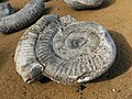 Ammonite at Port Mulgrave - geograph.org.uk - 397800.jpg 640 × 480; 131 KB
-
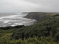
 Cliff top view Port Mulgrave - geograph.org.uk - 2148939.jpg 1,200 × 900; 480 KB
-
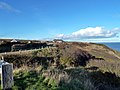
 Clifftop houses near Port Mulgrave - geograph.org.uk - 564209.jpg 640 × 479; 80 KB
-
 Coastal road Port Mulgrave - geograph.org.uk - 3647306.jpg 640 × 480; 63 KB
-
 Coastal view Port Mulgrave - geograph.org.uk - 3647305.jpg 640 × 480; 64 KB
-
 Coastal view Port Mulgrave - geograph.org.uk - 3647309.jpg 640 × 480; 77 KB
-
 Elevenses at Port Mulgrave - geograph.org.uk - 2269079.jpg 3,520 × 2,310; 1.07 MB
-
 Field in Port Mulgrave (20597199125).jpg 4,952 × 2,476; 3.79 MB
-
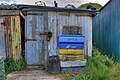 Fishermen's Huts, Port Mulgrave - geograph.org.uk - 855852.jpg 640 × 427; 248 KB
-
 Fishermen's Huts, Port Mulgrave - geograph.org.uk - 855855.jpg 427 × 640; 252 KB
-
 Fishermen's Huts, Port Mulgrave - geograph.org.uk - 857724.jpg 640 × 427; 261 KB
-
 Fishermen's Huts, Port Mulgrave - geograph.org.uk - 857728.jpg 427 × 640; 270 KB
-
 Landslip. Rosedale Wyke - geograph.org.uk - 40428.jpg 480 × 640; 119 KB
-
 Low Tide at Port Mulgrave - geograph.org.uk - 857719.jpg 640 × 427; 238 KB
-
 Mineral Stains, Rosedale Cliffs - geograph.org.uk - 1455022.jpg 427 × 640; 61 KB
-
 Mineral Stains, Rosedale Cliffs - geograph.org.uk - 1455032.jpg 427 × 640; 98 KB
-
 National Trust sign at Port Mulgrave - geograph.org.uk - 247164.jpg 480 × 640; 127 KB
-

-
 Old Pier - geograph.org.uk - 700003.jpg 640 × 430; 85 KB
-
-
 Port Mulgrave - geograph.org.uk - 2148927.jpg 1,200 × 900; 627 KB
-
 Port Mulgrave - geograph.org.uk - 2252910.jpg 2,000 × 1,362; 525 KB
-
 Port Mulgrave - geograph.org.uk - 2760248.jpg 640 × 427; 181 KB
-
 Port Mulgrave - geograph.org.uk - 700004.jpg 640 × 430; 65 KB
-
 Port Mulgrave - geograph.org.uk - 855834.jpg 640 × 427; 258 KB
-
 Port Mulgrave - geograph.org.uk - 855843.jpg 640 × 427; 233 KB
-
 Port Mulgrave - geograph.org.uk - 855851.jpg 640 × 427; 275 KB
-
 Port Mulgrave - geograph.org.uk - 855858.jpg 640 × 427; 195 KB
-
 Port Mulgrave - geograph.org.uk - 857712.jpg 427 × 640; 268 KB
-
 Port Mulgrave - geograph.org.uk - 857731.jpg 640 × 427; 240 KB
-
 Port Mulgrave and Rosedale Wyke seen from above - geograph.org.uk - 6793110.jpg 2,000 × 523; 1.01 MB
-
 Port Mulgrave village - geograph.org.uk - 564213.jpg 640 × 479; 70 KB
-
 Rosedale Lane Port Mulgrave - geograph.org.uk - 3425924.jpg 4,000 × 3,000; 2.18 MB
-

-
 Ship Inn, Port Mulgrave - geograph.org.uk - 700001.jpg 640 × 430; 75 KB
-
 The remains of the pier at Port Mulgrave - geograph.org.uk - 3425911.jpg 3,000 × 4,000; 3.04 MB
-
 Fisherman's Hut - geograph.org.uk - 439253.jpg 640 × 480; 110 KB
-
 Mine Entrance, Port Mulgrave - geograph.org.uk - 40447.jpg 640 × 480; 175 KB
-
 Port Mulgrave - geograph.org.uk - 397786.jpg 640 × 480; 113 KB
-
 Port Mulgrave - geograph.org.uk - 439244.jpg 640 × 480; 89 KB


.jpg)


