Category:Population-based cartograms
Jump to navigation
Jump to search
Media in category "Population-based cartograms"
The following 30 files are in this category, out of 30 total.
-
Anamorfose vs inwonertallen.PNG 1,202 × 766; 48 KB
-
Cartlinearlarge.png 701 × 448; 185 KB
-
Cartogram projector cz.png 1,099 × 620; 197 KB
-
Countycartlinear1280x1024.png 1,280 × 1,024; 350 KB
-
Développement humain depuis -60 000.png 3,150 × 4,200; 3.07 MB
-
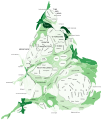
England and Wales population cartogram districts.svg 1,022 × 1,166; 805 KB
-
England and Wales population cartogram.svg 1,006 × 1,187; 737 KB
-
Eu cartogram.png 490 × 436; 10 KB
-
EU Pop2008 1024 new.png 1,536 × 1,534; 312 KB
-
EU Pop2008 1024-not contiguity.svg 600 × 620; 271 KB
-
EU Pop2008 1024.PNG 1,536 × 1,534; 249 KB
-
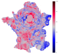
France 2012 round2 cartogram.png 900 × 800; 124 KB
-
Gastner map redblue bypopulation bycounty.png 700 × 448; 89 KB
-
Gastner map redblue bypopulation bystate.png 711 × 453; 52 KB
-
Germany population states hexagonal.svg 1,600 × 2,208; 43 KB
-
Germany-population-cartogram.png 377 × 480; 162 KB
-
Isodemographische Karte Weltbevoelkerung.png 1,242 × 842; 43 KB
-
Kartogram ludnosci Polski.png 857 × 845; 412 KB
-
Kartogram ludnosci Polski.svg 1,178 × 913; 665 KB
-
LibyaCartogramColored.png 2,105 × 1,488; 161 KB
-
NetRevenue2004Cartogram.png 1,693 × 908; 181 KB
-
Oregoncartogram.png 403 × 400; 6 KB
-
Polish speakers in England and Wales.svg 1,067 × 1,188; 878 KB
-
Population balls (narrow).png 4,148 × 2,184; 1.14 MB
-
Population balls (wide).png 5,004 × 2,540; 1.29 MB
-
Première carte communes france.svg 595 × 842; 81 MB
-
Scotland population cartogram.png 950 × 858; 181 KB
-
Scotland population cartogram.svg 512 × 823; 118 KB
-
Sweden.population.2008-11-01.cart.svg 290 × 654; 276 KB
-
World Population Cartogram Map 2002.tif 2,362 × 1,181; 639 KB


