
Category:Populated places in County Donegal
Counties of the Republic of Ireland: Carlow · Cavan · Clare · Cork(1) · Donegal · Fingal(2) · Galway(3) · Kerry · Kildare · Kilkenny · Laois · Leitrim · Limerick · Longford · Louth · Mayo · Meath · Monaghan · Offaly · Roscommon · Sligo · South Dublin(2) · Tipperary(4) · Waterford · Westmeath · Wexford · Wicklow – Separate cities: – Former counties: Dublin(2) · Former counties of Northern Ireland: Antrim · Armagh · Down · Fermanagh · Londonderry · Tyrone
Wikimedia category | |||||
| Upload media | |||||
| Instance of | |||||
|---|---|---|---|---|---|
| Category combines topics | |||||
| |||||
Subcategories
This category has the following 106 subcategories, out of 106 total.
A
- Annagry (24 F)
B
- Ballybofey (231 F)
- Ballyliffin (24 F)
- Bridgend, County Donegal (7 F)
- Brinlack, County Donegal (51 F)
- Bunnagee (7 F)
- Burnfoot, County Donegal (17 F)
- Burtonport (61 F)
C
- Carrick, County Donegal (3 F)
- Carrickarory (5 F)
- Carrigart (29 F)
- Carrowreagh (3 F)
- Castlefin (12 F)
- Cloghan, County Donegal (33 F)
- Convoy, County Donegal (28 F)
D
- Doochary (26 F)
- Downings (19 F)
- Drumoghill (17 F)
- Drung, County Donegal (9 F)
- Dunfanaghy (186 F)
- Dunkineely (77 F)
F
- Falcarragh (82 F)
- Fintown (50 F)
G
- Glen, County Donegal (17 F)
- Gleneely, Donegal (1 P, 6 F)
- Glenvar (5 F)
- Gortahork (21 F)
I
K
- Kill, County Donegal (11 F)
- Killea, County Donegal (2 F)
L
- Laconnell (22 F)
- Leabgarrow (14 F)
- Lettermacaward (27 F)
- Loch an Iúir (10 F)
M
- Maghery Donegal (13 F)
- Meenlaragh (21 F)
- Monclink (7 F)
- Monreagh, County Donegal (10 F)
- Mountcharles (84 F)
- Muff, County Donegal (45 F)
N
P
- Portnablagh (9 F)
Q
- Quigley's Point (42 F)
R
- Ramelton (488 F)
- Redcastle, County Donegal (14 F)
- Roosky, County Donegal (2 F)
S
- St Johnston (7 F)
- Stranorlar (108 F)
Pages in category "Populated places in County Donegal"
This category contains only the following page.
Media in category "Populated places in County Donegal"
The following 21 files are in this category, out of 21 total.
-
 Ardagh House.jpg 1,144 × 753; 395 KB
-
 Bailesuingean.jpg 648 × 486; 46 KB
-
 Bulbinbeg, Co. Donegal - geograph.org.uk - 1382726.jpg 640 × 480; 92 KB
-
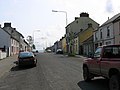
 Carrick main street.jpg 1,200 × 400; 132 KB
-
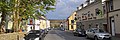
 Carrick-Donegal.jpg 1,500 × 600; 177 KB
-
 Dunuisce, Co Donegal - geograph.org.uk - 5672172.jpg 640 × 427; 305 KB
-
 Laganaber Townland - geograph.org.uk - 1380119.jpg 640 × 479; 74 KB
-
 McDaid's Superstore - geograph.org.uk - 1368347.jpg 640 × 479; 62 KB
-
 Road at Carrowtrasna - geograph.org.uk - 1806204.jpg 640 × 480; 71 KB
-
 Road at Cockhill - geograph.org.uk - 1368344.jpg 640 × 479; 54 KB
-
 Road at Drumadooey - geograph.org.uk - 1037718.jpg 640 × 479; 61 KB
-
 Road at Drummonaghan - geograph.org.uk - 1757202.jpg 640 × 480; 45 KB
-
 Road at Drummonaghan - geograph.org.uk - 1757213.jpg 640 × 480; 84 KB
-
 St.Johnstown Co.Donegal - geograph.org.uk - 304305.jpg 640 × 480; 54 KB
-
 Tawny - geograph.org.uk - 4001761.jpg 640 × 480; 279 KB
-

-

-

-
 Dunlewy, Lough Dunlewy. - geograph.org.uk - 70361.jpg 640 × 412; 84 KB
-
 Pettigoe, County Donegal - geograph.org.uk - 449705.jpg 640 × 479; 65 KB
-
 View over Dooey Peninsula - geograph.org.uk - 306274.jpg 640 × 429; 60 KB


