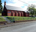
Category:Pontycymer
Jump to navigation
Jump to search
village in Wales | |||||
| Upload media | |||||
| Instance of | |||||
|---|---|---|---|---|---|
| Location | Bridgend County Borough, Wales | ||||
 | |||||
English: Pontycymer is a former coal mining village in the Garw Valley, in the county borough of Bridgend, Wales, United Kingdom. It is sometimes spelled and referred to as "Pontycymmer".
Media in category "Pontycymer"
The following 13 files are in this category, out of 13 total.
-
Birds of a Feather - geograph.org.uk - 985721.jpg 480 × 640; 403 KB
-
Coal loading point at Pontycymer - geograph.org.uk - 841592.jpg 640 × 428; 97 KB
-
Cwm Garw Fechan (geograph 6317792).jpg 1,024 × 768; 259 KB
-
Disused railway line - geograph.org.uk - 1460302.jpg 640 × 480; 95 KB
-
Dried mud - geograph.org.uk - 979835.jpg 640 × 480; 110 KB
-
Entering Lluest on the A4064 - geograph.org.uk - 947307.jpg 640 × 480; 57 KB
-
Gelliron Cemetery chapel, Pontycymer - geograph.org.uk - 4163032.jpg 800 × 704; 243 KB
-
Pontycymer War Memorial - geograph.org.uk - 4148435.jpg 800 × 620; 230 KB
-
Pontycymmer Fire Station - geograph.org.uk - 460862.jpg 640 × 426; 190 KB
-
Sorry, no cars - geograph.org.uk - 984604.jpg 640 × 480; 146 KB
-
St David's Church, Pontycymer - geograph.org.uk - 4148555.jpg 800 × 719; 199 KB
-
View of Pontycymer from Waun Tynewydd - geograph.org.uk - 985703.jpg 640 × 418; 235 KB
-
Wide views - geograph.org.uk - 984668.jpg 640 × 480; 127 KB


